Randonnée Marche Merlas - cirkwi circuit_pedestre___la_crypte_de_saint_sixte - Photo

cirkwi circuit_pedestre___la_crypte_de_saint_sixte

 bascait
bascait

Utilisateur

© OpenStreetMap contributors
Longueur
Longueur
6,1 km
Altitude max
Altitude max
735 m
Dénivelé positif
Dénivelé positif
265 m
Km-Effort
Km-Effort  
9,6 km
Altitude min
Altitude min
462 m
Dénivelé négatif
Dénivelé négatif
269 m
Boucle
Boucle
Oui
Date de création :
2014-12-10 00:00:00.0
Dernière modification :
2014-12-10 00:00:00.0

(1 Avis)

Marche
Marche
--
Difficulté : Inconnu

Scannez ce code QR pour ouvrir la randonnée dans l'application SityTrail

Application GPS de randonnée GRATUITE

Logo SityTrail SityTrail

IGN / Instituts géographiques

Télécharger SityTrail sur l'App Store Télécharger SityTrail sur Google Play

Logo SityTrail SityTrail World

Le monde est à vous

Télécharger SityTrail sur l'App Store Télécharger SityTrail sur Google Play Télécharger SityTrail sur Huawei AppGallery

À propos

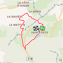
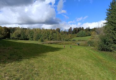
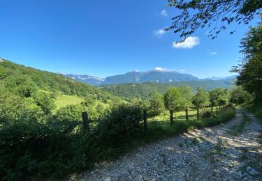
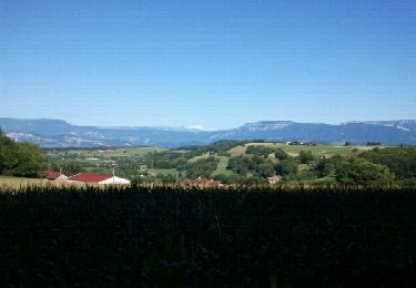
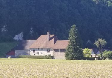
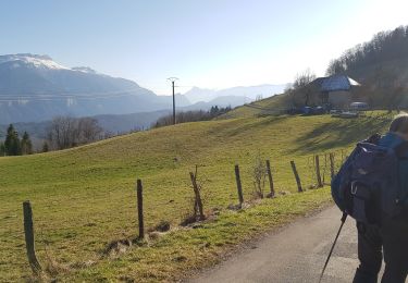
Randonnée Marche de 6,1 km à découvrir à Auvergne-Rhône-Alpes, Isère, Merlas. Cette randonnée est proposée par bascait.

Profil altimétrique

Points d'intérêt

Point d'intérêt Massieu - Tournez à droite - Photo
bascait
Point d'intérêt Massieu - La davière - Photo
bascait
MASSIEU 
Point d'intérêt Massieu - La Mérie - Photo
bascait
MASSIEU 
Point d'intérêt Merlas - Tournez à droite - Photo
bascait
Point d'intérêt Merlas - Arrivée - Photo
bascait
MERLAS 

Localisation

Pays :
France
Région :
Auvergne-Rhône-Alpes
Département/Province :
Isère
Commune :
Merlas
Localité :
Unknown
Départ:(Dec)
Départ:(UTM)
705720 ; 5033776 (31T) N.

Commentaires

Veuillez vous connecter pour laisser un commentaire ou une note


chouette paisible simple peu connu.


Randonnées à proximité

Randonnée Randonnée équestre Saint-Aupre - CHA - J3 - 12/09 - St Aupre > La Ruchère - R - Photo
Randonnée équestre
aeldin

Randonnée équestre

Moyen
(1)
Saint-Aupre, Auvergne-Rhône-Alpes, Isère, France
21 km | 37 km-effort
2h 59min
Non
Randonnée Randonnée équestre Saint-Aupre - CHA - J3 - 12/09 - St Aupre > La Ruchère - Photo
Randonnée équestre
aeldin

Randonnée équestre

Moyen
(1)
Saint-Aupre, Auvergne-Rhône-Alpes, Isère, France
22 km | 40 km-effort
2h 59min
Non
Randonnée Marche Merlas - Merlas boucle par le lac de St Sixt et étang des chartreux  - Photo
Marche
gmtrando

Marche

Facile
Merlas, Auvergne-Rhône-Alpes, Isère, France
16,6 km | 23 km-effort
4h 30min
Oui
Randonnée Marche Saint-Aupre - Circuit au départ de Saint Aupre - Photo
Marche
choubaka77

Marche

Facile
Saint-Aupre, Auvergne-Rhône-Alpes, Isère, France
9,7 km | 15,4 km-effort
3h 28min
Oui
Randonnée Marche Saint-Sulpice-des-Rivoires - st sulpice mt blanc - Photo
Marche
lmontbazon

Marche

Facile
Saint-Sulpice-des-Rivoires, Auvergne-Rhône-Alpes, Isère, France
9,7 km | 12,6 km-effort
2h 46min
Oui
Randonnée V.T.C. Miribel-les-Échelles - Miribel - Les Echelles - St Christophe la Grotte - St Laurent - Miribel - Photo
V.T.C.
meskiangasher

V.T.C.

Très facile
Miribel-les-Échelles, Auvergne-Rhône-Alpes, Isère, France
31 km | 38 km-effort
2h 6min
Oui
Randonnée Marche Miribel-les-Échelles - Col des mille martyrs - Photo
Marche
crocau

Marche

Très facile
(1)
Miribel-les-Échelles, Auvergne-Rhône-Alpes, Isère, France
5,9 km | 8,2 km-effort
2h 42min
Non
Randonnée Marche Miribel-les-Échelles - 1000 DOLMEN SOURCE ETC - Photo
Marche
boutier mallorie

Marche

Difficile
Miribel-les-Échelles, Auvergne-Rhône-Alpes, Isère, France
13,4 km | 18,7 km-effort
4h 15min
Oui
Randonnée V.T.T. Merlas - saint sixte - Photo
V.T.T.
les4elements

V.T.T.

Facile
Merlas, Auvergne-Rhône-Alpes, Isère, France
11,2 km | 18,4 km-effort
1h 44min
Non


Fermer
Mes abonnements