


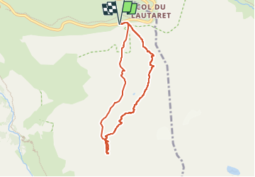

6 km | 9,4 km-effort


Utilisateur


Application GPS de randonnée GRATUITE
 SityTrail
IGN / Instituts géographiques
SityTrail World
Le monde est à vous
Randonnée Ski de randonnée de 7,2 km à découvrir à Provence-Alpes-Côte d'Azur, Hautes-Alpes, Villar-d'Arêne. Cette randonnée est proposée par loicthev.
ski de rando
Combeynot Ouest, point 2861
Départ Lautaret
ski 3.2
Alexandre
21/03/2023

Marche

Marche

Ski de randonnée

Marche
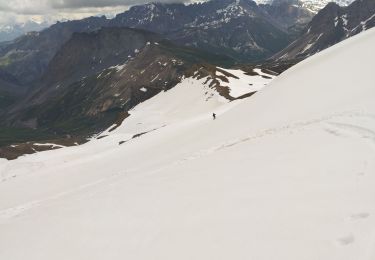
Ski de randonnée

Marche

Marche
Marche
Marche