![](/images/other/stat-length.png)
![Randonnée A pied Genk - Etappe 5: Thorpark (Genk) – Kattevennen (Genk): 11 km - Photo](https://media.geolcdn.com/t/1900/400/ext.pjpeg?maxdim=2&url=https%3A%2F%2Fstatic1.geolcdn.com%2Fsiteimages%2Fupload%2Ffiles%2F1545311037marcheuse_200dpi.jpg)
Etappe 5: Thorpark (Genk) – Kattevennen (Genk): 11 km
National Park Trail
Les sentiers du parc national de la Haute Campine
![Longueur](/images/other/stat-length.png)
![Altitude max](https://static1.geolcdn.com/siteimages/upload/files/1508320355ic_sort_altitude_max_24dp.png)
![Dénivelé positif](https://static1.geolcdn.com/siteimages/upload/files/1508320355ic_sort_den_pos_24dp.png)
![Km-Effort](/images/other/stat-length.png)
![Altitude min](https://static1.geolcdn.com/siteimages/upload/files/1508320355ic_sort_altitude_min_24dp.png)
![Dénivelé négatif](https://static1.geolcdn.com/siteimages/upload/files/1508320355ic_sort_den_neg_24dp.png)
![Boucle](https://static1.geolcdn.com/siteimages/upload/files/16400158638029165_repeat_loop_refresh_sync_direction_icon.png)
![A pied](https://static1.geolcdn.com/sitytour/trail-icons/100.png)
2h46
Difficulté : Facile
![Scannez ce code QR pour ouvrir la randonnée dans l'application SityTrail](https://capi.geolives.com/qq0zvz2zws4bq2lad0pu/sitytour/trails/3591394/qr.png?size=200)
Application GPS de randonnée GRATUITE
À propos
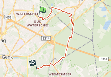
Randonnée A pied de 11 km à découvrir à Flandre, Limbourg, Genk. Cette randonnée est proposée par National Park Trail.
Description
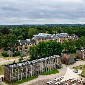
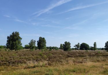
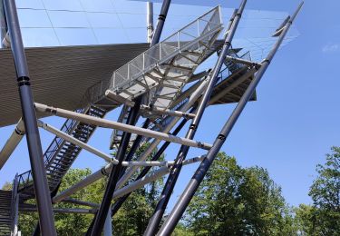
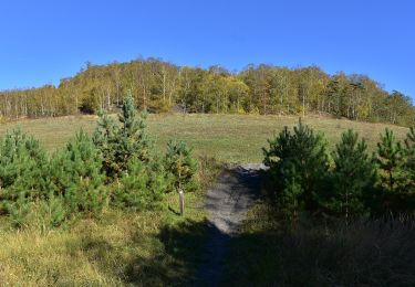
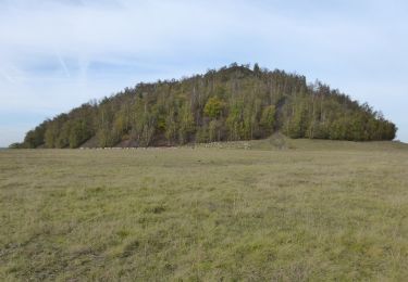
This short, flat connecting stage runs through the former Waterschei entrenchment to the Stiemerbeek valley, and then through extensive woodland. About halfway you pass a former children's colony, now a pleasant café/restaurant (De Kolonie). You cross the highway via the first 'Eco-recreaduct' in Flanders and after the golf course Spiegelven, you reach Kattevennen.
Localisation
Commentaires
Randonnées à proximité
![Randonnée Vélo Genk - Points de vue surprenants - Photo](https://media.geolcdn.com/t/375/260/31227550-2d1e-474d-a121-b2a405d0d5b9.jpg&format=jpg&maxdim=2)
![Vélo Vélo](https://static1.geolcdn.com/sitytour/trail-icons/200.png)
Vélo
![](/images/other/stat-length.png)
![](https://static1.geolcdn.com/siteimages/upload/files/16400158638029165_repeat_loop_refresh_sync_direction_icon.png)
![Randonnée Marche Genk - Promenade de Kattevennen - Photo](https://media.geolcdn.com/t/375/260/89f9be8b-be87-4190-884b-d7d87ca5b9ad.jpg&format=jpg&maxdim=2)
![Marche Marche](https://static1.geolcdn.com/sitytour/trail-icons/101.png)
Marche
![](/images/other/stat-length.png)
![](https://static1.geolcdn.com/siteimages/upload/files/16400158638029165_repeat_loop_refresh_sync_direction_icon.png)
![Randonnée A pied As - Mechelse Heide Noord - Photo](https://media.geolcdn.com/t/375/260/6c3d6be9-86c4-472e-82c2-64c07d2c49aa.jpeg&format=jpg&maxdim=2)
![A pied A pied](https://static1.geolcdn.com/sitytour/trail-icons/100.png)
A pied
![](/images/other/stat-length.png)
![](https://static1.geolcdn.com/siteimages/upload/files/16400158638029165_repeat_loop_refresh_sync_direction_icon.png)
![Randonnée A pied Oudsbergen - Moorsberg Paarse trapezium - Photo](https://media.geolcdn.com/t/375/260/4c7fd886-c3d5-4662-96ec-c951a3de83c7.jpeg&format=jpg&maxdim=2)
![A pied A pied](https://static1.geolcdn.com/sitytour/trail-icons/100.png)
A pied
![](/images/other/stat-length.png)
![](https://static1.geolcdn.com/siteimages/upload/files/16400158638029165_repeat_loop_refresh_sync_direction_icon.png)
![Randonnée A pied As - Heiderbos blauwe ruit - Photo](https://media.geolcdn.com/t/375/260/e65c145e-dca4-4d58-ae17-fc8ca78c84c8.jpeg&format=jpg&maxdim=2)
![A pied A pied](https://static1.geolcdn.com/sitytour/trail-icons/100.png)
A pied
![](/images/other/stat-length.png)
![](https://static1.geolcdn.com/siteimages/upload/files/16400158638029165_repeat_loop_refresh_sync_direction_icon.png)
![Randonnée A pied Genk - Thorpark Groene rechthoek - Photo](https://media.geolcdn.com/t/375/260/5d7a6518-21eb-43eb-96c3-b85d7a924753.jpeg&format=jpg&maxdim=2)
![A pied A pied](https://static1.geolcdn.com/sitytour/trail-icons/100.png)
A pied
![](/images/other/stat-length.png)
![](https://static1.geolcdn.com/siteimages/upload/files/16400158638029165_repeat_loop_refresh_sync_direction_icon.png)
![Randonnée A pied Genk - Thorpark - De Kolonie Rode driehoek - Photo](https://media.geolcdn.com/t/375/260/1c715178-bd32-42a8-8c79-dfbf5aac80a5.jpeg&format=jpg&maxdim=2)
![A pied A pied](https://static1.geolcdn.com/sitytour/trail-icons/100.png)
A pied
![](/images/other/stat-length.png)
![](https://static1.geolcdn.com/siteimages/upload/files/16400158638029165_repeat_loop_refresh_sync_direction_icon.png)
![Randonnée A pied Genk - Thorpark Blauwe ruit - Photo](https://media.geolcdn.com/t/375/260/5d7a6518-21eb-43eb-96c3-b85d7a924753.jpeg&format=jpg&maxdim=2)
![A pied A pied](https://static1.geolcdn.com/sitytour/trail-icons/100.png)
A pied
![](/images/other/stat-length.png)
![](https://static1.geolcdn.com/siteimages/upload/files/16400158638029165_repeat_loop_refresh_sync_direction_icon.png)
![Randonnée A pied Genk - Thorpark - Heiderbos Gele zeshoek - Photo](https://media.geolcdn.com/t/375/260/c6f79672-6cbb-4c88-882a-ca6add2e9582.jpeg&format=jpg&maxdim=2)
![A pied A pied](https://static1.geolcdn.com/sitytour/trail-icons/100.png)
A pied
![](/images/other/stat-length.png)
![](https://static1.geolcdn.com/siteimages/upload/files/16400158638029165_repeat_loop_refresh_sync_direction_icon.png)