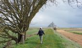
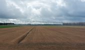
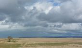
![](/images/other/stat-length.png)
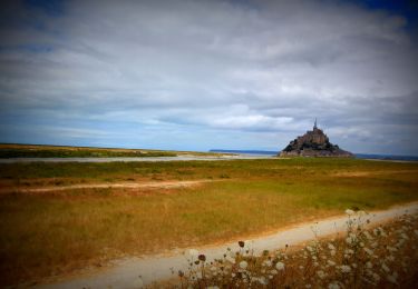
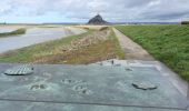
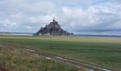
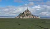
![Randonnée Marche Le Mont-Saint-Michel - GR_34_AA_01_Mt-St-Michel_St-Marcan_20230318 - Photo](https://media.geolcdn.com/t/1900/400/a17250a1-0bf7-444e-8b49-3029941c7cbf.jpg&format=pjpeg&maxdim=2)
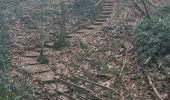
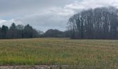
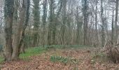
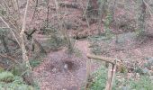
GR_34_AA_01_Mt-St-Michel_St-Marcan_20230318
patrickdanilo
Utilisateur
![Longueur](/images/other/stat-length.png)
Longueur
16,7 km
![Altitude max](https://static1.geolcdn.com/siteimages/upload/files/1508320355ic_sort_altitude_max_24dp.png)
Altitude max
84 m
![Dénivelé positif](https://static1.geolcdn.com/siteimages/upload/files/1508320355ic_sort_den_pos_24dp.png)
Dénivelé positif
162 m
![Km-Effort](/images/other/stat-length.png)
Km-Effort
18,7 km
![Altitude min](https://static1.geolcdn.com/siteimages/upload/files/1508320355ic_sort_altitude_min_24dp.png)
Altitude min
3 m
![Dénivelé négatif](https://static1.geolcdn.com/siteimages/upload/files/1508320355ic_sort_den_neg_24dp.png)
Dénivelé négatif
110 m
![Boucle](https://static1.geolcdn.com/siteimages/upload/files/16400158638029165_repeat_loop_refresh_sync_direction_icon.png)
Boucle
Non
Date de création :
2023-03-18 10:10:48.302
Dernière modification :
2023-03-22 09:47:31.51
![Marche](https://static1.geolcdn.com/sitytour/trail-icons/101.png)
4h01
Difficulté : Très facile
![Scannez ce code QR pour ouvrir la randonnée dans l'application SityTrail](https://capi.geolives.com/qq0zvz2zws4bq2lad0pu/sitytour/trails/3589182/qr.png?size=200)
Application GPS de randonnée GRATUITE
À propos
Randonnée Marche de 16,7 km à découvrir à Normandie, Manche, Le Mont-Saint-Michel. Cette randonnée est proposée par patrickdanilo.
Description
Randonnée Marche de 17 km à découvrir à Normandie, Manche, Le Mont-Saint-Michel. Cette randonnée est proposée par patrickdanilo.
Localisation
Pays :
France
Région :
Normandie
Département/Province :
Manche
Commune :
Le Mont-Saint-Michel
Localité :
Unknown
Départ:(Dec)
Départ:(UTM)
609710 ; 5386014 (30U) N.
Commentaires
Randonnées à proximité
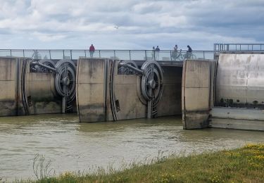
![Randonnée Marche Le Mont-Saint-Michel - Mont St Michel J2 - Photo](https://media.geolcdn.com/t/375/260/b4e16eca-62f6-4a45-b3f4-364badeabd8c.jpg&format=jpg&maxdim=2)
![Marche Marche](https://static1.geolcdn.com/sitytour/trail-icons/101.png)
Mont St Michel J2
Marche
Très facile
Le Mont-Saint-Michel,
Normandie,
Manche,
France
![](/images/other/stat-length.png)
17,4 km | 21 km-effort
4h 22min
![](https://static1.geolcdn.com/siteimages/upload/files/16400158638029165_repeat_loop_refresh_sync_direction_icon.png)
Oui
![Randonnée Marche Le Mont-Saint-Michel - Mont St Michel J1 - Photo](https://media.geolcdn.com/t/375/260/2b75de4d-6596-478a-9a3f-dcd60f498a33.jpg&format=jpg&maxdim=2)
![Marche Marche](https://static1.geolcdn.com/sitytour/trail-icons/101.png)
Mont St Michel J1
Marche
Difficile
Le Mont-Saint-Michel,
Normandie,
Manche,
France
![](/images/other/stat-length.png)
12,1 km | 14 km-effort
2h 46min
![](https://static1.geolcdn.com/siteimages/upload/files/16400158638029165_repeat_loop_refresh_sync_direction_icon.png)
Oui
![Randonnée A pied Saint-Georges-de-Gréhaigne - Découverte des polders - Photo](https://media.geolcdn.com/t/375/260/1947c4ab-7a2f-4caa-9962-ed302558c2aa.jpeg&format=jpg&maxdim=2)
![A pied A pied](https://static1.geolcdn.com/sitytour/trail-icons/100.png)
Découverte des polders
A pied
Facile
Saint-Georges-de-Gréhaigne,
Bretagne,
Ille-et-Vilaine,
France
![](/images/other/stat-length.png)
14,6 km | 15,3 km-effort
3h 27min
![](https://static1.geolcdn.com/siteimages/upload/files/16400158638029165_repeat_loop_refresh_sync_direction_icon.png)
Oui
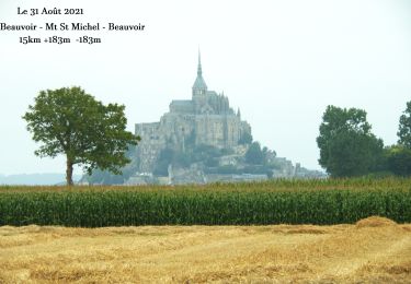
![Randonnée Marche Beauvoir - N°0 GR34 Beauvoir -- Mont St Michel -- Beauvoir - Photo](https://media.geolcdn.com/t/375/260/ad92d366-53f3-47e6-821c-d2813336be7e.jpg&format=jpg&maxdim=2)
![Marche Marche](https://static1.geolcdn.com/sitytour/trail-icons/101.png)
N°0 GR34 Beauvoir -- Mont St Michel -- Beauvoir
Marche
Difficile
Beauvoir,
Normandie,
Manche,
France
![](/images/other/stat-length.png)
14,9 km | 17,3 km-effort
3h 55min
![](https://static1.geolcdn.com/siteimages/upload/files/16400158638029165_repeat_loop_refresh_sync_direction_icon.png)
Oui
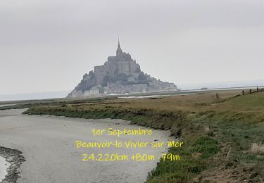
![Randonnée Marche Beauvoir - N°1 GR34 Beauvoir -- Le Vivier-sur-Mer - Photo](https://media.geolcdn.com/t/375/260/d6dcce93-6874-4297-ba3a-4d6b0fb11eaf.jpg&format=jpg&maxdim=2)
![Marche Marche](https://static1.geolcdn.com/sitytour/trail-icons/101.png)
N°1 GR34 Beauvoir -- Le Vivier-sur-Mer
Marche
Facile
Beauvoir,
Normandie,
Manche,
France
![](/images/other/stat-length.png)
25 km | 27 km-effort
6h 9min
![](https://static1.geolcdn.com/siteimages/upload/files/16400158638029165_repeat_loop_refresh_sync_direction_icon.png)
Non
![V.T.T. V.T.T.](https://static1.geolcdn.com/sitytour/trail-icons/202.png)
VTT autour du Mont Saint Michel
V.T.T.
Moyen
Beauvoir,
Normandie,
Manche,
France
![](/images/other/stat-length.png)
29 km | 32 km-effort
Inconnu
![](https://static1.geolcdn.com/siteimages/upload/files/16400158638029165_repeat_loop_refresh_sync_direction_icon.png)
Oui
![Randonnée Marche Huisnes-sur-Mer - Huisnes-sur-Mer - vue Mont-St-Michel - Pointe de Roche Torin - 14km 75m 4h30 (45mn) - 2017 06 26 - Photo](https://media.geolcdn.com/t/375/260/9d39b175-437c-4c0f-9152-c4bc208b1660.jpg&format=jpg&maxdim=2)
![Marche Marche](https://static1.geolcdn.com/sitytour/trail-icons/101.png)
Huisnes-sur-Mer - vue Mont-St-Michel - Pointe de Roche Torin - 14km 75m 4h30 ...
Marche
Facile
Huisnes-sur-Mer,
Normandie,
Manche,
France
![](/images/other/stat-length.png)
14 km | 15 km-effort
4h 30min
![](https://static1.geolcdn.com/siteimages/upload/files/16400158638029165_repeat_loop_refresh_sync_direction_icon.png)
Oui
![Randonnée Marche Beauvoir - GR_37_AA_15_Beauvoir_Pleine-Fougeres_20210521 - Photo](https://media.geolcdn.com/t/375/260/45a2928d-2310-48d8-b8a4-fe1aa26383e2.jpg&format=jpg&maxdim=2)
![Marche Marche](https://static1.geolcdn.com/sitytour/trail-icons/101.png)
GR_37_AA_15_Beauvoir_Pleine-Fougeres_20210521
Marche
Très facile
Beauvoir,
Normandie,
Manche,
France
![](/images/other/stat-length.png)
14,2 km | 15,5 km-effort
3h 8min
![](https://static1.geolcdn.com/siteimages/upload/files/16400158638029165_repeat_loop_refresh_sync_direction_icon.png)
Non
![Randonnée Marche Pontorson - GR34 étape 6 - Photo](https://media.geolcdn.com/t/375/260/ext.jpg?maxdim=2&url=https%3A%2F%2Fservices.sitytrail.com%2FGeolivesWS%2FDownloadMedia.ashx%3FTrailID%3D271016%26Media%3Dfix__20140412093116.jpg)
![Marche Marche](https://static1.geolcdn.com/sitytour/trail-icons/101.png)