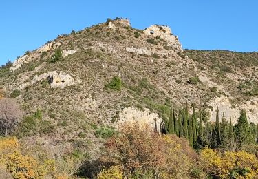
17,8 km | 30 km-effort
qa
michelastruc
Utilisateur
Longueur
84 m
Altitude max
131 m
Dénivelé positif
0 m
Km-Effort
84 m
Altitude min
129 m
Dénivelé négatif
0 m
Boucle
Non
Date de création :
2023-03-15 08:23:36.955
Dernière modification :
2023-03-15 08:25:02.839
1m
Difficulté : Facile
Application GPS de randonnée GRATUITE
À propos
Randonnée Marche de 84 m à découvrir à Occitanie, Aude, Saint-Jean-de-Barrou. Cette randonnée est proposée par michelastruc.
Description
aaa
Localisation
Pays :
France
Région :
Occitanie
Département/Province :
Aude
Commune :
Saint-Jean-de-Barrou
Localité :
Unknown
Départ:(Dec)
Départ:(UTM)
486834 ; 4756238 (31T) N.
Commentaires
Randonnées à proximité
Embres et Castelmaure
Marche
Moyen
(1)
Embres-et-Castelmaure,
Occitanie,
Aude,
France
11,2 km | 14,6 km-effort
3h 0min
Oui
Estrons de la vieille
Marche
Moyen
(2)
Roquefort-des-Corbières,
Occitanie,
Aude,
France
9 km | 11,8 km-effort
3h 24min
Oui
Cathare 2 de Durban à Tuchan
Randonnée à dos d'âne
Moyen
Durban-Corbières,
Occitanie,
Aude,
France
28 km | 39 km-effort
6h 50min
Non
Col de Feuilla Perellos en boucle
Marche
Moyen
Feuilla,
Occitanie,
Aude,
France
16,9 km | 27 km-effort
5h 28min
Non
M020-Durban Corbières
Marche
Moyen
Durban-Corbières,
Occitanie,
Aude,
France
19,7 km | 28 km-effort
5h 50min
Oui
M014-Durban Corbières
Marche
Moyen
Durban-Corbières,
Occitanie,
Aude,
France
13,4 km | 18,1 km-effort
3h 48min
Oui
Embres castelmaure
Marche
Très difficile
Embres-et-Castelmaure,
Occitanie,
Aude,
France
17,9 km | 26 km-effort
4h 35min
Oui
Ambres et Castelmaure 18/10/2023
Marche
Moyen
Embres-et-Castelmaure,
Occitanie,
Aude,
France
11,1 km | 15,6 km-effort
3h 22min
Oui