![](/images/other/stat-length.png)
![Randonnée Marche Asse - Petit tour dans la campagne flamande - Photo](https://media.geolcdn.com/t/1900/400/fffc7bf7-6432-451c-a261-43342b6a27de.jpg&format=pjpeg&maxdim=2)
Petit tour dans la campagne flamande
griffet
Utilisateur
![Longueur](/images/other/stat-length.png)
Longueur
6,7 km
![Altitude max](https://static1.geolcdn.com/siteimages/upload/files/1508320355ic_sort_altitude_max_24dp.png)
Altitude max
78 m
![Dénivelé positif](https://static1.geolcdn.com/siteimages/upload/files/1508320355ic_sort_den_pos_24dp.png)
Dénivelé positif
90 m
![Km-Effort](/images/other/stat-length.png)
Km-Effort
7,9 km
![Altitude min](https://static1.geolcdn.com/siteimages/upload/files/1508320355ic_sort_altitude_min_24dp.png)
Altitude min
33 m
![Dénivelé négatif](https://static1.geolcdn.com/siteimages/upload/files/1508320355ic_sort_den_neg_24dp.png)
Dénivelé négatif
90 m
![Boucle](https://static1.geolcdn.com/siteimages/upload/files/16400158638029165_repeat_loop_refresh_sync_direction_icon.png)
Boucle
Oui
Date de création :
2023-03-12 12:40:09.0
Dernière modification :
2023-03-12 14:49:28.767
![Marche](https://static1.geolcdn.com/sitytour/trail-icons/101.png)
1h52
Difficulté : Facile
![Scannez ce code QR pour ouvrir la randonnée dans l'application SityTrail](https://capi.geolives.com/qq0zvz2zws4bq2lad0pu/sitytour/trails/3582202/qr.png?size=200)
Application GPS de randonnée GRATUITE
À propos
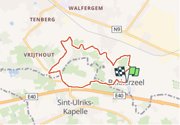
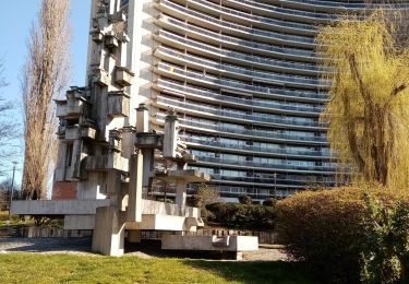
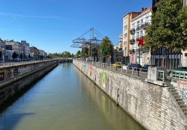
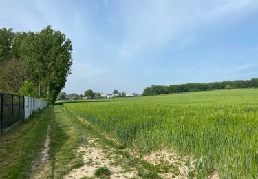
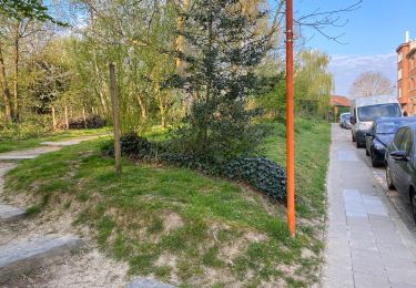
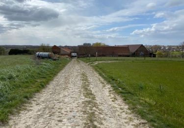
Randonnée Marche de 6,7 km à découvrir à Flandre, Brabant flamand, Asse. Cette randonnée est proposée par griffet.
Description
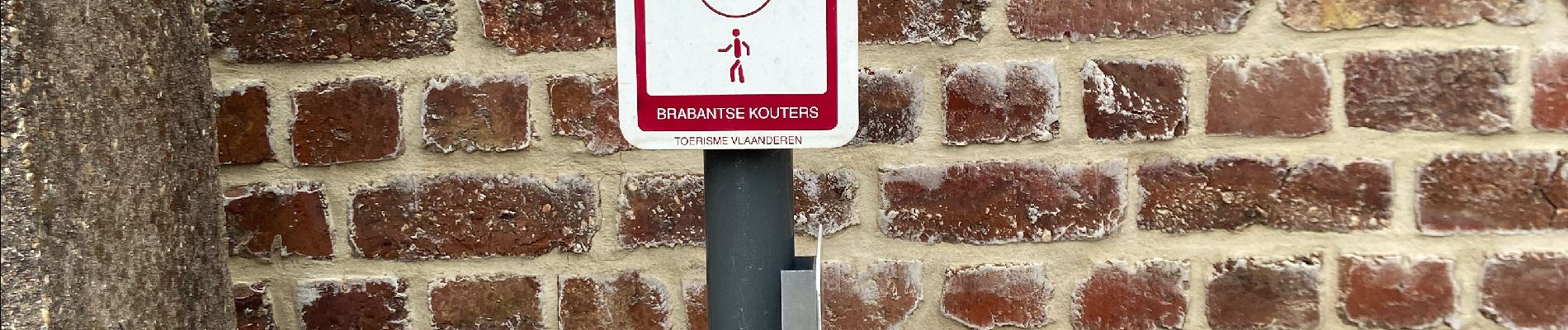
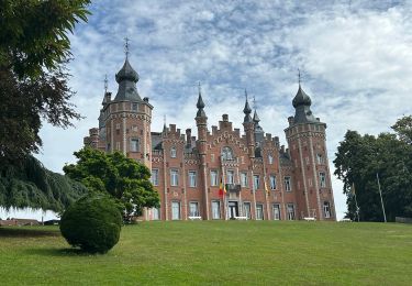
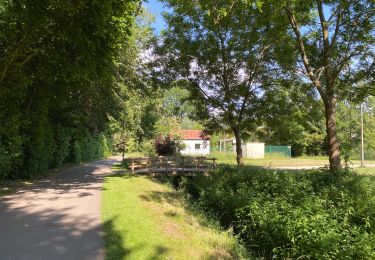
Un très joli petit tour à travers la campagne flamande par des sentier entre les prairies et les bois MAIS MAIS MAIS sous le hurlement permanent de l’E40 toute proche >>> A ÉVITER ABSOLUMENT !!!
Localisation
Pays :
Belgique
Région :
Flandre
Département/Province :
Brabant flamand
Commune :
Asse
Localité :
Bekkerzeel
Départ:(Dec)
Départ:(UTM)
587120 ; 5637794 (31U) N.
Commentaires
Randonnées à proximité
![Marche Marche](https://static1.geolcdn.com/sitytour/trail-icons/101.png)
#230714 - Dilbeek, Kattenberg, Rés. Nat. Wolfsputten**
Marche
Moyen
(1)
Dilbeek,
Flandre,
Brabant flamand,
Belgique
![](/images/other/stat-length.png)
5,1 km | 6,2 km-effort
1h 24min
![](https://static1.geolcdn.com/siteimages/upload/files/16400158638029165_repeat_loop_refresh_sync_direction_icon.png)
Oui
![Randonnée Marche Wemmel - Wemmel Beverbos 6 km - Photo](https://media.geolcdn.com/t/375/260/3be3b710-42f6-4600-9f48-b1342818e945.jpg&format=jpg&maxdim=2)
![Marche Marche](https://static1.geolcdn.com/sitytour/trail-icons/101.png)
Wemmel Beverbos 6 km
Marche
Moyen
(2)
Wemmel,
Flandre,
Brabant flamand,
Belgique
![](/images/other/stat-length.png)
6,7 km | 7,6 km-effort
1h 32min
![](https://static1.geolcdn.com/siteimages/upload/files/16400158638029165_repeat_loop_refresh_sync_direction_icon.png)
Oui
![Randonnée Marche Berchem-Sainte-Agathe - Molenbeek vert 1 - Photo](https://media.geolcdn.com/t/375/260/beb9cc6b-2ce6-4f36-acea-34847e0cf6e9.jpg&format=jpg&maxdim=2)
![Marche Marche](https://static1.geolcdn.com/sitytour/trail-icons/101.png)
Molenbeek vert 1
Marche
Très facile
(1)
Berchem-Sainte-Agathe,
Bruxelles-Capitale,
Inconnu,
Belgique
![](/images/other/stat-length.png)
8,3 km | 9,5 km-effort
1h 55min
![](https://static1.geolcdn.com/siteimages/upload/files/16400158638029165_repeat_loop_refresh_sync_direction_icon.png)
Non
![Randonnée Marche Berchem-Sainte-Agathe - Berchem Cinquantenaire 13.7 km - Photo](https://media.geolcdn.com/t/375/260/7407fd43-fb12-43d9-bd02-ae43914d5b03.jpg&format=jpg&maxdim=2)
![Marche Marche](https://static1.geolcdn.com/sitytour/trail-icons/101.png)
Berchem Cinquantenaire 13.7 km
Marche
Facile
Berchem-Sainte-Agathe,
Bruxelles-Capitale,
Inconnu,
Belgique
![](/images/other/stat-length.png)
13,8 km | 16,1 km-effort
3h 34min
![](https://static1.geolcdn.com/siteimages/upload/files/16400158638029165_repeat_loop_refresh_sync_direction_icon.png)
Non
![Randonnée Marche Asse - Asse 25 km - Photo](https://media.geolcdn.com/t/375/260/93373654-1789-4a22-a980-4e4078e012f6.jpg&format=jpg&maxdim=2)
![Marche Marche](https://static1.geolcdn.com/sitytour/trail-icons/101.png)
![Randonnée Marche Berchem-Sainte-Agathe - Berchem St Ulrike k 17 km - Photo](https://media.geolcdn.com/t/375/260/3526b289-c30d-467a-b575-61e9a65c555e.jpg&format=jpg&maxdim=2)
![Marche Marche](https://static1.geolcdn.com/sitytour/trail-icons/101.png)
Berchem St Ulrike k 17 km
Marche
Moyen
Berchem-Sainte-Agathe,
Bruxelles-Capitale,
Inconnu,
Belgique
![](/images/other/stat-length.png)
16,8 km | 19,3 km-effort
3h 39min
![](https://static1.geolcdn.com/siteimages/upload/files/16400158638029165_repeat_loop_refresh_sync_direction_icon.png)
Oui
![Randonnée Marche Berchem-Sainte-Agathe - Tour du fleuriste de Grand Bigard 9,5 km - Photo](https://media.geolcdn.com/t/375/260/7aa60d96-0b26-4aa3-a5ef-65562c4230a7.jpg&format=jpg&maxdim=2)
![Marche Marche](https://static1.geolcdn.com/sitytour/trail-icons/101.png)
Tour du fleuriste de Grand Bigard 9,5 km
Marche
Moyen
Berchem-Sainte-Agathe,
Bruxelles-Capitale,
Inconnu,
Belgique
![](/images/other/stat-length.png)
9,5 km | 10,6 km-effort
1h 59min
![](https://static1.geolcdn.com/siteimages/upload/files/16400158638029165_repeat_loop_refresh_sync_direction_icon.png)
Oui
![Randonnée Marche Berchem-Sainte-Agathe - Grand tour de l’échangeur de la mer 13,5 Km - Photo](https://media.geolcdn.com/t/375/260/02f8d9d5-f257-418f-a9df-e7493936d59e.jpg&format=jpg&maxdim=2)
![Marche Marche](https://static1.geolcdn.com/sitytour/trail-icons/101.png)
Grand tour de l’échangeur de la mer 13,5 Km
Marche
Moyen
Berchem-Sainte-Agathe,
Bruxelles-Capitale,
Inconnu,
Belgique
![](/images/other/stat-length.png)
14,2 km | 16,1 km-effort
2h 56min
![](https://static1.geolcdn.com/siteimages/upload/files/16400158638029165_repeat_loop_refresh_sync_direction_icon.png)
Oui
![Randonnée Marche Berchem-Sainte-Agathe - Tour ferme 1700 -7,6 km - Photo](https://media.geolcdn.com/t/375/260/98a3bb58-6d3a-4906-854c-95eb48a25d83.jpg&format=jpg&maxdim=2)
![Marche Marche](https://static1.geolcdn.com/sitytour/trail-icons/101.png)
Tour ferme 1700 -7,6 km
Marche
Moyen
Berchem-Sainte-Agathe,
Bruxelles-Capitale,
Inconnu,
Belgique
![](/images/other/stat-length.png)
7,7 km | 8,7 km-effort
1h 36min
![](https://static1.geolcdn.com/siteimages/upload/files/16400158638029165_repeat_loop_refresh_sync_direction_icon.png)
Oui