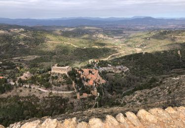
15 km | 18,2 km-effort
Castelnou autour
Jocelyne LIGER
Utilisateur
Longueur
10,1 km
Altitude max
452 m
Dénivelé positif
399 m
Km-Effort
15,5 km
Altitude min
193 m
Dénivelé négatif
416 m
Boucle
Oui
Date de création :
2023-03-08 08:05:05.452
Dernière modification :
2023-03-08 13:05:21.416
3h18
Difficulté : Moyen
Application GPS de randonnée GRATUITE
À propos
Randonnée Marche de 10,1 km à découvrir à Occitanie, Pyrénées-Orientales, Castelnou. Cette randonnée est proposée par Jocelyne LIGER.
Localisation
Pays :
France
Région :
Occitanie
Département/Province :
Pyrénées-Orientales
Commune :
Castelnou
Localité :
Unknown
Départ:(Dec)
Départ:(UTM)
476435 ; 4719333 (31T) N.
Commentaires
Randonnées à proximité
66 LLUPIA - FOURQUES - TERRATS promenade dans les ASPRES et son vignoble
Marche
Moyen
(1)
Llupia,
Occitanie,
Pyrénées-Orientales,
France
2h 36min
Oui
CASTELNOU 66 - CAMELAS - ermitage San Marti de La Roca
Marche
Difficile
(1)
Castelnou,
Occitanie,
Pyrénées-Orientales,
France
10,8 km | 16,7 km-effort
2h 19min
Oui
Thuir à Castelnou
Marche
Moyen
(1)
Thuir,
Occitanie,
Pyrénées-Orientales,
France
14,1 km | 20 km-effort
4h 13min
Oui
Thuir
Marche
Très facile
(1)
Castelnou,
Occitanie,
Pyrénées-Orientales,
France
9,3 km | 12,1 km-effort
4h 4min
Non
castel nous
Marche
Très facile
(1)
Castelnou,
Occitanie,
Pyrénées-Orientales,
France
11,9 km | 16,7 km-effort
4h 0min
Oui
THUIR 66 - Castelnou - Ste Colombe de la C.
Marche
Moyen
(2)
Sainte-Colombe-de-la-Commanderie,
Occitanie,
Pyrénées-Orientales,
France
14,8 km | 21 km-effort
2h 56min
Oui
cerbère chapelle sa t père del bosc
Marche
Difficile
Corbère-les-Cabanes,
Occitanie,
Pyrénées-Orientales,
France
9,9 km | 12,6 km-effort
2h 51min
Oui
Camelas Castelnou
Marche
Facile
Camélas,
Occitanie,
Pyrénées-Orientales,
France
11,7 km | 18 km-effort
4h 4min
Oui
20230316 Sté Colombe-Castelnou
Marche
Moyen
Sainte-Colombe-de-la-Commanderie,
Occitanie,
Pyrénées-Orientales,
France
16,3 km | 23 km-effort
3h 55min
Oui