![](/images/other/stat-length.png)
![Randonnée Marche Sergenaux - Sentier Jacquot - Photo](https://media.geolcdn.com/t/1900/400/ext.pjpeg?maxdim=2&url=https%3A%2F%2Fservices.sitytrail.com%2FGeolivesWS%2FDownloadMedia.ashx%3FTrailID%3D357386%26Media%3Dfix__20141026143753.jpg)
Sentier Jacquot
albert39
Utilisateur
![Longueur](/images/other/stat-length.png)
Longueur
6,2 km
![Altitude max](https://static1.geolcdn.com/siteimages/upload/files/1508320355ic_sort_altitude_max_24dp.png)
Altitude max
229 m
![Dénivelé positif](https://static1.geolcdn.com/siteimages/upload/files/1508320355ic_sort_den_pos_24dp.png)
Dénivelé positif
69 m
![Km-Effort](/images/other/stat-length.png)
Km-Effort
7,1 km
![Altitude min](https://static1.geolcdn.com/siteimages/upload/files/1508320355ic_sort_altitude_min_24dp.png)
Altitude min
197 m
![Dénivelé négatif](https://static1.geolcdn.com/siteimages/upload/files/1508320355ic_sort_den_neg_24dp.png)
Dénivelé négatif
69 m
![Boucle](https://static1.geolcdn.com/siteimages/upload/files/16400158638029165_repeat_loop_refresh_sync_direction_icon.png)
Boucle
Oui
Date de création :
2014-12-10 00:00:00.0
Dernière modification :
2014-12-10 00:00:00.0
![Marche](https://static1.geolcdn.com/sitytour/trail-icons/101.png)
2h23
Difficulté : Inconnu
![Scannez ce code QR pour ouvrir la randonnée dans l'application SityTrail](https://capi.geolives.com/qq0zvz2zws4bq2lad0pu/sitytour/trails/357386/qr.png?size=200)
Application GPS de randonnée GRATUITE
À propos
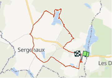
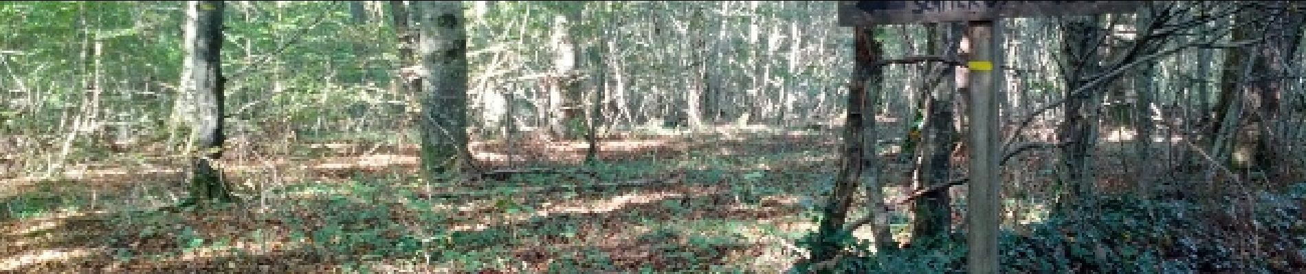
Randonnée Marche de 6,2 km à découvrir à Bourgogne-Franche-Comté, Jura, Sergenaux. Cette randonnée est proposée par albert39.
Description
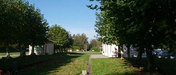
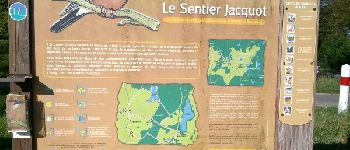
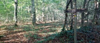
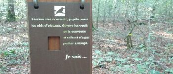
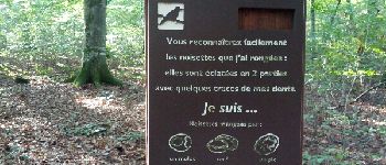
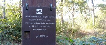
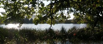
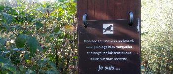
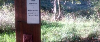
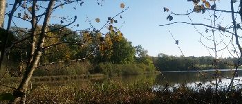
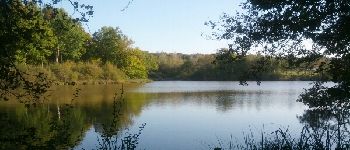
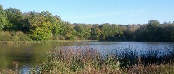
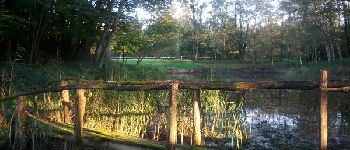
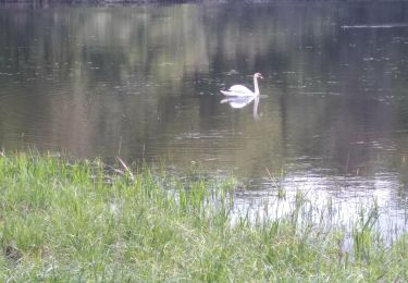
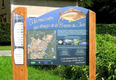
Les étangs de la Bresse : le sentier Jacquot est à la croisée des mondes bressan et jurassien. le livret-guide s'impose ! On le trouve a la Maison des étangs vers l'ancienne gare de Sergenaux (départ du circuit).
Points d'intérêt
Localisation
Pays :
France
Région :
Bourgogne-Franche-Comté
Département/Province :
Jura
Commune :
Sergenaux
Localité :
Unknown
Départ:(Dec)
Départ:(UTM)
688319 ; 5195012 (31T) N.
Commentaires
Randonnées à proximité
![Randonnée A pied Les Deux-Fays - Circuits des 19 Etangs - Photo](https://media.geolcdn.com/t/375/260/50d427ae-feed-4f46-8668-ae85cbe76d54.jpeg&format=jpg&maxdim=2)
![A pied A pied](https://static1.geolcdn.com/sitytour/trail-icons/100.png)
Circuits des 19 Etangs
A pied
Facile
Les Deux-Fays,
Bourgogne-Franche-Comté,
Jura,
France
![](/images/other/stat-length.png)
8,3 km | 9,3 km-effort
2h 7min
![](https://static1.geolcdn.com/siteimages/upload/files/16400158638029165_repeat_loop_refresh_sync_direction_icon.png)
Non
![Randonnée Marche Champrougier - Champrougier - Photo](https://media.geolcdn.com/t/375/260/c8f9cb36-e993-46d8-b9b9-7bb265df4e23.jpg&format=jpg&maxdim=2)
![Marche Marche](https://static1.geolcdn.com/sitytour/trail-icons/101.png)
Champrougier
Marche
Très facile
Champrougier,
Bourgogne-Franche-Comté,
Jura,
France
![](/images/other/stat-length.png)
22 km | 25 km-effort
5h 35min
![](https://static1.geolcdn.com/siteimages/upload/files/16400158638029165_repeat_loop_refresh_sync_direction_icon.png)
Oui
![Randonnée V.T.T. Chaumergy - VTT Maison des étangs Ouest - Chaumergy - Photo](https://media.geolcdn.com/t/375/260/ext.jpg?maxdim=2&url=https%3A%2F%2Fservices.sitytrail.com%2FGeolivesWS%2FDownloadMedia.ashx%3FTrailID%3D111439%26Media%3D7270_2.jpg)
![V.T.T. V.T.T.](https://static1.geolcdn.com/sitytour/trail-icons/202.png)
VTT Maison des étangs Ouest - Chaumergy
V.T.T.
Facile
Chaumergy,
Bourgogne-Franche-Comté,
Jura,
France
![](/images/other/stat-length.png)
21 km | 23 km-effort
2h 0min
![](https://static1.geolcdn.com/siteimages/upload/files/16400158638029165_repeat_loop_refresh_sync_direction_icon.png)
Oui
![Randonnée A pied Les Deux-Fays - PR sentier des Étangs 7 km - Photo](https://media.geolcdn.com/t/375/260/ext.jpg?maxdim=2&url=https%3A%2F%2Fstatic1.geolcdn.com%2Fsiteimages%2Fupload%2Ffiles%2F1545311037marcheuse_200dpi.jpg)
![A pied A pied](https://static1.geolcdn.com/sitytour/trail-icons/100.png)
PR sentier des Étangs 7 km
A pied
Facile
Les Deux-Fays,
Bourgogne-Franche-Comté,
Jura,
France
![](/images/other/stat-length.png)
5,8 km | 6,5 km-effort
1h 29min
![](https://static1.geolcdn.com/siteimages/upload/files/16400158638029165_repeat_loop_refresh_sync_direction_icon.png)
Non
![Randonnée Marche Champrougier - depart l'étang rouge vers champrougier - Photo](https://media.geolcdn.com/t/375/260/ext.jpg?maxdim=2&url=https%3A%2F%2Fstatic1.geolcdn.com%2Fsiteimages%2Fupload%2Ffiles%2F1553511878bg_sport_marche.png)
![Marche Marche](https://static1.geolcdn.com/sitytour/trail-icons/101.png)
depart l'étang rouge vers champrougier
Marche
Très difficile
Champrougier,
Bourgogne-Franche-Comté,
Jura,
France
![](/images/other/stat-length.png)
23 km | 26 km-effort
5h 53min
![](https://static1.geolcdn.com/siteimages/upload/files/16400158638029165_repeat_loop_refresh_sync_direction_icon.png)
Oui
![Randonnée Marche Sergenaux - serveneaux - Photo](https://media.geolcdn.com/t/375/260/ext.jpg?maxdim=2&url=https%3A%2F%2Fstatic1.geolcdn.com%2Fsiteimages%2Fupload%2Ffiles%2F1553511878bg_sport_marche.png)
![Marche Marche](https://static1.geolcdn.com/sitytour/trail-icons/101.png)
serveneaux
Marche
Très difficile
Sergenaux,
Bourgogne-Franche-Comté,
Jura,
France
![](/images/other/stat-length.png)
17,1 km | 19,5 km-effort
4h 51min
![](https://static1.geolcdn.com/siteimages/upload/files/16400158638029165_repeat_loop_refresh_sync_direction_icon.png)
Oui
![Randonnée Cheval Champrougier - jura liaison champrougier lavigny - Photo](https://media.geolcdn.com/t/375/260/ext.jpg?maxdim=2&url=https%3A%2F%2Fstatic1.geolcdn.com%2Fsiteimages%2Fupload%2Ffiles%2F1524743154cheval.jpg)
![Cheval Cheval](https://static1.geolcdn.com/sitytour/trail-icons/300.png)
jura liaison champrougier lavigny
Cheval
Moyen
Champrougier,
Bourgogne-Franche-Comté,
Jura,
France
![](/images/other/stat-length.png)
26 km | 31 km-effort
3h 52min
![](https://static1.geolcdn.com/siteimages/upload/files/16400158638029165_repeat_loop_refresh_sync_direction_icon.png)
Non
![Randonnée Cheval Champrougier - jura journée 3 - Photo](https://media.geolcdn.com/t/375/260/ext.jpg?maxdim=2&url=https%3A%2F%2Fstatic1.geolcdn.com%2Fsiteimages%2Fupload%2Ffiles%2F1524743154cheval.jpg)
![Cheval Cheval](https://static1.geolcdn.com/sitytour/trail-icons/300.png)
jura journée 3
Cheval
Moyen
Champrougier,
Bourgogne-Franche-Comté,
Jura,
France
![](/images/other/stat-length.png)
39 km | 45 km-effort
5h 37min
![](https://static1.geolcdn.com/siteimages/upload/files/16400158638029165_repeat_loop_refresh_sync_direction_icon.png)
Oui
![Randonnée Cheval Champrougier - jura journée 2 - Photo](https://media.geolcdn.com/t/375/260/ext.jpg?maxdim=2&url=https%3A%2F%2Fstatic1.geolcdn.com%2Fsiteimages%2Fupload%2Ffiles%2F1524743154cheval.jpg)
![Cheval Cheval](https://static1.geolcdn.com/sitytour/trail-icons/300.png)
jura journée 2
Cheval
Moyen
Champrougier,
Bourgogne-Franche-Comté,
Jura,
France
![](/images/other/stat-length.png)
30 km | 34 km-effort
4h 16min
![](https://static1.geolcdn.com/siteimages/upload/files/16400158638029165_repeat_loop_refresh_sync_direction_icon.png)
Oui