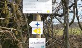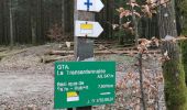

VESQUEVILLE ... par le Pré des Béguines.

GerardBouche
Utilisateur

Longueur
11,2 km

Altitude max
573 m

Dénivelé positif
220 m

Km-Effort
14,1 km

Altitude min
448 m

Dénivelé négatif
223 m
Boucle
Oui
Date de création :
2023-02-28 12:29:10.702
Dernière modification :
2023-02-28 17:00:24.733
2h32
Difficulté : Facile

Application GPS de randonnée GRATUITE
À propos
Randonnée Marche de 11,2 km à découvrir à Wallonie, Luxembourg, Saint-Hubert. Cette randonnée est proposée par GerardBouche.
Description
Un parcours forestier au départ des Fonds de Mayavau par le chemin sous le Chenet, la Fagne qui Goutte, les Champs Hallet et le lieu-dit " Aux Champs de Culée ".
Localisation
Pays :
Belgique
Région :
Wallonie
Département/Province :
Luxembourg
Commune :
Saint-Hubert
Localité :
Unknown
Départ:(Dec)
Départ:(UTM)
671200 ; 5542465 (31U) N.
Commentaires
Randonnées à proximité
Saint-Hubert - La Borne (SH07)


Marche
Difficile
(9)
Saint-Hubert,
Wallonie,
Luxembourg,
Belgique

13,9 km | 17,6 km-effort
3h 47min
Oui
Hatrival - Banalbois (SH13)


Marche
Moyen
(6)
Saint-Hubert,
Wallonie,
Luxembourg,
Belgique

7,5 km | 9,5 km-effort
2h 2min
Oui
RB-Lu-26_Saint-Hubert_via-racc-1-et-2


Marche
Très facile
(8)
Saint-Hubert,
Wallonie,
Luxembourg,
Belgique

14,6 km | 19,5 km-effort
4h 15min
Oui

Vesqueville - Vesqueville (SH09)


Marche
Difficile
(6)
Saint-Hubert,
Wallonie,
Luxembourg,
Belgique

15,6 km | 19,4 km-effort
4h 9min
Oui
Saint-Hubert - Les Abanages (SH03)


Marche
Difficile
(13)
Saint-Hubert,
Wallonie,
Luxembourg,
Belgique

9,8 km | 13,1 km-effort
2h 49min
Oui
Saint-Hubert - Les Gottes (SH02)


Marche
Moyen
(17)
Saint-Hubert,
Wallonie,
Luxembourg,
Belgique

6,9 km | 8,6 km-effort
1h 52min
Oui
Marche ADEPS Arville


Marche
Moyen
(1)
Saint-Hubert,
Wallonie,
Luxembourg,
Belgique

10,2 km | 13,6 km-effort
2h 13min
Oui
ADEPS Saint Hubert


Marche
Difficile
(1)
Saint-Hubert,
Wallonie,
Luxembourg,
Belgique

10,8 km | 13,7 km-effort
1h 57min
Oui
RB-Lu-26_Saint-Hubert


Marche
Très facile
(7)
Saint-Hubert,
Wallonie,
Luxembourg,
Belgique

25 km | 33 km-effort
7h 2min
Oui


 SityTrail


