![](/images/other/stat-length.png)
![Randonnée Marche Couchey - Couchey, Chemein du Carmel, Chamerey, retour par le haut de la côte - Photo](https://media.geolcdn.com/t/1900/400/ext.pjpeg?maxdim=2&url=https%3A%2F%2Fstatic1.geolcdn.com%2Fsiteimages%2Fupload%2Ffiles%2F1553511878bg_sport_marche.png)
Couchey, Chemein du Carmel, Chamerey, retour par le haut de la côte
mricard
Utilisateur
![Longueur](/images/other/stat-length.png)
Longueur
13,8 km
![Altitude max](https://static1.geolcdn.com/siteimages/upload/files/1508320355ic_sort_altitude_max_24dp.png)
Altitude max
528 m
![Dénivelé positif](https://static1.geolcdn.com/siteimages/upload/files/1508320355ic_sort_den_pos_24dp.png)
Dénivelé positif
266 m
![Km-Effort](/images/other/stat-length.png)
Km-Effort
17,4 km
![Altitude min](https://static1.geolcdn.com/siteimages/upload/files/1508320355ic_sort_altitude_min_24dp.png)
Altitude min
419 m
![Dénivelé négatif](https://static1.geolcdn.com/siteimages/upload/files/1508320355ic_sort_den_neg_24dp.png)
Dénivelé négatif
266 m
![Boucle](https://static1.geolcdn.com/siteimages/upload/files/16400158638029165_repeat_loop_refresh_sync_direction_icon.png)
Boucle
Oui
Date de création :
2023-02-20 18:01:39.188
Dernière modification :
2023-02-20 18:05:05.312
![Marche](https://static1.geolcdn.com/sitytour/trail-icons/101.png)
3h15
Difficulté : Facile
![Scannez ce code QR pour ouvrir la randonnée dans l'application SityTrail](https://capi.geolives.com/qq0zvz2zws4bq2lad0pu/sitytour/trails/3559322/qr.png?size=200)
Application GPS de randonnée GRATUITE
À propos
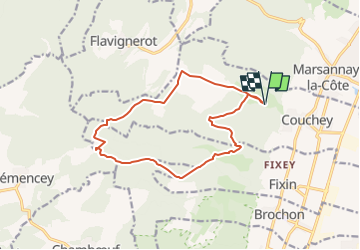
Randonnée Marche de 13,8 km à découvrir à Bourgogne-Franche-Comté, Côte-d'Or, Couchey. Cette randonnée est proposée par mricard.
Description
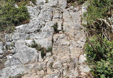
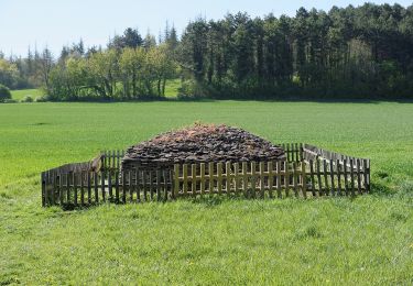
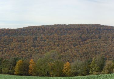
Parcours entre chemins blancs et forêt sans difficulté. Le plus sportifs pourront opter pour le Batier pour traverser la combe Laveau de Fixey
Localisation
Pays :
France
Région :
Bourgogne-Franche-Comté
Département/Province :
Côte-d'Or
Commune :
Couchey
Localité :
Unknown
Départ:(Dec)
Départ:(UTM)
648787 ; 5236388 (31T) N.
Commentaires
Randonnées à proximité
![Randonnée Marche Marsannay-la-Côte - Marsannay la Côte 2021-03-02 repérage CAF - Photo](https://media.geolcdn.com/t/375/260/a8946688-d158-4deb-8004-8983d24f20f3.jpg&format=jpg&maxdim=2)
![Marche Marche](https://static1.geolcdn.com/sitytour/trail-icons/101.png)
Marsannay la Côte 2021-03-02 repérage CAF
Marche
Très facile
(1)
Marsannay-la-Côte,
Bourgogne-Franche-Comté,
Côte-d'Or,
France
![](/images/other/stat-length.png)
23 km | 30 km-effort
4h 39min
![](https://static1.geolcdn.com/siteimages/upload/files/16400158638029165_repeat_loop_refresh_sync_direction_icon.png)
Oui
![Randonnée Marche Brochon - falaises et plateau - Photo](https://media.geolcdn.com/t/375/260/ext.jpg?maxdim=2&url=https%3A%2F%2Fservices.sitytrail.com%2FGeolivesWS%2FDownloadMedia.ashx%3FTrailID%3D640375%26Media%3Dfix__20161002163015.jpg)
![Marche Marche](https://static1.geolcdn.com/sitytour/trail-icons/101.png)
falaises et plateau
Marche
Difficile
(1)
Brochon,
Bourgogne-Franche-Comté,
Côte-d'Or,
France
![](/images/other/stat-length.png)
15,9 km | 22 km-effort
4h 45min
![](https://static1.geolcdn.com/siteimages/upload/files/16400158638029165_repeat_loop_refresh_sync_direction_icon.png)
Non
![Randonnée Marche Dijon - Combe St Joseph 21km Prj P8 MC 20220928 - Photo](https://media.geolcdn.com/t/375/260/e4ec7260-8a8c-4801-b869-91a5e0f7e844.jpg&format=jpg&maxdim=2)
![Marche Marche](https://static1.geolcdn.com/sitytour/trail-icons/101.png)
Combe St Joseph 21km Prj P8 MC 20220928
Marche
Très facile
(1)
Dijon,
Bourgogne-Franche-Comté,
Côte-d'Or,
France
![](/images/other/stat-length.png)
21 km | 29 km-effort
3h 34min
![](https://static1.geolcdn.com/siteimages/upload/files/16400158638029165_repeat_loop_refresh_sync_direction_icon.png)
Oui
![Randonnée Marche Brochon - Boucle des cent marches et du pavillon de l'empereur - Photo](https://media.geolcdn.com/t/375/260/c945b0b3-6e82-40bf-bac2-b1d204cc41d7.jpg&format=jpg&maxdim=2)
![Marche Marche](https://static1.geolcdn.com/sitytour/trail-icons/101.png)
Boucle des cent marches et du pavillon de l'empereur
Marche
Moyen
Brochon,
Bourgogne-Franche-Comté,
Côte-d'Or,
France
![](/images/other/stat-length.png)
5,5 km | 8,1 km-effort
1h 38min
![](https://static1.geolcdn.com/siteimages/upload/files/16400158638029165_repeat_loop_refresh_sync_direction_icon.png)
Oui
![Randonnée A pied Corcelles-les-Monts - Circuit découverte des Cadoles - Photo](https://media.geolcdn.com/t/375/260/f66f9569-7efe-45a6-9b51-0fd81c98626e.jpeg&format=jpg&maxdim=2)
![A pied A pied](https://static1.geolcdn.com/sitytour/trail-icons/100.png)
Circuit découverte des Cadoles
A pied
Facile
Corcelles-les-Monts,
Bourgogne-Franche-Comté,
Côte-d'Or,
France
![](/images/other/stat-length.png)
3,3 km | 4 km-effort
53min
![](https://static1.geolcdn.com/siteimages/upload/files/16400158638029165_repeat_loop_refresh_sync_direction_icon.png)
Oui
![Randonnée A pied Flavignerot - Du Naizou au Mont Afrique - Photo](https://media.geolcdn.com/t/375/260/37780069-2b1d-4f93-92c0-3e0d6f5857c8.jpeg&format=jpg&maxdim=2)
![A pied A pied](https://static1.geolcdn.com/sitytour/trail-icons/100.png)
Du Naizou au Mont Afrique
A pied
Facile
Flavignerot,
Bourgogne-Franche-Comté,
Côte-d'Or,
France
![](/images/other/stat-length.png)
8,9 km | 11,4 km-effort
2h 35min
![](https://static1.geolcdn.com/siteimages/upload/files/16400158638029165_repeat_loop_refresh_sync_direction_icon.png)
Oui
![Randonnée Marche Fixin - nouveaux chemins - Photo](https://media.geolcdn.com/t/375/260/ext.jpg?maxdim=2&url=https%3A%2F%2Fstatic1.geolcdn.com%2Fsiteimages%2Fupload%2Ffiles%2F1553511878bg_sport_marche.png)
![Marche Marche](https://static1.geolcdn.com/sitytour/trail-icons/101.png)
nouveaux chemins
Marche
Moyen
(1)
Fixin,
Bourgogne-Franche-Comté,
Côte-d'Or,
France
![](/images/other/stat-length.png)
12,6 km | 16,5 km-effort
3h 3min
![](https://static1.geolcdn.com/siteimages/upload/files/16400158638029165_repeat_loop_refresh_sync_direction_icon.png)
Oui
![Randonnée Marche Corcelles-les-Monts - Corcelles les Monts - Photo](https://media.geolcdn.com/t/375/260/ext.jpg?maxdim=2&url=https%3A%2F%2Fstatic1.geolcdn.com%2Fsiteimages%2Fupload%2Ffiles%2F1553511878bg_sport_marche.png)
![Marche Marche](https://static1.geolcdn.com/sitytour/trail-icons/101.png)
Corcelles les Monts
Marche
Facile
(1)
Corcelles-les-Monts,
Bourgogne-Franche-Comté,
Côte-d'Or,
France
![](/images/other/stat-length.png)
11,4 km | 16,6 km-effort
3h 29min
![](https://static1.geolcdn.com/siteimages/upload/files/16400158638029165_repeat_loop_refresh_sync_direction_icon.png)
Oui
![Randonnée V.T.T. Chenôve - chenove Vcre - Photo](https://media.geolcdn.com/t/375/260/ext.jpg?maxdim=2&url=https%3A%2F%2Fstatic1.geolcdn.com%2Fsiteimages%2Fupload%2Ffiles%2F1524743154velo.jpg)
![V.T.T. V.T.T.](https://static1.geolcdn.com/sitytour/trail-icons/202.png)
chenove Vcre
V.T.T.
Facile
(1)
Chenôve,
Bourgogne-Franche-Comté,
Côte-d'Or,
France
![](/images/other/stat-length.png)
34 km | 40 km-effort
2h 52min
![](https://static1.geolcdn.com/siteimages/upload/files/16400158638029165_repeat_loop_refresh_sync_direction_icon.png)
Non