Randonnée Randonnée équestre Tritteling-Redlach - 2022-07-10-01 ACDV Balade à cheval en huit depuis Tritteling - Photo

2022-07-10-01 ACDV Balade à cheval en huit depuis Tritteling

 Paul57
Paul57

Utilisateur

© OpenStreetMap contributors
Longueur
Longueur
23 km
Altitude max
Altitude max
408 m
Dénivelé positif
Dénivelé positif
417 m
Km-Effort
Km-Effort  
28 km
Altitude min
Altitude min
297 m
Dénivelé négatif
Dénivelé négatif
417 m
Boucle
Boucle
Oui
Date de création :
2023-02-20 14:41:17.47
Dernière modification :
2023-02-20 14:42:44.608

(0 Avis)

Randonnée équestre
Randonnée équestre
3h42
Difficulté : Moyen

Scannez ce code QR pour ouvrir la randonnée dans l'application SityTrail

Application GPS de randonnée GRATUITE

Logo SityTrail SityTrail

IGN / Instituts géographiques

Télécharger SityTrail sur l'App Store Télécharger SityTrail sur Google Play

Logo SityTrail SityTrail World

Le monde est à vous

Télécharger SityTrail sur l'App Store Télécharger SityTrail sur Google Play Télécharger SityTrail sur Huawei AppGallery

À propos

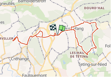
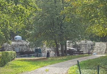
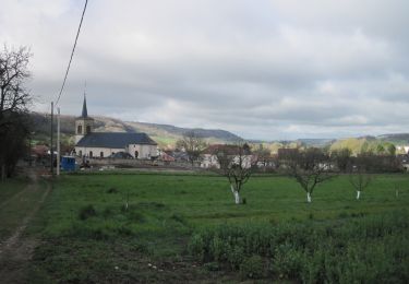
Randonnée Randonnée équestre de 23 km à découvrir à Grand Est, Moselle, Tritteling-Redlach. Cette randonnée est proposée par Paul57.

Description

Balade à cheval en huit depuis Tritteling de 23km.

Profil altimétrique

Localisation

Pays :
France
Région :
Grand Est
Département/Province :
Moselle
Commune :
Tritteling-Redlach
Localité :
Unknown
Départ:(Dec)
Départ:(UTM)
326349 ; 5438908 (32U) N.

Randonnées à proximité

Randonnée Marche Bambiderstroff - Circuit de la Vallée du Bambesch - Bambiderstroff - Photo
Marche
tracegps

Marche

Moyen
(1)
Bambiderstroff, Grand Est, Moselle, France
16,5 km | 20 km-effort
4h 0min
Oui
Randonnée A pied Bambiderstroff - Circuit Vallée du Bambesh - Photo
A pied
PRO

A pied

Facile
Bambiderstroff, Grand Est, Moselle, France
14,6 km | 17,9 km-effort
4h 3min
Oui
Randonnée A pied Folschviller - Circuit Découverte du Site Minier - Photo
A pied
PRO

A pied

Facile
Folschviller, Grand Est, Moselle, France
10 km | 12,3 km-effort
2h 47min
Oui
Randonnée A pied Pontpierre - Circuit du golf - Photo
A pied
PRO

A pied

Facile
Pontpierre, Grand Est, Moselle, France
16 km | 19,4 km-effort
4h 24min
Oui
Randonnée Marche Pontpierre - expo nature Faulquemont  - Photo
Marche
Bob5757

Marche

Très facile
Pontpierre, Grand Est, Moselle, France
3,6 km | 4,3 km-effort
2h 46min
Non
Randonnée Marche Longeville-lès-Saint-Avold - Longeville - Bambiderstroff - Photo
Marche
oger_eric

Marche

Facile
(1)
Longeville-lès-Saint-Avold, Grand Est, Moselle, France
10,4 km | 13,7 km-effort
2h 56min
Oui
Randonnée Marche nordique Bambiderstroff - Eric Bambiderstroff  - Photo
Marche nordique
oger_eric

Marche nordique

Facile
Bambiderstroff, Grand Est, Moselle, France
14,8 km | 18,4 km-effort
2h 35min
Oui
Randonnée Marche Bambiderstroff - Tour de Bambiderstroff - Photo
Marche
piem

Marche

Moyen
Bambiderstroff, Grand Est, Moselle, France
12,8 km | 15,8 km-effort
3h 50min
Oui
Randonnée A pied Longeville-lès-Saint-Avold - Circuit de St Martin-en-Glandière - Photo
A pied
PRO

A pied

Facile
Longeville-lès-Saint-Avold, Grand Est, Moselle, France
4,3 km | 6,4 km-effort
1h 27min
Non


Fermer
Mes abonnements