![](/images/other/stat-length.png)
![Randonnée Marche Saint-Fortunat-sur-Eyrieux - St Fortunat - Photo](https://media.geolcdn.com/t/1900/400/381c4b81-0aa1-4f19-b6ca-35bea67274ae.jpg&format=pjpeg&maxdim=2)
St Fortunat
ajd26
Utilisateur
![Longueur](/images/other/stat-length.png)
Longueur
16,7 km
![Altitude max](https://static1.geolcdn.com/siteimages/upload/files/1508320355ic_sort_altitude_max_24dp.png)
Altitude max
655 m
![Dénivelé positif](https://static1.geolcdn.com/siteimages/upload/files/1508320355ic_sort_den_pos_24dp.png)
Dénivelé positif
594 m
![Km-Effort](/images/other/stat-length.png)
Km-Effort
25 km
![Altitude min](https://static1.geolcdn.com/siteimages/upload/files/1508320355ic_sort_altitude_min_24dp.png)
Altitude min
147 m
![Dénivelé négatif](https://static1.geolcdn.com/siteimages/upload/files/1508320355ic_sort_den_neg_24dp.png)
Dénivelé négatif
594 m
![Boucle](https://static1.geolcdn.com/siteimages/upload/files/16400158638029165_repeat_loop_refresh_sync_direction_icon.png)
Boucle
Oui
Date de création :
2023-02-20 08:43:48.0
Dernière modification :
2023-02-22 16:39:29.409
![Marche](https://static1.geolcdn.com/sitytour/trail-icons/101.png)
4h38
Difficulté : Moyen
![Scannez ce code QR pour ouvrir la randonnée dans l'application SityTrail](https://capi.geolives.com/qq0zvz2zws4bq2lad0pu/sitytour/trails/3558918/qr.png?size=200)
Application GPS de randonnée GRATUITE
À propos
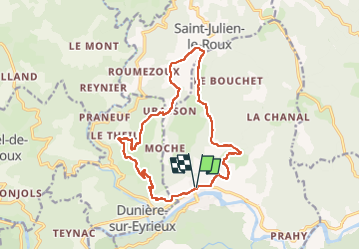
Randonnée Marche de 16,7 km à découvrir à Auvergne-Rhône-Alpes, Ardèche, Saint-Fortunat-sur-Eyrieux. Cette randonnée est proposée par ajd26.
Description
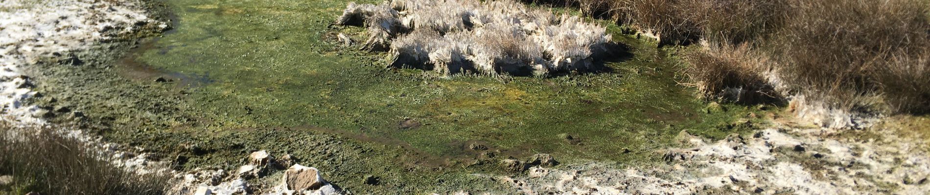
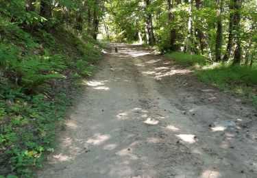
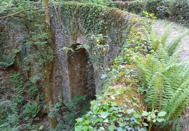
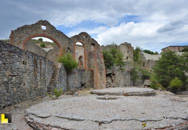
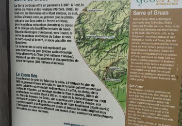
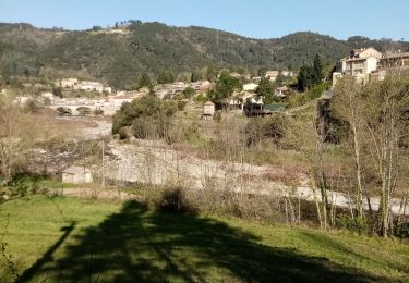
beaux points de vue tout au long du parcours
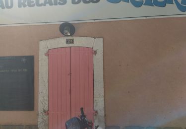
au départ de St Fortunat court passage sur la D120 et après le petit pont, forte montée sur 500m
Localisation
Pays :
France
Région :
Auvergne-Rhône-Alpes
Département/Province :
Ardèche
Commune :
Saint-Fortunat-sur-Eyrieux
Localité :
Unknown
Départ:(Dec)
Départ:(UTM)
632571 ; 4965402 (31T) N.
Commentaires
Randonnées à proximité
![Randonnée Marche Saint-Fortunat-sur-Eyrieux - 07 st fortunat dubieres st Vincent dufort - Photo](https://media.geolcdn.com/t/375/260/c34c03c4-9768-4a05-aafb-3fcd76453ebb.jpg&format=jpg&maxdim=2)
![Marche Marche](https://static1.geolcdn.com/sitytour/trail-icons/101.png)
07 st fortunat dubieres st Vincent dufort
Marche
Moyen
Saint-Fortunat-sur-Eyrieux,
Auvergne-Rhône-Alpes,
Ardèche,
France
![](/images/other/stat-length.png)
22 km | 33 km-effort
8h 41min
![](https://static1.geolcdn.com/siteimages/upload/files/16400158638029165_repeat_loop_refresh_sync_direction_icon.png)
Oui
![Randonnée Marche Les Ollières-sur-Eyrieux - 07 ollieres sur eyrieux Gruas - Photo](https://media.geolcdn.com/t/375/260/9ffda187-d312-43bf-86a6-ea773d0d4ffe.jpg&format=jpg&maxdim=2)
![Marche Marche](https://static1.geolcdn.com/sitytour/trail-icons/101.png)
07 ollieres sur eyrieux Gruas
Marche
Moyen
Les Ollières-sur-Eyrieux,
Auvergne-Rhône-Alpes,
Ardèche,
France
![](/images/other/stat-length.png)
16,5 km | 27 km-effort
7h 0min
![](https://static1.geolcdn.com/siteimages/upload/files/16400158638029165_repeat_loop_refresh_sync_direction_icon.png)
Oui
![Randonnée Vélo de route Saint-Fortunat-sur-Eyrieux - 07 st Fortunat st agreve vv - Photo](https://media.geolcdn.com/t/375/260/8f83dac9-764a-4d77-bc61-77b94ef715b6.jpg&format=jpg&maxdim=2)
![Vélo de route Vélo de route](https://static1.geolcdn.com/sitytour/trail-icons/201.png)
07 st Fortunat st agreve vv
Vélo de route
Moyen
(1)
Saint-Fortunat-sur-Eyrieux,
Auvergne-Rhône-Alpes,
Ardèche,
France
![](/images/other/stat-length.png)
59 km | 80 km-effort
6h 31min
![](https://static1.geolcdn.com/siteimages/upload/files/16400158638029165_repeat_loop_refresh_sync_direction_icon.png)
Non
![Randonnée Marche Saint-Cierge-la-Serre - St-Cierge-la-Serre 13,5km. - Photo](https://media.geolcdn.com/t/375/260/5f198452-8c98-4283-ab78-413b9a406c9c.jpg&format=jpg&maxdim=2)
![Marche Marche](https://static1.geolcdn.com/sitytour/trail-icons/101.png)
St-Cierge-la-Serre 13,5km.
Marche
Difficile
Saint-Cierge-la-Serre,
Auvergne-Rhône-Alpes,
Ardèche,
France
![](/images/other/stat-length.png)
13,7 km | 19,8 km-effort
4h 29min
![](https://static1.geolcdn.com/siteimages/upload/files/16400158638029165_repeat_loop_refresh_sync_direction_icon.png)
Oui
![Randonnée Marche Les Ollières-sur-Eyrieux - Serré de Gruas - Photo](https://media.geolcdn.com/t/375/260/08cf67dd-d65b-4d6b-a337-2ee393033a8e.jpg&format=jpg&maxdim=2)
![Marche Marche](https://static1.geolcdn.com/sitytour/trail-icons/101.png)
Serré de Gruas
Marche
Facile
Les Ollières-sur-Eyrieux,
Auvergne-Rhône-Alpes,
Ardèche,
France
![](/images/other/stat-length.png)
16,8 km | 27 km-effort
4h 51min
![](https://static1.geolcdn.com/siteimages/upload/files/16400158638029165_repeat_loop_refresh_sync_direction_icon.png)
Oui
![Randonnée Marche Les Ollières-sur-Eyrieux - la croix du banc - Photo](https://media.geolcdn.com/t/375/260/d82c3cd3-35d0-4e92-bd70-cb6fc678571a.jpg&format=jpg&maxdim=2)
![Marche Marche](https://static1.geolcdn.com/sitytour/trail-icons/101.png)
la croix du banc
Marche
Moyen
Les Ollières-sur-Eyrieux,
Auvergne-Rhône-Alpes,
Ardèche,
France
![](/images/other/stat-length.png)
13,6 km | 20 km-effort
4h 27min
![](https://static1.geolcdn.com/siteimages/upload/files/16400158638029165_repeat_loop_refresh_sync_direction_icon.png)
Oui
![Randonnée Marche Dunière-sur-Eyrieux - Duniere reco - Photo](https://media.geolcdn.com/t/375/260/cf0e22a2-5839-4204-9a80-7596afd65d2e.jpg&format=jpg&maxdim=2)
![Marche Marche](https://static1.geolcdn.com/sitytour/trail-icons/101.png)
Duniere reco
Marche
Moyen
Dunière-sur-Eyrieux,
Auvergne-Rhône-Alpes,
Ardèche,
France
![](/images/other/stat-length.png)
12,4 km | 19,3 km-effort
6h 30min
![](https://static1.geolcdn.com/siteimages/upload/files/16400158638029165_repeat_loop_refresh_sync_direction_icon.png)
Oui
![Randonnée Marche Saint-Fortunat-sur-Eyrieux - LA Caracole. Saint-Fortunat-sur-Eyrieux - Photo](https://media.geolcdn.com/t/375/260/571461e7-0aec-4cfe-9c68-45930b9f1aa3.jpg&format=jpg&maxdim=2)
![Marche Marche](https://static1.geolcdn.com/sitytour/trail-icons/101.png)
LA Caracole. Saint-Fortunat-sur-Eyrieux
Marche
Difficile
Saint-Fortunat-sur-Eyrieux,
Auvergne-Rhône-Alpes,
Ardèche,
France
![](/images/other/stat-length.png)
18,8 km | 0 m-effort
4h 44min
![](https://static1.geolcdn.com/siteimages/upload/files/16400158638029165_repeat_loop_refresh_sync_direction_icon.png)
Non
![Randonnée Marche Saint-Julien-le-Roux - Col de la Mure haut vivarais - Photo](https://media.geolcdn.com/t/375/260/ext.jpg?maxdim=2&url=https%3A%2F%2Fstatic1.geolcdn.com%2Fsiteimages%2Fupload%2Ffiles%2F1553511878bg_sport_marche.png)
![Marche Marche](https://static1.geolcdn.com/sitytour/trail-icons/101.png)
Col de la Mure haut vivarais
Marche
Moyen
Saint-Julien-le-Roux,
Auvergne-Rhône-Alpes,
Ardèche,
France
![](/images/other/stat-length.png)
10,1 km | 13,6 km-effort
2h 35min
![](https://static1.geolcdn.com/siteimages/upload/files/16400158638029165_repeat_loop_refresh_sync_direction_icon.png)
Oui