![](/images/other/stat-length.png)
![Randonnée V.T.T. Saint-Antoine-du-Rocher - Saint Antoine-Serrain-Bois du Mortier-Neuillé-Rouziers-4 Vents-St.Antoine-35,1 Km-Le 19 Octobre 2014-Auteur tintin37 - Photo](https://media.geolcdn.com/t/1900/400/ext.pjpeg?maxdim=2&url=https%3A%2F%2Fstatic1.geolcdn.com%2Fsiteimages%2Fupload%2Ffiles%2F1524743154velo.jpg)
Saint Antoine-Serrain-Bois du Mortier-Neuillé-Rouziers-4 Vents-St.Antoine-35,1 Km-Le 19 Octobre 2014-Auteur tintin37
Martinjeanclaude
Utilisateur
![Longueur](/images/other/stat-length.png)
![Altitude max](https://static1.geolcdn.com/siteimages/upload/files/1508320355ic_sort_altitude_max_24dp.png)
![Dénivelé positif](https://static1.geolcdn.com/siteimages/upload/files/1508320355ic_sort_den_pos_24dp.png)
![Km-Effort](/images/other/stat-length.png)
![Altitude min](https://static1.geolcdn.com/siteimages/upload/files/1508320355ic_sort_altitude_min_24dp.png)
![Dénivelé négatif](https://static1.geolcdn.com/siteimages/upload/files/1508320355ic_sort_den_neg_24dp.png)
![Boucle](https://static1.geolcdn.com/siteimages/upload/files/16400158638029165_repeat_loop_refresh_sync_direction_icon.png)
![V.T.T.](https://static1.geolcdn.com/sitytour/trail-icons/202.png)
2h35
Difficulté : Moyen
![Scannez ce code QR pour ouvrir la randonnée dans l'application SityTrail](https://capi.geolives.com/qq0zvz2zws4bq2lad0pu/sitytour/trails/355609/qr.png?size=200)
Application GPS de randonnée GRATUITE
À propos
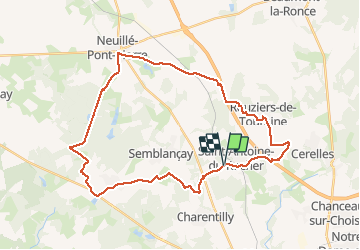
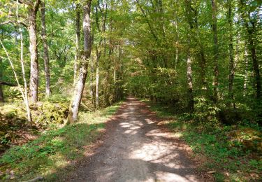
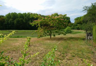
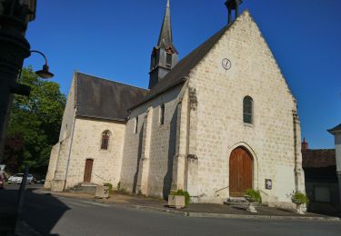
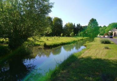
Randonnée V.T.T. de 35 km à découvrir à Centre-Val de Loire, Indre-et-Loire, Saint-Antoine-du-Rocher. Cette randonnée est proposée par Martinjeanclaude.
Description
La garenne-Les caves Buard-Dir.Semblancay-Le Serrain-Route de Chateau la Vallières-Chemin dir. route Sonzay-Bois du Mortier aux Moines-Neuille Pont Pierre-Route direc.Rouziers-Passage gibiers A28-Rouziers terrain de foot-Chemin salle des 4 vents-Route de Cerelles-St.Antoine-La Garenne
Localisation
Commentaires
Randonnées à proximité
![Randonnée Marche Cerelles - Cerelles - Photo](https://media.geolcdn.com/t/375/260/ext.jpg?maxdim=2&url=https%3A%2F%2Fservices.sitytrail.com%2FGeolivesWS%2FDownloadMedia.ashx%3FTrailID%3D231250%26Media%3Dfix__20131106141542.jpg)
![Marche Marche](https://static1.geolcdn.com/sitytour/trail-icons/101.png)
Marche
![](/images/other/stat-length.png)
![](https://static1.geolcdn.com/siteimages/upload/files/16400158638029165_repeat_loop_refresh_sync_direction_icon.png)
![Randonnée Marche Rouziers-de-Touraine - Rouziers-de-Touraine - Circuit 3 - 21km 175m 5h00 (35mn) - 2023 05 21 - Photo](https://media.geolcdn.com/t/375/260/2c3469a1-6005-4652-bab3-634d6cf350c3.jpg&format=jpg&maxdim=2)
![Marche Marche](https://static1.geolcdn.com/sitytour/trail-icons/101.png)
Marche
![](/images/other/stat-length.png)
![](https://static1.geolcdn.com/siteimages/upload/files/16400158638029165_repeat_loop_refresh_sync_direction_icon.png)
![Randonnée Marche Saint-Antoine-du-Rocher - Saint-Antoine-du-Rocher - Rouziers-de-Touraine - 21.4km 165m 4h55 - 2022 04 03 - Photo](https://media.geolcdn.com/t/375/260/8b36e295-8247-4873-9751-f344e6172f47.jpg&format=jpg&maxdim=2)
![Marche Marche](https://static1.geolcdn.com/sitytour/trail-icons/101.png)
Marche
![](/images/other/stat-length.png)
![](https://static1.geolcdn.com/siteimages/upload/files/16400158638029165_repeat_loop_refresh_sync_direction_icon.png)
![Randonnée Marche Charentilly - Charentilly - PR la Choisillette avec variante - 9km 100m 1h50 - 2020 11 28 - Photo](https://media.geolcdn.com/t/375/260/c1b744c0-bc06-4fe5-a4fc-24f9728adfe5.jpg&format=jpg&maxdim=2)
![Marche Marche](https://static1.geolcdn.com/sitytour/trail-icons/101.png)
Marche
![](/images/other/stat-length.png)
![](https://static1.geolcdn.com/siteimages/upload/files/16400158638029165_repeat_loop_refresh_sync_direction_icon.png)
![Randonnée Marche Cerelles - Cérelles - Circuits 2 puis 1 - 18.9km 255m 4h05 - 2020 09 11 - Photo](https://media.geolcdn.com/t/375/260/2967519f-5900-49cf-b0ee-522e62c44bc9.jpg&format=jpg&maxdim=2)
![Marche Marche](https://static1.geolcdn.com/sitytour/trail-icons/101.png)
Marche
![](/images/other/stat-length.png)
![](https://static1.geolcdn.com/siteimages/upload/files/16400158638029165_repeat_loop_refresh_sync_direction_icon.png)
![Randonnée Marche Charentilly - Charentilly - Circuit 2 avec variante - 14.8km 135m 3h05 - 2020 08 15 - Photo](https://media.geolcdn.com/t/375/260/3d2c51a1-3af7-44d8-bc0c-6a33566d6f6e.jpg&format=jpg&maxdim=2)
![Marche Marche](https://static1.geolcdn.com/sitytour/trail-icons/101.png)
Marche
![](/images/other/stat-length.png)
![](https://static1.geolcdn.com/siteimages/upload/files/16400158638029165_repeat_loop_refresh_sync_direction_icon.png)
![Randonnée Marche Rouziers-de-Touraine - Rouziers-de-Touraine - Circuit 2 - 14.1km 160m 3h10 - 2020 05 12 - Photo](https://media.geolcdn.com/t/375/260/85070cc1-3935-4159-861b-15cf660616ad.jpg&format=jpg&maxdim=2)
![Marche Marche](https://static1.geolcdn.com/sitytour/trail-icons/101.png)
Marche
![](/images/other/stat-length.png)
![](https://static1.geolcdn.com/siteimages/upload/files/16400158638029165_repeat_loop_refresh_sync_direction_icon.png)
![Randonnée Marche Saint-Antoine-du-Rocher - Saint-Antoine-du-Rocher - circuit 2 - 9.2km 95m 2h05 - 2019 06 18 - Photo](https://media.geolcdn.com/t/375/260/04077eac-cbda-460d-bd61-597d1f82138d.jpg&format=jpg&maxdim=2)
![Marche Marche](https://static1.geolcdn.com/sitytour/trail-icons/101.png)
Marche
![](/images/other/stat-length.png)
![](https://static1.geolcdn.com/siteimages/upload/files/16400158638029165_repeat_loop_refresh_sync_direction_icon.png)
![Randonnée Marche Rouziers-de-Touraine - bois bourdeil beaumont variante - Photo](https://media.geolcdn.com/t/375/260/ext.jpg?maxdim=2&url=https%3A%2F%2Fstatic1.geolcdn.com%2Fsiteimages%2Fupload%2Ffiles%2F1553511878bg_sport_marche.png)
![Marche Marche](https://static1.geolcdn.com/sitytour/trail-icons/101.png)
Marche
![](/images/other/stat-length.png)
![](https://static1.geolcdn.com/siteimages/upload/files/16400158638029165_repeat_loop_refresh_sync_direction_icon.png)