![](/images/other/stat-length.png)
![Randonnée Marche Thiers - Thiers_Couteliere_3 - Photo](https://media.geolcdn.com/t/1900/400/dcb28280-70fa-4637-9a62-befd9280dc1e.jpg&format=pjpeg&maxdim=2)
Thiers_Couteliere_3
jagarnier
Utilisateur GUIDE
![Longueur](/images/other/stat-length.png)
![Altitude max](https://static1.geolcdn.com/siteimages/upload/files/1508320355ic_sort_altitude_max_24dp.png)
![Dénivelé positif](https://static1.geolcdn.com/siteimages/upload/files/1508320355ic_sort_den_pos_24dp.png)
![Km-Effort](/images/other/stat-length.png)
![Altitude min](https://static1.geolcdn.com/siteimages/upload/files/1508320355ic_sort_altitude_min_24dp.png)
![Dénivelé négatif](https://static1.geolcdn.com/siteimages/upload/files/1508320355ic_sort_den_neg_24dp.png)
![Boucle](https://static1.geolcdn.com/siteimages/upload/files/16400158638029165_repeat_loop_refresh_sync_direction_icon.png)
![Marche](https://static1.geolcdn.com/sitytour/trail-icons/101.png)
7h00
Difficulté : Difficile
![Scannez ce code QR pour ouvrir la randonnée dans l'application SityTrail](https://capi.geolives.com/qq0zvz2zws4bq2lad0pu/sitytour/trails/3554056/qr.png?size=200)
Application GPS de randonnée GRATUITE
À propos
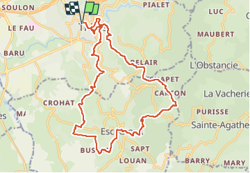
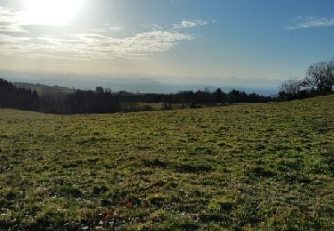
Randonnée Marche de 21 km à découvrir à Auvergne-Rhône-Alpes, Puy-de-Dôme, Thiers. Cette randonnée est proposée par jagarnier.
Description
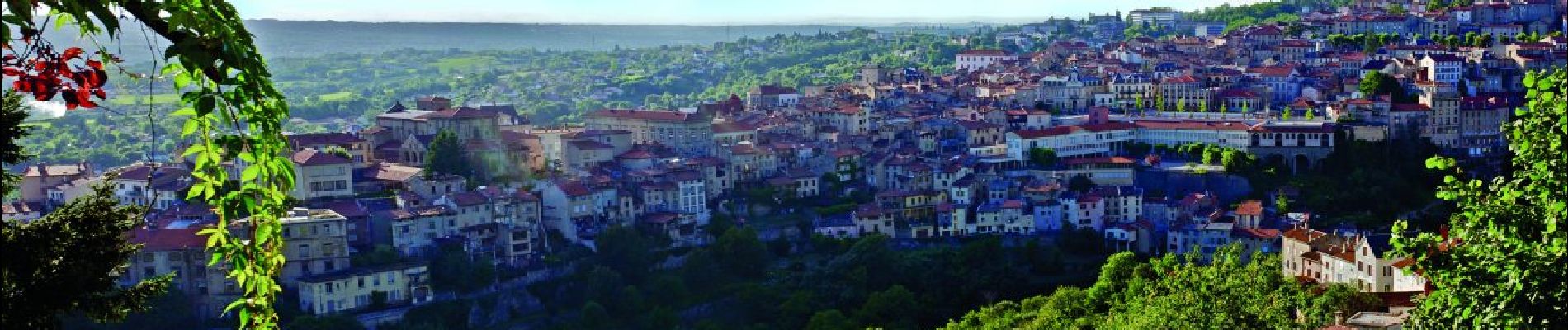
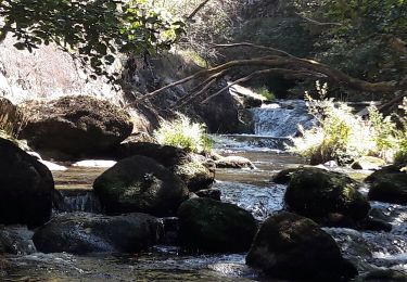
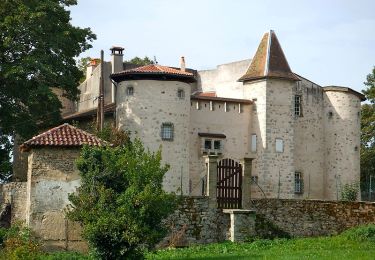
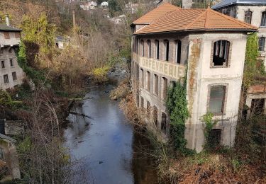
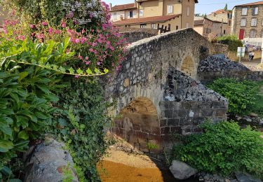
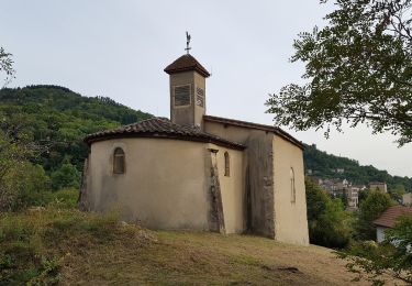
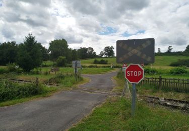
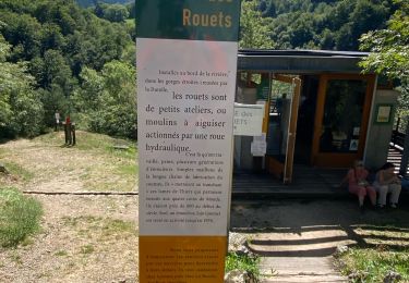
Thiers, depuis 6 siècles, a été marqué par ses couteliers, le GMIT (Groupe des Marcheurs Indépendants de Thiers) leur dédie une randonnée avec un parcours recentré sur la région thiernoise, la Vallée des rouets, la Durolle, la cité médiévale, les paysages du Livradois Forez et du val de DORE, ...
Localisation
Commentaires
Randonnées à proximité
![Randonnée Marche Thiers - Thiers_Enfer_Rouets - Photo](https://media.geolcdn.com/t/375/260/d30f62f6-c2be-42d4-8327-b960a8e7ad10.jpg&format=jpg&maxdim=2)
![Marche Marche](https://static1.geolcdn.com/sitytour/trail-icons/101.png)
Marche
![](/images/other/stat-length.png)
![](https://static1.geolcdn.com/siteimages/upload/files/16400158638029165_repeat_loop_refresh_sync_direction_icon.png)
![Randonnée Marche Thiers - Thiers_Horts - Photo](https://media.geolcdn.com/t/375/260/a517b9ce-72b2-4eb8-b533-599543dd0dbf.jpg&format=jpg&maxdim=2)
![Marche Marche](https://static1.geolcdn.com/sitytour/trail-icons/101.png)
Marche
![](/images/other/stat-length.png)
![](https://static1.geolcdn.com/siteimages/upload/files/16400158638029165_repeat_loop_refresh_sync_direction_icon.png)
![Randonnée Marche Saint-Rémy-sur-Durolle - 2016-1-26- Chabrol - Photo](https://media.geolcdn.com/t/375/260/ext.jpg?maxdim=2&url=https%3A%2F%2Fservices.sitytrail.com%2FGeolivesWS%2FDownloadMedia.ashx%3FTrailID%3D517769%26Media%3Dfix__20160126160133.jpg)
![Marche Marche](https://static1.geolcdn.com/sitytour/trail-icons/101.png)
Marche
![](/images/other/stat-length.png)
![](https://static1.geolcdn.com/siteimages/upload/files/16400158638029165_repeat_loop_refresh_sync_direction_icon.png)
![Randonnée A pied Thiers - Thiers - Château de Vaulx - Photo](https://media.geolcdn.com/t/375/260/d9376438-b0f9-4c05-849e-307a520c5889.jpeg&format=jpg&maxdim=2)
![A pied A pied](https://static1.geolcdn.com/sitytour/trail-icons/100.png)
A pied
![](/images/other/stat-length.png)
![](https://static1.geolcdn.com/siteimages/upload/files/16400158638029165_repeat_loop_refresh_sync_direction_icon.png)
![Randonnée A pied Thiers - Château de Vaulx - Thiers - Photo](https://media.geolcdn.com/t/375/260/a3f04348-13bb-4f13-9b8b-5e876d0aa9b1.jpeg&format=jpg&maxdim=2)
![A pied A pied](https://static1.geolcdn.com/sitytour/trail-icons/100.png)
A pied
![](/images/other/stat-length.png)
![](https://static1.geolcdn.com/siteimages/upload/files/16400158638029165_repeat_loop_refresh_sync_direction_icon.png)
![Randonnée A pied Dorat - Le sentier de Néron - Photo](https://media.geolcdn.com/t/375/260/c929225b-d926-40dd-9fd6-d6dd547a4945.jpeg&format=jpg&maxdim=2)
![A pied A pied](https://static1.geolcdn.com/sitytour/trail-icons/100.png)
A pied
![](/images/other/stat-length.png)
![](https://static1.geolcdn.com/siteimages/upload/files/16400158638029165_repeat_loop_refresh_sync_direction_icon.png)
![Randonnée A pied Thiers - De l'Enfer aux Rouets - Photo](https://media.geolcdn.com/t/375/260/929c0432-0df8-4b9b-9f47-7f14e14b443e.jpeg&format=jpg&maxdim=2)
![A pied A pied](https://static1.geolcdn.com/sitytour/trail-icons/100.png)
A pied
![](/images/other/stat-length.png)
![](https://static1.geolcdn.com/siteimages/upload/files/16400158638029165_repeat_loop_refresh_sync_direction_icon.png)
![Randonnée A pied Escoutoux - Les Terrasses de la Dore - Photo](https://media.geolcdn.com/t/375/260/35672727-a85c-4fd8-ae6f-8544d7faa0f5.jpeg&format=jpg&maxdim=2)
![A pied A pied](https://static1.geolcdn.com/sitytour/trail-icons/100.png)
A pied
![](/images/other/stat-length.png)
![](https://static1.geolcdn.com/siteimages/upload/files/16400158638029165_repeat_loop_refresh_sync_direction_icon.png)
![Randonnée Marche Thiers - Ballet des rouets - Photo](https://media.geolcdn.com/t/375/260/810cc98b-159f-4c9b-8e0c-49a79d616f43.jpg&format=jpg&maxdim=2)
![Marche Marche](https://static1.geolcdn.com/sitytour/trail-icons/101.png)
Marche
![](/images/other/stat-length.png)
![](https://static1.geolcdn.com/siteimages/upload/files/16400158638029165_repeat_loop_refresh_sync_direction_icon.png)