![](/images/other/stat-length.png)
![Randonnée Marche Hamois - HAMOIS _ Marche Fédérale _ NA _ 4/02/2023 - Photo](https://media.geolcdn.com/t/1900/400/ext.pjpeg?maxdim=2&url=https%3A%2F%2Fstatic1.geolcdn.com%2Fsiteimages%2Fupload%2Ffiles%2F1553511878bg_sport_marche.png)
HAMOIS _ Marche Fédérale _ NA _ 4/02/2023
jeangulu
Utilisateur
![Longueur](/images/other/stat-length.png)
Longueur
22 km
![Altitude max](https://static1.geolcdn.com/siteimages/upload/files/1508320355ic_sort_altitude_max_24dp.png)
Altitude max
328 m
![Dénivelé positif](https://static1.geolcdn.com/siteimages/upload/files/1508320355ic_sort_den_pos_24dp.png)
Dénivelé positif
304 m
![Km-Effort](/images/other/stat-length.png)
Km-Effort
26 km
![Altitude min](https://static1.geolcdn.com/siteimages/upload/files/1508320355ic_sort_altitude_min_24dp.png)
Altitude min
239 m
![Dénivelé négatif](https://static1.geolcdn.com/siteimages/upload/files/1508320355ic_sort_den_neg_24dp.png)
Dénivelé négatif
301 m
![Boucle](https://static1.geolcdn.com/siteimages/upload/files/16400158638029165_repeat_loop_refresh_sync_direction_icon.png)
Boucle
Oui
Date de création :
2023-02-04 09:27:10.875
Dernière modification :
2023-02-04 18:45:20.52
![Marche](https://static1.geolcdn.com/sitytour/trail-icons/101.png)
5h04
Difficulté : Moyen
![Scannez ce code QR pour ouvrir la randonnée dans l'application SityTrail](https://capi.geolives.com/qq0zvz2zws4bq2lad0pu/sitytour/trails/3540475/qr.png?size=200)
Application GPS de randonnée GRATUITE
À propos
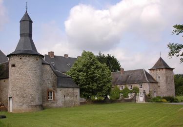
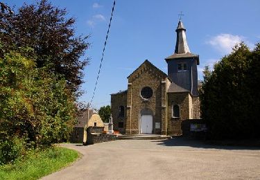
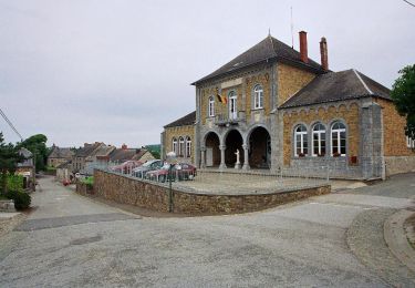
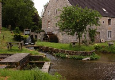
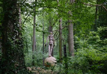
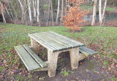
Randonnée Marche de 22 km à découvrir à Wallonie, Namur, Hamois. Cette randonnée est proposée par jeangulu.
Description
Point de départ : Maison des Jeunes - Rue Saint Pierre 38 [ 5360 ] - HAMOIS.
Organisateur : NA 026
LES CULS DE JATTE DU MAUGE.
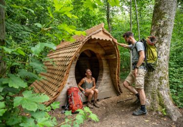
Marche d'hiver ( Saison )
Localisation
Pays :
Belgique
Région :
Wallonie
Département/Province :
Namur
Commune :
Hamois
Localité :
Unknown
Départ:(Dec)
Départ:(UTM)
653033 ; 5579064 (31U) N.
Commentaires
Randonnées à proximité
![Randonnée Marche Hamois - HAMOIS- Scy (Mohiville)- Promenade du Berceau du Bocq - Photo](https://media.geolcdn.com/t/375/260/ext.jpg?maxdim=2&url=https%3A%2F%2Fservices.sitytrail.com%2FGeolivesWS%2FDownloadMedia.ashx%3FTrailID%3D250701%26Media%3D514f4968-57f7-4b3e-aef8-c121b3f2a3eb.jpg)
![Marche Marche](https://static1.geolcdn.com/sitytour/trail-icons/101.png)
HAMOIS- Scy (Mohiville)- Promenade du Berceau du Bocq
Marche
Facile
(12)
Hamois,
Wallonie,
Namur,
Belgique
![](/images/other/stat-length.png)
7,9 km | 9,8 km-effort
2h 4min
![](https://static1.geolcdn.com/siteimages/upload/files/16400158638029165_repeat_loop_refresh_sync_direction_icon.png)
Oui
![Randonnée Marche Hamois - HAMOIS- Schaltin- Promenade du Bois du Bocq au Colombier - Photo](https://media.geolcdn.com/t/375/260/ext.jpg?maxdim=2&url=https%3A%2F%2Fservices.sitytrail.com%2FGeolivesWS%2FDownloadMedia.ashx%3FTrailID%3D250699%26Media%3Df5fa6a8e-df6b-4e51-95e3-c58e93d30411.jpg)
![Marche Marche](https://static1.geolcdn.com/sitytour/trail-icons/101.png)
HAMOIS- Schaltin- Promenade du Bois du Bocq au Colombier
Marche
Très facile
(7)
Hamois,
Wallonie,
Namur,
Belgique
![](/images/other/stat-length.png)
4,9 km | 5,8 km-effort
1h 15min
![](https://static1.geolcdn.com/siteimages/upload/files/16400158638029165_repeat_loop_refresh_sync_direction_icon.png)
Oui
![Randonnée A pied Hamois - Sentiers d'Art : Boucle 4 Hamois - Schaltin - Photo](https://media.geolcdn.com/t/375/260/2c7c2e61-e4de-40f0-ab0a-7cb107473369.jpg&format=jpg&maxdim=2)
![A pied A pied](https://static1.geolcdn.com/sitytour/trail-icons/100.png)
Sentiers d'Art : Boucle 4 Hamois - Schaltin
A pied
Facile
(1)
Hamois,
Wallonie,
Namur,
Belgique
![](/images/other/stat-length.png)
13,2 km | 16,3 km-effort
3h 42min
![](https://static1.geolcdn.com/siteimages/upload/files/16400158638029165_repeat_loop_refresh_sync_direction_icon.png)
Oui
![Randonnée Marche Havelange - HAVELANGE- Flostoy- Promenade de la Caracole - Photo](https://media.geolcdn.com/t/375/260/ext.jpg?maxdim=2&url=https%3A%2F%2Fservices.sitytrail.com%2FGeolivesWS%2FDownloadMedia.ashx%3FTrailID%3D250681%26Media%3Db4692c7d-0045-4942-bb68-c1e9689abc11.jpg)
![Marche Marche](https://static1.geolcdn.com/sitytour/trail-icons/101.png)
HAVELANGE- Flostoy- Promenade de la Caracole
Marche
Très facile
(4)
Havelange,
Wallonie,
Namur,
Belgique
![](/images/other/stat-length.png)
13,2 km | 16,2 km-effort
3h 26min
![](https://static1.geolcdn.com/siteimages/upload/files/16400158638029165_repeat_loop_refresh_sync_direction_icon.png)
Oui
![Randonnée Marche Hamois - HAMOIS- Hamois- Promenade du Tige al Creûjette - Photo](https://media.geolcdn.com/t/375/260/ext.jpg?maxdim=2&url=https%3A%2F%2Fservices.sitytrail.com%2FGeolivesWS%2FDownloadMedia.ashx%3FTrailID%3D250668%26Media%3D2dcd42b4-7825-4c6c-b964-62af389c92a8.jpg)
![Marche Marche](https://static1.geolcdn.com/sitytour/trail-icons/101.png)
HAMOIS- Hamois- Promenade du Tige al Creûjette
Marche
Très facile
(3)
Hamois,
Wallonie,
Namur,
Belgique
![](/images/other/stat-length.png)
5,2 km | 6,3 km-effort
1h 22min
![](https://static1.geolcdn.com/siteimages/upload/files/16400158638029165_repeat_loop_refresh_sync_direction_icon.png)
Oui
![Randonnée Marche Hamois - HAMOIS- Achet- Promenade du Chapitre Saint-Paul en Tourlouette - Photo](https://media.geolcdn.com/t/375/260/ext.jpg?maxdim=2&url=https%3A%2F%2Fservices.sitytrail.com%2FGeolivesWS%2FDownloadMedia.ashx%3FTrailID%3D250667%26Media%3D711a5ab0-f1b5-4358-8e7d-16aef65342fb.jpg)
![Marche Marche](https://static1.geolcdn.com/sitytour/trail-icons/101.png)
HAMOIS- Achet- Promenade du Chapitre Saint-Paul en Tourlouette
Marche
Facile
(2)
Hamois,
Wallonie,
Namur,
Belgique
![](/images/other/stat-length.png)
7,3 km | 9 km-effort
1h 52min
![](https://static1.geolcdn.com/siteimages/upload/files/16400158638029165_repeat_loop_refresh_sync_direction_icon.png)
Oui
![Randonnée Marche Hamois - SENTIERS D'ART - 74 km - Schaltin, Gesves, Ohey, Havelange, Hamois, Schaltin - Photo](https://media.geolcdn.com/t/375/260/ed3535b1-7f98-4002-879c-f79483ce43a3.jpg&format=jpg&maxdim=2)
![Marche Marche](https://static1.geolcdn.com/sitytour/trail-icons/101.png)
SENTIERS D'ART - 74 km - Schaltin, Gesves, Ohey, Havelange, Hamois, Schaltin
Marche
Très difficile
Hamois,
Wallonie,
Namur,
Belgique
![](/images/other/stat-length.png)
74 km | 91 km-effort
20h 36min
![](https://static1.geolcdn.com/siteimages/upload/files/16400158638029165_repeat_loop_refresh_sync_direction_icon.png)
Oui
![Randonnée Marche Hamois - La Promenade du Berceau du Bocq - Photo](https://media.geolcdn.com/t/375/260/c1ecebef-4dce-4991-920f-3cf80ab64a6d.jpg&format=jpg&maxdim=2)
![Marche Marche](https://static1.geolcdn.com/sitytour/trail-icons/101.png)
La Promenade du Berceau du Bocq
Marche
Moyen
(1)
Hamois,
Wallonie,
Namur,
Belgique
![](/images/other/stat-length.png)
9,3 km | 11,2 km-effort
4h 41min
![](https://static1.geolcdn.com/siteimages/upload/files/16400158638029165_repeat_loop_refresh_sync_direction_icon.png)
Oui
![Randonnée A pied Havelange - Flostoy: Promenade de la Caracole - Photo](https://media.geolcdn.com/t/375/260/ext.jpg?maxdim=2&url=https%3A%2F%2Fpivotmedia.tourismewallonie.be%2FOTH-A0-0031-0YJC%2FOTH-A0-0031-0YJC.jpg)
![A pied A pied](https://static1.geolcdn.com/sitytour/trail-icons/100.png)
Flostoy: Promenade de la Caracole
A pied
Difficile
Havelange,
Wallonie,
Namur,
Belgique
![](/images/other/stat-length.png)
26 km | 32 km-effort
7h 13min
![](https://static1.geolcdn.com/siteimages/upload/files/16400158638029165_repeat_loop_refresh_sync_direction_icon.png)
Oui