Randonnée Marche Saint-Jean-de-Vaulx - le villaret-la peyrouse - Photo
 maupassant38
maupassant38

Utilisateur

© OpenStreetMap contributors
Longueur
Longueur
9,8 km
Altitude max
Altitude max
1707 m
Dénivelé positif
Dénivelé positif
667 m
Km-Effort
Km-Effort  
18,7 km
Altitude min
Altitude min
1061 m
Dénivelé négatif
Dénivelé négatif
668 m
Boucle
Boucle
Oui
Date de création :
2019-02-22 22:31:54.922
Dernière modification :
2019-02-22 22:31:54.944

(1 Avis)

Marche
Marche
2h34
Difficulté : Moyen

Scannez ce code QR pour ouvrir la randonnée dans l'application SityTrail

Application GPS de randonnée GRATUITE

Logo SityTrail SityTrail

IGN / Instituts géographiques

Télécharger SityTrail sur l'App Store Télécharger SityTrail sur Google Play

Logo SityTrail SityTrail World

Le monde est à vous

Télécharger SityTrail sur l'App Store Télécharger SityTrail sur Google Play Télécharger SityTrail sur Huawei AppGallery

À propos

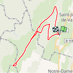
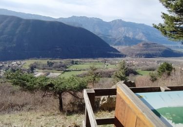
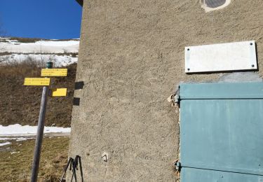
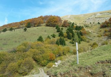
Randonnée Marche de 9,8 km à découvrir à Auvergne-Rhône-Alpes, Isère, Saint-Jean-de-Vaulx. Cette randonnée est proposée par maupassant38.

Profil altimétrique

Localisation

Pays :
France
Région :
Auvergne-Rhône-Alpes
Département/Province :
Isère
Commune :
Saint-Jean-de-Vaulx
Localité :
Unknown
Départ:(Dec)
Départ:(UTM)
716903 ; 4987157 (31T) N.

Commentaires

Veuillez vous connecter pour laisser un commentaire ou une note


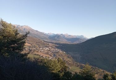
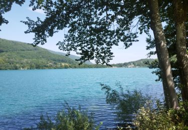
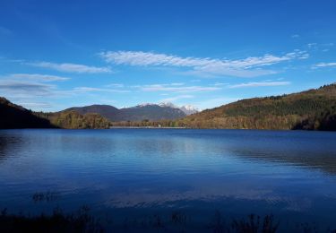
Excellente boucle qui permet d'avoir une magnifique vue sur les lacs. l'arrivée sur le sommet est spectaculaire.


Randonnées à proximité

Randonnée V.T.T. Pierre-Châtel - Tour des lacs Pierre-Chatel - Photo
V.T.T.
Vicenzozo

V.T.T.

Très facile
(1)
Pierre-Châtel, Auvergne-Rhône-Alpes, Isère, France
32 km | 46 km-effort
4h 28min
Oui
Randonnée Marche La Motte-Saint-Martin - connex - Photo
Marche
paulin bruno

Marche

Moyen
La Motte-Saint-Martin, Auvergne-Rhône-Alpes, Isère, France
15,6 km | 28 km-effort
6h 26min
Oui
Randonnée Marche Laffrey - tour du lac de la laffrey  - Photo
Marche
Youcef Atallah

Marche

Difficile
Laffrey, Auvergne-Rhône-Alpes, Isère, France
11,3 km | 15,6 km-effort
2h 59min
Oui
Randonnée Marche Saint-Georges-de-Commiers - Boucle autour de Saint Georges de Commiers - Photo
Marche
permanent 31

Marche

Difficile
Saint-Georges-de-Commiers, Auvergne-Rhône-Alpes, Isère, France
8,2 km | 12 km-effort
2h 26min
Non
Randonnée Marche Saint-Jean-de-Vaulx - Beauregard  - Photo
Marche
Youcef Atallah

Marche

Difficile
Saint-Jean-de-Vaulx, Auvergne-Rhône-Alpes, Isère, France
10,3 km | 17,2 km-effort
3h 13min
Oui
Randonnée Marche Laffrey - Tour du Grand Lac de Laffrey en circuit - Photo
Marche
Emelle

Marche

Moyen
Laffrey, Auvergne-Rhône-Alpes, Isère, France
17,5 km | 25 km-effort
6h 33min
Non
Randonnée Marche nordique Saint-Jean-de-Vaulx - Alpage du Conest en traversée  - Photo
Marche nordique
Emelle

Marche nordique

Moyen
Saint-Jean-de-Vaulx, Auvergne-Rhône-Alpes, Isère, France
14 km | 21 km-effort
5h 41min
Oui
Randonnée Marche Saint-Théoffrey - chollonge villard saint Christophe  - Photo
Marche
bailleulherve

Marche

Très facile
Saint-Théoffrey, Auvergne-Rhône-Alpes, Isère, France
13 km | 18,4 km-effort
4h 10min
Oui
Randonnée Marche Saint-Jean-de-Vaulx - PIERRE PERCÉE - Photo
Marche
floup6138

Marche

Moyen
Saint-Jean-de-Vaulx, Auvergne-Rhône-Alpes, Isère, France
9,5 km | 14,5 km-effort
3h 8min
Non


Fermer
Mes abonnements