Randonnée Marche Saint-Jean-Saint-Nicolas - La Mondonette  +636 - Photo
 claude nier
claude nier

Utilisateur

© OpenStreetMap contributors
Longueur
Longueur
11,8 km
Altitude max
Altitude max
1685 m
Dénivelé positif
Dénivelé positif
636 m
Km-Effort
Km-Effort  
20 km
Altitude min
Altitude min
1192 m
Dénivelé négatif
Dénivelé négatif
655 m
Boucle
Boucle
Oui
Date de création :
2022-12-29 16:32:02.423
Dernière modification :
2022-12-29 16:33:47.414

(0 Avis)

Marche
Marche
4h37
Difficulté : Très difficile

Scannez ce code QR pour ouvrir la randonnée dans l'application SityTrail

Application GPS de randonnée GRATUITE

Logo SityTrail SityTrail

IGN / Instituts géographiques

Télécharger SityTrail sur l'App Store Télécharger SityTrail sur Google Play

Logo SityTrail SityTrail World

Le monde est à vous

Télécharger SityTrail sur l'App Store Télécharger SityTrail sur Google Play Télécharger SityTrail sur Huawei AppGallery

À propos

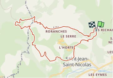
Randonnée Marche de 11,8 km à découvrir à Provence-Alpes-Côte d'Azur, Hautes-Alpes, Saint-Jean-Saint-Nicolas. Cette randonnée est proposée par claude nier.

Description

Beau paysage
Petite rando du Dimanche ....

Profil altimétrique

Localisation

Pays :
France
Région :
Provence-Alpes-Côte d'Azur
Département/Province :
Hautes-Alpes
Commune :
Saint-Jean-Saint-Nicolas
Localité :
Unknown
Départ:(UTM)
280270 ; 4951337 (32T) N.

Randonnées à proximité

Randonnée Marche Saint-Jean-Saint-Nicolas - Circuit de Costebelle - Photo
Marche
Dervalmarc

Marche

Très facile
(2)
Saint-Jean-Saint-Nicolas, Provence-Alpes-Côte d'Azur, Hautes-Alpes, France
7,4 km | 12,1 km-effort
2h 16min
Oui
Randonnée Marche Saint-Jean-Saint-Nicolas - Le Palastre - Photo
Marche
GUIDE
Marco05

Marche

Moyen
Saint-Jean-Saint-Nicolas, Provence-Alpes-Côte d'Azur, Hautes-Alpes, France
9,1 km | 17,9 km-effort
4h 4min
Oui
Randonnée Marche Saint-Michel-de-Chaillol - Col de l'Escalier - Photo
Marche
GUIDE
Marco05

Marche

Difficile
Saint-Michel-de-Chaillol, Provence-Alpes-Côte d'Azur, Hautes-Alpes, France
16 km | 27 km-effort
6h 13min
Oui
Randonnée A pied Champoléon - Refuge du Tourond - Photo
A pied
GUIDE
Marco05

A pied

Facile
Champoléon, Provence-Alpes-Côte d'Azur, Hautes-Alpes, France
8,4 km | 14,2 km-effort
3h 14min
Oui
Randonnée Marche Saint-Michel-de-Chaillol - Pic Queyrel - Photo
Marche
GUIDE
Marco05

Marche

Difficile
Saint-Michel-de-Chaillol, Provence-Alpes-Côte d'Azur, Hautes-Alpes, France
10,4 km | 19,8 km-effort
4h 29min
Oui
Randonnée Marche Saint-Michel-de-Chaillol - Pic du Tourond - Photo
Marche
GUIDE
Marco05

Marche

Très difficile
Saint-Michel-de-Chaillol, Provence-Alpes-Côte d'Azur, Hautes-Alpes, France
13,7 km | 27 km-effort
6h 14min
Oui
Randonnée Marche Champoléon - Méollion - Photo
Marche
GUIDE
Marco05

Marche

Moyen
Champoléon, Provence-Alpes-Côte d'Azur, Hautes-Alpes, France
7,5 km | 13,7 km-effort
2h 59min
Oui
Randonnée Marche Saint-Michel-de-Chaillol - Lac de Malcros - Photo
Marche
GUIDE
Marco05

Marche

Très difficile
Saint-Michel-de-Chaillol, Provence-Alpes-Côte d'Azur, Hautes-Alpes, France
18,7 km | 34 km-effort
7h 43min
Oui
Randonnée Marche Champoléon - Balade Vallée Champoléon - Photo
Marche
GUIDE
nadinebondoux

Marche

Facile
Champoléon, Provence-Alpes-Côte d'Azur, Hautes-Alpes, France
9,5 km | 12,2 km-effort
2h 40min
Oui


Fermer
Mes abonnements