Randonnée Marche Clermont-Soubiran - 47_Clermont_Soubiran_cdt47_variante - Photo

47_Clermont_Soubiran_cdt47_variante

 jab31
jab31

Utilisateur

© OpenStreetMap contributors
Longueur
Longueur
19,2 km
Altitude max
Altitude max
180 m
Dénivelé positif
Dénivelé positif
395 m
Km-Effort
Km-Effort  
24 km
Altitude min
Altitude min
52 m
Dénivelé négatif
Dénivelé négatif
396 m
Boucle
Boucle
Oui
Date de création :
2022-12-25 13:27:43.996
Dernière modification :
2022-12-25 13:28:31.17

(0 Avis)

Marche
Marche
6h07
Difficulté : Très difficile

Scannez ce code QR pour ouvrir la randonnée dans l'application SityTrail

Application GPS de randonnée GRATUITE

Logo SityTrail SityTrail

IGN / Instituts géographiques

Télécharger SityTrail sur l'App Store Télécharger SityTrail sur Google Play

Logo SityTrail SityTrail World

Le monde est à vous

Télécharger SityTrail sur l'App Store Télécharger SityTrail sur Google Play Télécharger SityTrail sur Huawei AppGallery

À propos

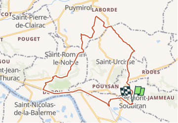
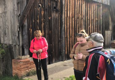
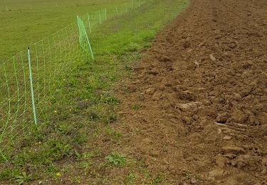
Randonnée Marche de 19,2 km à découvrir à Nouvelle-Aquitaine, Lot-et-Garonne, Clermont-Soubiran. Cette randonnée est proposée par jab31.

Description

version CDT47; 19 km

Profil altimétrique

Localisation

Pays :
France
Région :
Nouvelle-Aquitaine
Département/Province :
Lot-et-Garonne
Commune :
Clermont-Soubiran
Localité :
Unknown
Départ:(UTM)
326583 ; 4889689 (31T) N.

Randonnées à proximité

Randonnée sport Valence - 08/07/2024 - Photo
sport
cheepewa

sport

Très facile
Valence, Occitanie, Tarn-et-Garonne, France
7,8 km | 9,5 km-effort
Inconnu
Oui
Randonnée sport Valence - 05/07/2024 - Photo
sport
cheepewa

sport

Très facile
Valence, Occitanie, Tarn-et-Garonne, France
11,7 km | 12,6 km-effort
Inconnu
Oui
Randonnée sport Valence - Ballade 29/06/24 - Photo
sport
cheepewa

sport

Très facile
Valence, Occitanie, Tarn-et-Garonne, France
11,6 km | 13,6 km-effort
Inconnu
Oui
Randonnée sport Valence - Lundi 22avril 2024 - Photo
sport
cheepewa

sport

Très facile
Valence, Occitanie, Tarn-et-Garonne, France
10,5 km | 12,7 km-effort
Inconnu
Oui
Randonnée sport Valence - Les marcheurs du Pontus 18 avril 2024 - Photo
sport
cheepewa

sport

Très facile
Valence, Occitanie, Tarn-et-Garonne, France
10,8 km | 11,7 km-effort
Inconnu
Oui
Randonnée Marche Clermont-Soubiran - Coteaux depuis maison Roiatti  - Photo
Marche
jlc12

Marche

Moyen
Clermont-Soubiran, Nouvelle-Aquitaine, Lot-et-Garonne, France
4,1 km | 5,5 km-effort
1h 7min
Oui
Randonnée Marche Clermont-Soubiran - coupet autour de labro - Photo
Marche
jlc12

Marche

Moyen
(2)
Clermont-Soubiran, Nouvelle-Aquitaine, Lot-et-Garonne, France
11,5 km | 14,7 km-effort
3h 11min
Oui
Randonnée V.T.T. Donzac - Les sentiers du Brulhois - Donzac - Photo
V.T.T.
tracegps

V.T.T.

Moyen
Donzac, Occitanie, Tarn-et-Garonne, France
40 km | 48 km-effort
2h 45min
Oui
Randonnée V.T.T. Saint-Romain-le-Noble - St Romain le Noble / St Pierre de Clairac / Puymirol - Photo
V.T.T.
tracegps

V.T.T.

Difficile
Saint-Romain-le-Noble, Nouvelle-Aquitaine, Lot-et-Garonne, France
27 km | 36 km-effort
2h 0min
Oui


Fermer
Mes abonnements