![](/images/other/stat-length.png)
![Randonnée V.T.T. Langogne - Stevenson étape 1 - Photo](https://media.geolcdn.com/t/1900/400/ext.pjpeg?maxdim=2&url=https%3A%2F%2Fstatic1.geolcdn.com%2Fsiteimages%2Fupload%2Ffiles%2F1524743154velo.jpg)
Stevenson étape 1
marcgiraud
Utilisateur
![Longueur](/images/other/stat-length.png)
Longueur
55 km
![Altitude max](https://static1.geolcdn.com/siteimages/upload/files/1508320355ic_sort_altitude_max_24dp.png)
Altitude max
1413 m
![Dénivelé positif](https://static1.geolcdn.com/siteimages/upload/files/1508320355ic_sort_den_pos_24dp.png)
Dénivelé positif
1669 m
![Km-Effort](/images/other/stat-length.png)
Km-Effort
76 km
![Altitude min](https://static1.geolcdn.com/siteimages/upload/files/1508320355ic_sort_altitude_min_24dp.png)
Altitude min
913 m
![Dénivelé négatif](https://static1.geolcdn.com/siteimages/upload/files/1508320355ic_sort_den_neg_24dp.png)
Dénivelé négatif
1512 m
![Boucle](https://static1.geolcdn.com/siteimages/upload/files/16400158638029165_repeat_loop_refresh_sync_direction_icon.png)
Boucle
Non
Date de création :
2022-12-21 15:19:11.022
Dernière modification :
2023-05-08 12:24:04.802
![V.T.T.](https://static1.geolcdn.com/sitytour/trail-icons/202.png)
5h17
Difficulté : Très difficile
![Scannez ce code QR pour ouvrir la randonnée dans l'application SityTrail](https://capi.geolives.com/qq0zvz2zws4bq2lad0pu/sitytour/trails/3488050/qr.png?size=200)
Application GPS de randonnée GRATUITE
À propos
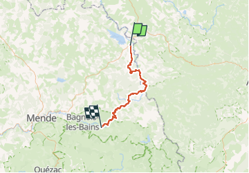
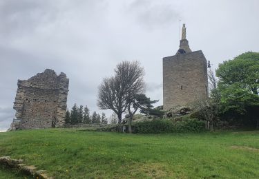
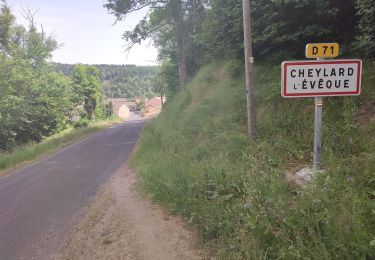
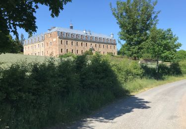
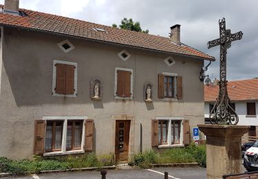
Randonnée V.T.T. de 55 km à découvrir à Occitanie, Lozère, Langogne. Cette randonnée est proposée par marcgiraud.
Description
Faire le Stevenson/Regordane en 3 jours avec un départ de Lngogne et des étapes de 50/55 kms et 1300/1500 de D .
Localisation
Pays :
France
Région :
Occitanie
Département/Province :
Lozère
Commune :
Langogne
Localité :
Unknown
Départ:(Dec)
Départ:(UTM)
567656 ; 4952554 (31T) N.
Commentaires
Randonnées à proximité
![Randonnée Marche Naussac-Fontanes - naussac - Photo](https://media.geolcdn.com/t/375/260/ext.jpg?maxdim=2&url=https%3A%2F%2Fservices.sitytrail.com%2FGeolivesWS%2FDownloadMedia.ashx%3FTrailID%3D208949%26Media%3Dfix__20130730162442.jpg)
![Marche Marche](https://static1.geolcdn.com/sitytour/trail-icons/101.png)
naussac
Marche
Facile
(1)
Naussac-Fontanes,
Occitanie,
Lozère,
France
![](/images/other/stat-length.png)
7,9 km | 10,2 km-effort
2h 6min
![](https://static1.geolcdn.com/siteimages/upload/files/16400158638029165_repeat_loop_refresh_sync_direction_icon.png)
Oui
![Randonnée V.T.T. Langogne - Espace VTT FFC du Gévaudan - n°08 - Circuit du Ras Chambon - Photo](https://media.geolcdn.com/t/375/260/ext.jpg?maxdim=2&url=https%3A%2F%2Fservices.sitytrail.com%2FGeolivesWS%2FDownloadMedia.ashx%3FTrailID%3D102665%26Media%3D3674_1.jpg)
![V.T.T. V.T.T.](https://static1.geolcdn.com/sitytour/trail-icons/202.png)
Espace VTT FFC du Gévaudan - n°08 - Circuit du Ras Chambon
V.T.T.
Difficile
(2)
Langogne,
Occitanie,
Lozère,
France
![](/images/other/stat-length.png)
17,2 km | 22 km-effort
2h 15min
![](https://static1.geolcdn.com/siteimages/upload/files/16400158638029165_repeat_loop_refresh_sync_direction_icon.png)
Oui
![Randonnée Vélo de route Langogne - Langogne, le nouveau monde - Photo](https://media.geolcdn.com/t/375/260/da33af3e-6429-4314-8b80-a9ce97f3ff9d.jpg&format=jpg&maxdim=2)
![Vélo de route Vélo de route](https://static1.geolcdn.com/sitytour/trail-icons/201.png)
Langogne, le nouveau monde
Vélo de route
Moyen
Langogne,
Occitanie,
Lozère,
France
![](/images/other/stat-length.png)
68 km | 85 km-effort
4h 31min
![](https://static1.geolcdn.com/siteimages/upload/files/16400158638029165_repeat_loop_refresh_sync_direction_icon.png)
Oui
![Randonnée Marche Langogne - E4 Langogne - Luc GR70 - Photo](https://media.geolcdn.com/t/375/260/1c56381b-c00a-405a-bfd0-d26b1cee708f.jpg&format=jpg&maxdim=2)
![Marche Marche](https://static1.geolcdn.com/sitytour/trail-icons/101.png)
E4 Langogne - Luc GR70
Marche
Difficile
Langogne,
Occitanie,
Lozère,
France
![](/images/other/stat-length.png)
28 km | 38 km-effort
7h 6min
![](https://static1.geolcdn.com/siteimages/upload/files/16400158638029165_repeat_loop_refresh_sync_direction_icon.png)
Non
![Randonnée Marche Langogne - 09-05-2023 E4 Langogne - Luc - Photo](https://media.geolcdn.com/t/375/260/8aa4ecd6-c9b0-4973-b359-d5c3520516bf.jpg&format=jpg&maxdim=2)
![Marche Marche](https://static1.geolcdn.com/sitytour/trail-icons/101.png)
09-05-2023 E4 Langogne - Luc
Marche
Difficile
Langogne,
Occitanie,
Lozère,
France
![](/images/other/stat-length.png)
28 km | 38 km-effort
8h 35min
![](https://static1.geolcdn.com/siteimages/upload/files/16400158638029165_repeat_loop_refresh_sync_direction_icon.png)
Non
![Randonnée Marche Saint-Flour-de-Mercoire - le chélard - Photo](https://media.geolcdn.com/t/375/260/95b8db69-3dce-47bc-9f31-4efaab872b01.jpg&format=jpg&maxdim=2)
![Marche Marche](https://static1.geolcdn.com/sitytour/trail-icons/101.png)
le chélard
Marche
Difficile
Saint-Flour-de-Mercoire,
Occitanie,
Lozère,
France
![](/images/other/stat-length.png)
11 km | 14,9 km-effort
3h 6min
![](https://static1.geolcdn.com/siteimages/upload/files/16400158638029165_repeat_loop_refresh_sync_direction_icon.png)
Non
![Randonnée Marche Saint-Flour-de-Mercoire - L’Herm Notre dame des neiges - Photo](https://media.geolcdn.com/t/375/260/1b1c5ae2-25c5-4141-8eeb-1c7365743d8a.jpg&format=jpg&maxdim=2)
![Marche Marche](https://static1.geolcdn.com/sitytour/trail-icons/101.png)
L’Herm Notre dame des neiges
Marche
Très difficile
Saint-Flour-de-Mercoire,
Occitanie,
Lozère,
France
![](/images/other/stat-length.png)
34 km | 46 km-effort
8h 51min
![](https://static1.geolcdn.com/siteimages/upload/files/16400158638029165_repeat_loop_refresh_sync_direction_icon.png)
Non
![Randonnée Vélo de route Langogne - NAUSSAC - COL DE LA PIERRE PLANTEE - Photo](https://media.geolcdn.com/t/375/260/ea2ac3d2-069e-4639-8ab2-1f7be14e0b5b.jpg&format=jpg&maxdim=2)
![Vélo de route Vélo de route](https://static1.geolcdn.com/sitytour/trail-icons/201.png)
NAUSSAC - COL DE LA PIERRE PLANTEE
Vélo de route
Facile
Langogne,
Occitanie,
Lozère,
France
![](/images/other/stat-length.png)
76 km | 91 km-effort
6h 20min
![](https://static1.geolcdn.com/siteimages/upload/files/16400158638029165_repeat_loop_refresh_sync_direction_icon.png)
Oui
![Randonnée Vélo de route Langogne - NAUSSAC - FORÊT DE MERCOIRE - Photo](https://media.geolcdn.com/t/375/260/bee6304c-62f9-4a40-9375-d692fc3ab022.jpg&format=jpg&maxdim=2)
![Vélo de route Vélo de route](https://static1.geolcdn.com/sitytour/trail-icons/201.png)
NAUSSAC - FORÊT DE MERCOIRE
Vélo de route
Moyen
Langogne,
Occitanie,
Lozère,
France
![](/images/other/stat-length.png)
68 km | 81 km-effort
5h 40min
![](https://static1.geolcdn.com/siteimages/upload/files/16400158638029165_repeat_loop_refresh_sync_direction_icon.png)
Oui