


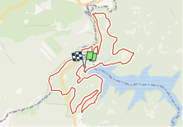

19,9 km | 26 km-effort


Randonnées de la Maison du Tourisme de Spa Hautes-Fagnes Ardennes PRO


Application GPS de randonnée GRATUITE
 SityTrail
IGN / Instituts géographiques
SityTrail World
Le monde est à vous
Randonnée Trail de 12,4 km à découvrir à Wallonie, Liège, Jalhay. Cette randonnée est proposée par Maison du Tourisme de Spa Hautes-Fagnes Ardennes.
Afin d'accéder aux dernières informations relatives à Extratrail® et aux tracés GPX à jour, vous pouvez consulter directement le site web d'Extratrail®:
www.extratrail.com
EXTRATRAIL
Haut Nivezé, 25
4845 Jalhay
Belgique
run@extratrail.com
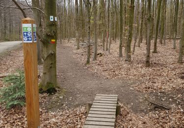
 12 km - Photo 1")

Marche

Marche

Marche
Marche

Marche

Marche

Marche

Marche