mt oberon SityTrail > Randonnées > Outdoor > Australie > Victoria > Shire of South Gippsland > Unknown SityTrail > Randonnées > Outdoor > Australie > Victoria > Shire of South Gippsland > Unknown mt oberon lablaquiere Utilisateur 3D © OpenStreetMap contributors Longueur 6,8 km Altitude max 550 m Dénivelé positif 336 m Km-Effort 11,3 km Altitude min 212 m Dénivelé négatif 335 m Boucle Oui Date de création : 2022-12-06 03:51:36.249 Dernière modification : 2022-12-06 06:15:29.965 (0 Avis) Marche 1h36 Difficulté : Moyen Application GPS de randonnée GRATUITE SityTrail IGN / Instituts géographiques SityTrail World Le monde est à vous À propos 
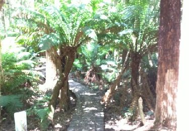
Randonnée Marche de 6,8 km à découvrir à Victoria, Shire of South Gippsland. Cette randonnée est proposée par lablaquiere. Légendes | Plus de détails (PDF) Profil altimétrique Légendes > 15% 15% - 10% 10% - 5% à plat 5% - 10% 10% - 15% 15% - 30% > 30% Localisation Pays : Australie Région : Victoria Département/Province : Shire of South Gippsland Commune : Unknown Localité : Unknown Départ:(Dec) -39.0326327 / 146.355606 Départ:(UTM) 444226 ; 5679405 (55H) S. Commentaires Veuillez vous connecter pour laisser un commentaire ou une note Randonnées à proximité reneperrin Sailer cove Marche Facile , Victoria, Shire of South Gippsland, Australie 19 km | 27 km-effort 4h 22min Oui reneperrin Sailer cove Marche Facile , Victoria, Shire of South Gippsland, Australie 19 km | 27 km-effort 4h 22min Oui Broken Telegraph saddle carpark to Sealers Cove Marche Très facile , Victoria, Shire of South Gippsland, Australie 8,9 km | 12,3 km-effort Inconnu Non phidge Tidal River Marche Très facile , Victoria, Shire of South Gippsland, Australie 2,4 km | 3 km-effort 47min Non