![](/images/other/stat-length.png)
![Randonnée Marche nordique Beauchamps - La Beauchampoise 2022 - Photo](https://media.geolcdn.com/t/1900/400/ext.pjpeg?maxdim=2&url=https%3A%2F%2Fstatic1.geolcdn.com%2Fsiteimages%2Fupload%2Ffiles%2F1545311037marcheuse_200dpi.jpg)
La Beauchampoise 2022
roselinemazeyrat
Utilisateur
![Longueur](/images/other/stat-length.png)
Longueur
10,9 km
![Altitude max](https://static1.geolcdn.com/siteimages/upload/files/1508320355ic_sort_altitude_max_24dp.png)
Altitude max
29 m
![Dénivelé positif](https://static1.geolcdn.com/siteimages/upload/files/1508320355ic_sort_den_pos_24dp.png)
Dénivelé positif
70 m
![Km-Effort](/images/other/stat-length.png)
Km-Effort
11,9 km
![Altitude min](https://static1.geolcdn.com/siteimages/upload/files/1508320355ic_sort_altitude_min_24dp.png)
Altitude min
12 m
![Dénivelé négatif](https://static1.geolcdn.com/siteimages/upload/files/1508320355ic_sort_den_neg_24dp.png)
Dénivelé négatif
76 m
![Boucle](https://static1.geolcdn.com/siteimages/upload/files/16400158638029165_repeat_loop_refresh_sync_direction_icon.png)
Boucle
Oui
Date de création :
2022-11-13 08:50:02.0
Dernière modification :
2022-12-02 10:32:54.814
![Marche nordique](https://static1.geolcdn.com/sitytour/trail-icons/102.png)
2h10
Difficulté : Inconnu
![Scannez ce code QR pour ouvrir la randonnée dans l'application SityTrail](https://capi.geolives.com/qq0zvz2zws4bq2lad0pu/sitytour/trails/3471716/qr.png?size=200)
Application GPS de randonnée GRATUITE
À propos
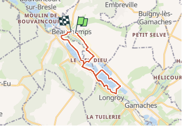
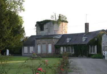
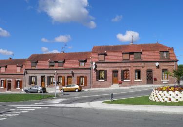
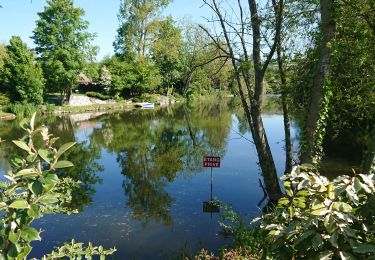
Randonnée Marche nordique de 10,9 km à découvrir à Hauts-de-France, Somme, Beauchamps. Cette randonnée est proposée par roselinemazeyrat.
Description
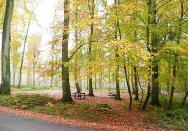
Marche agréable le long des étangs de la Bresle. Une partie du chemin en dur évite de patauger par mauvais temps.
Localisation
Pays :
France
Région :
Hauts-de-France
Département/Province :
Somme
Commune :
Beauchamps
Localité :
Unknown
Départ:(Dec)
Départ:(UTM)
393351 ; 5541627 (31U) N.
Commentaires
Randonnées à proximité
![Randonnée Marche Incheville - Balade dans le Massif du Triage - Forêt d'Eu - Photo](https://media.geolcdn.com/t/375/260/ext.jpg?maxdim=2&url=https%3A%2F%2Fservices.sitytrail.com%2FGeolivesWS%2FDownloadMedia.ashx%3FTrailID%3D172311%26Media%3D13631_5.jpg)
![Marche Marche](https://static1.geolcdn.com/sitytour/trail-icons/101.png)
Balade dans le Massif du Triage - Forêt d'Eu
Marche
Moyen
(3)
Incheville,
Normandie,
Seine-Maritime,
France
![](/images/other/stat-length.png)
13,2 km | 16,8 km-effort
2h 45min
![](https://static1.geolcdn.com/siteimages/upload/files/16400158638029165_repeat_loop_refresh_sync_direction_icon.png)
Oui
![Randonnée A pied Gamaches - L'eau vive - Photo](https://media.geolcdn.com/t/375/260/3c4fa46f-9dc2-4d1a-9161-49027c2a541e.jpeg&format=jpg&maxdim=2)
![A pied A pied](https://static1.geolcdn.com/sitytour/trail-icons/100.png)
L'eau vive
A pied
Facile
Gamaches,
Hauts-de-France,
Somme,
France
![](/images/other/stat-length.png)
4,8 km | 5,3 km-effort
1h 11min
![](https://static1.geolcdn.com/siteimages/upload/files/16400158638029165_repeat_loop_refresh_sync_direction_icon.png)
Oui
![Randonnée Marche Saint-Pierre-en-Val - Saint Pierre en Val - Photo](https://media.geolcdn.com/t/375/260/1d7876e3-8f35-485b-8199-215d6e725d0f.jpg&format=jpg&maxdim=2)
![Marche Marche](https://static1.geolcdn.com/sitytour/trail-icons/101.png)
Saint Pierre en Val
Marche
Moyen
Saint-Pierre-en-Val,
Normandie,
Seine-Maritime,
France
![](/images/other/stat-length.png)
12,1 km | 15,5 km-effort
3h 2min
![](https://static1.geolcdn.com/siteimages/upload/files/16400158638029165_repeat_loop_refresh_sync_direction_icon.png)
Oui
![Randonnée A pied Gamaches - Au fil des Étangs - Photo](https://media.geolcdn.com/t/375/260/fbb955a0-b551-4370-8c7b-e1b57583333e.jpeg&format=jpg&maxdim=2)
![A pied A pied](https://static1.geolcdn.com/sitytour/trail-icons/100.png)
Au fil des Étangs
A pied
Facile
Gamaches,
Hauts-de-France,
Somme,
France
![](/images/other/stat-length.png)
3,1 km | 3,3 km-effort
45min
![](https://static1.geolcdn.com/siteimages/upload/files/16400158638029165_repeat_loop_refresh_sync_direction_icon.png)
Non
![Randonnée A pied Dargnies - Circuit de l'Isle - Photo](https://media.geolcdn.com/t/375/260/914a98f1-0c52-4e23-b3a2-afd495e2e4bc.jpeg&format=jpg&maxdim=2)
![A pied A pied](https://static1.geolcdn.com/sitytour/trail-icons/100.png)
Circuit de l'Isle
A pied
Facile
Dargnies,
Hauts-de-France,
Somme,
France
![](/images/other/stat-length.png)
11,3 km | 13,2 km-effort
2h 59min
![](https://static1.geolcdn.com/siteimages/upload/files/16400158638029165_repeat_loop_refresh_sync_direction_icon.png)
Oui
![Randonnée A pied Eu - Chemin des Étangs - Photo](https://media.geolcdn.com/t/375/260/e5479a46-c597-4ab1-9120-a821cd36903f.jpeg&format=jpg&maxdim=2)
![A pied A pied](https://static1.geolcdn.com/sitytour/trail-icons/100.png)
Chemin des Étangs
A pied
Facile
Eu,
Normandie,
Seine-Maritime,
France
![](/images/other/stat-length.png)
7,3 km | 7,9 km-effort
1h 47min
![](https://static1.geolcdn.com/siteimages/upload/files/16400158638029165_repeat_loop_refresh_sync_direction_icon.png)
Non
![Randonnée Marche Saint-Pierre-en-Val - St Pierre en val, circuit du Beaumont - Photo](https://media.geolcdn.com/t/375/260/1ea59eed-6f6f-450d-9e95-f2ef73be87d5.jpg&format=jpg&maxdim=2)
![Marche Marche](https://static1.geolcdn.com/sitytour/trail-icons/101.png)
St Pierre en val, circuit du Beaumont
Marche
Difficile
Saint-Pierre-en-Val,
Normandie,
Seine-Maritime,
France
![](/images/other/stat-length.png)
13,1 km | 16,3 km-effort
4h 30min
![](https://static1.geolcdn.com/siteimages/upload/files/16400158638029165_repeat_loop_refresh_sync_direction_icon.png)
Oui
![Randonnée Marche Incheville - incheville 20190513 les étangs - Photo](https://media.geolcdn.com/t/375/260/cceeab57-358f-4452-b8ac-b5c31f54eba5.jpg&format=jpg&maxdim=2)
![Marche Marche](https://static1.geolcdn.com/sitytour/trail-icons/101.png)
incheville 20190513 les étangs
Marche
Très facile
(1)
Incheville,
Normandie,
Seine-Maritime,
France
![](/images/other/stat-length.png)
8,1 km | 9,3 km-effort
2h 6min
![](https://static1.geolcdn.com/siteimages/upload/files/16400158638029165_repeat_loop_refresh_sync_direction_icon.png)
Oui
![Randonnée Marche Saint-Pierre-en-Val - 26 08 2017 - Photo](https://media.geolcdn.com/t/375/260/ext.jpg?maxdim=2&url=https%3A%2F%2Fstatic1.geolcdn.com%2Fsiteimages%2Fupload%2Ffiles%2F1553511878bg_sport_marche.png)
![Marche Marche](https://static1.geolcdn.com/sitytour/trail-icons/101.png)
26 08 2017
Marche
Très facile
(1)
Saint-Pierre-en-Val,
Normandie,
Seine-Maritime,
France
![](/images/other/stat-length.png)
12,3 km | 15,5 km-effort
3h 43min
![](https://static1.geolcdn.com/siteimages/upload/files/16400158638029165_repeat_loop_refresh_sync_direction_icon.png)
Oui