9,9 km | 11,5 km-effort
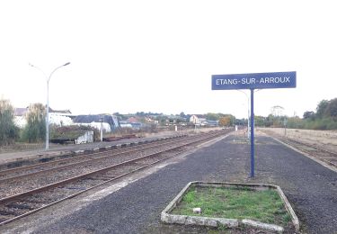
Étang sur arroux
Bonnefois Bernard
Utilisateur
Longueur
18,4 km
Altitude max
353 m
Dénivelé positif
226 m
Km-Effort
21 km
Altitude min
266 m
Dénivelé négatif
224 m
Boucle
Non
Date de création :
2022-11-24 08:05:01.0
Dernière modification :
2022-11-24 15:27:01.994
7h21
Difficulté : Très difficile
Application GPS de randonnée GRATUITE
À propos
Randonnée Marche de 18,4 km à découvrir à Bourgogne-Franche-Comté, Saône-et-Loire, Étang-sur-Arroux. Cette randonnée est proposée par Bonnefois Bernard.
Localisation
Pays :
France
Région :
Bourgogne-Franche-Comté
Département/Province :
Saône-et-Loire
Commune :
Étang-sur-Arroux
Localité :
Unknown
Départ:(Dec)
Départ:(UTM)
590488 ; 5191063 (31T) N.
Commentaires
Randonnées à proximité
Tour de la Butte de la Perrière
A pied
Facile
Étang-sur-Arroux,
Bourgogne-Franche-Comté,
Saône-et-Loire,
France
2h 36min
Non
Etang sur Arroux
A pied
Facile
Étang-sur-Arroux,
Bourgogne-Franche-Comté,
Saône-et-Loire,
France
6 km | 7,2 km-effort
1h 38min
Oui
laizy-les dues
Marche
Très facile
Laizy,
Bourgogne-Franche-Comté,
Saône-et-Loire,
France
22 km | 28 km-effort
5h 31min
Oui
vacances 2017 Retour
Vélo
Difficile
Mesvres,
Bourgogne-Franche-Comté,
Saône-et-Loire,
France
88 km | 106 km-effort
5h 56min
Non
Laizy
Marche
Très difficile
Laizy,
Bourgogne-Franche-Comté,
Saône-et-Loire,
France
15,3 km | 20 km-effort
4h 36min
Non
Grande traversée du Morvan
V.T.T.
Moyen
Étang-sur-Arroux,
Bourgogne-Franche-Comté,
Saône-et-Loire,
France
20 km | 25 km-effort
2h 12min
Non
Etang sur Arroux
Marche
Étang-sur-Arroux,
Bourgogne-Franche-Comté,
Saône-et-Loire,
France
7,2 km | 9,4 km-effort
2h 12min
Oui
toulongeo
Marche
Très facile
La Chapelle-sous-Uchon,
Bourgogne-Franche-Comté,
Saône-et-Loire,
France
8,9 km | 14,1 km-effort
2h 18min
Non
la chapelle sous uchon la Gravetière
Autre activité
Moyen
La Chapelle-sous-Uchon,
Bourgogne-Franche-Comté,
Saône-et-Loire,
France
10,8 km | 15,4 km-effort
2h 40min
Oui