![](/images/other/stat-length.png)
![Randonnée Marche Verdelais - Verdelais - Photo](https://media.geolcdn.com/t/1900/400/ac506b0f-5859-4b40-94f2-5df41beb3f87.jpg&format=pjpeg&maxdim=2)
Verdelais
plavengut
Utilisateur
![Longueur](/images/other/stat-length.png)
Longueur
10 km
![Altitude max](https://static1.geolcdn.com/siteimages/upload/files/1508320355ic_sort_altitude_max_24dp.png)
Altitude max
94 m
![Dénivelé positif](https://static1.geolcdn.com/siteimages/upload/files/1508320355ic_sort_den_pos_24dp.png)
Dénivelé positif
148 m
![Km-Effort](/images/other/stat-length.png)
Km-Effort
12 km
![Altitude min](https://static1.geolcdn.com/siteimages/upload/files/1508320355ic_sort_altitude_min_24dp.png)
Altitude min
4 m
![Dénivelé négatif](https://static1.geolcdn.com/siteimages/upload/files/1508320355ic_sort_den_neg_24dp.png)
Dénivelé négatif
157 m
![Boucle](https://static1.geolcdn.com/siteimages/upload/files/16400158638029165_repeat_loop_refresh_sync_direction_icon.png)
Boucle
Non
Date de création :
2022-11-18 12:32:35.497
Dernière modification :
2022-11-20 20:02:43.498
![Marche](https://static1.geolcdn.com/sitytour/trail-icons/101.png)
3h06
Difficulté : Moyen
![Scannez ce code QR pour ouvrir la randonnée dans l'application SityTrail](https://capi.geolives.com/qq0zvz2zws4bq2lad0pu/sitytour/trails/3461346/qr.png?size=200)
Application GPS de randonnée GRATUITE
À propos
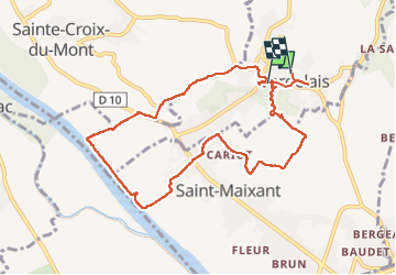
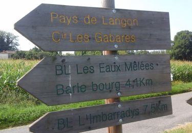
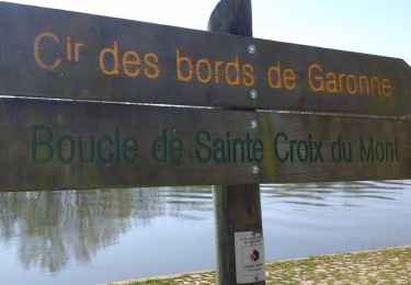
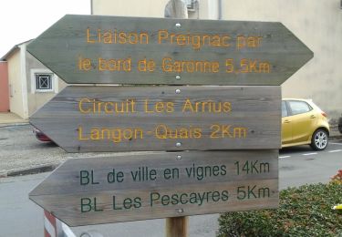
Randonnée Marche de 10 km à découvrir à Nouvelle-Aquitaine, Gironde, Verdelais. Cette randonnée est proposée par plavengut.
Description
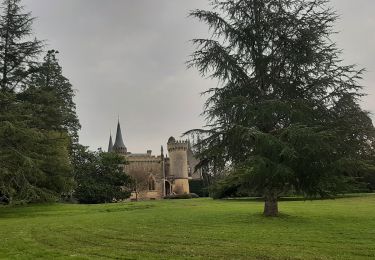
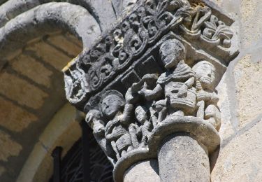
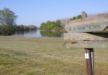
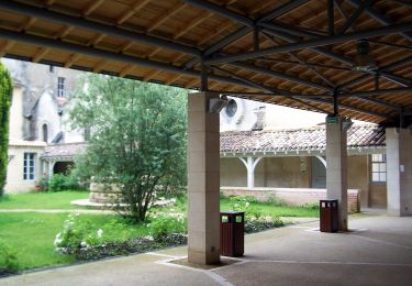
Agréable boucle au départ de la basilique de Verdelais par de petites routes à travers les vignes et les bords de Garonne. Nous avons repris la voiture pour aller pique-niquer au Pas de la mule à 1km de la basilique grand abri avec (tables et bancs)
Localisation
Pays :
France
Région :
Nouvelle-Aquitaine
Département/Province :
Gironde
Commune :
Verdelais
Localité :
Unknown
Départ:(Dec)
Départ:(UTM)
718279 ; 4940890 (30T) N.
Commentaires
Randonnées à proximité
![Randonnée Marche Verdelais - Verdelais boucle n1 1h30 7km - Photo](https://media.geolcdn.com/t/375/260/ext.jpg?maxdim=2&url=https%3A%2F%2Fservices.sitytrail.com%2FGeolivesWS%2FDownloadMedia.ashx%3FTrailID%3D40628%26Media%3Dimage8.jpg)
![Marche Marche](https://static1.geolcdn.com/sitytour/trail-icons/101.png)
Verdelais boucle n1 1h30 7km
Marche
Très facile
(1)
Verdelais,
Nouvelle-Aquitaine,
Gironde,
France
![](/images/other/stat-length.png)
7,1 km | 8,8 km-effort
Inconnu
![](https://static1.geolcdn.com/siteimages/upload/files/16400158638029165_repeat_loop_refresh_sync_direction_icon.png)
Oui
![Randonnée Marche Loupiac - Loupiac. Les coteaux. - Photo](https://media.geolcdn.com/t/375/260/f2129390-37e4-44db-941f-7256aa8ef486.jpg&format=jpg&maxdim=2)
![Marche Marche](https://static1.geolcdn.com/sitytour/trail-icons/101.png)
Loupiac. Les coteaux.
Marche
Difficile
Loupiac,
Nouvelle-Aquitaine,
Gironde,
France
![](/images/other/stat-length.png)
14 km | 17,7 km-effort
4h 1min
![](https://static1.geolcdn.com/siteimages/upload/files/16400158638029165_repeat_loop_refresh_sync_direction_icon.png)
Oui
![Randonnée A pied Langon - Les Gabares : circuit départemental - Photo](https://media.geolcdn.com/t/375/260/d1c9893c-3e2a-436e-a388-d134a1bf0ef0.jpeg&format=jpg&maxdim=2)
![A pied A pied](https://static1.geolcdn.com/sitytour/trail-icons/100.png)
Les Gabares : circuit départemental
A pied
Moyen
Langon,
Nouvelle-Aquitaine,
Gironde,
France
![](/images/other/stat-length.png)
21 km | 23 km-effort
5h 15min
![](https://static1.geolcdn.com/siteimages/upload/files/16400158638029165_repeat_loop_refresh_sync_direction_icon.png)
Non
![Randonnée A pied Loupiac - Monprimblanc et Loupiac : boucle locale - Photo](https://media.geolcdn.com/t/375/260/252b1336-069e-4cad-9573-2b7af99298fc.jpeg&format=jpg&maxdim=2)
![A pied A pied](https://static1.geolcdn.com/sitytour/trail-icons/100.png)
Monprimblanc et Loupiac : boucle locale
A pied
Facile
Loupiac,
Nouvelle-Aquitaine,
Gironde,
France
![](/images/other/stat-length.png)
10,5 km | 13,1 km-effort
2h 59min
![](https://static1.geolcdn.com/siteimages/upload/files/16400158638029165_repeat_loop_refresh_sync_direction_icon.png)
Non
![Randonnée A pied Barsac - Boucle locale de Barsac - Photo](https://media.geolcdn.com/t/375/260/aa6a797b-3dd2-4ea5-8850-cf566be6458d.jpeg&format=jpg&maxdim=2)
![A pied A pied](https://static1.geolcdn.com/sitytour/trail-icons/100.png)
Boucle locale de Barsac
A pied
Facile
Barsac,
Nouvelle-Aquitaine,
Gironde,
France
![](/images/other/stat-length.png)
17,6 km | 18,9 km-effort
4h 18min
![](https://static1.geolcdn.com/siteimages/upload/files/16400158638029165_repeat_loop_refresh_sync_direction_icon.png)
Oui
![Randonnée A pied Verdelais - Boucle locale de Verdelais - Photo](https://media.geolcdn.com/t/375/260/1483325e-e526-4e1b-bde7-bab75ad5ace7.jpeg&format=jpg&maxdim=2)
![A pied A pied](https://static1.geolcdn.com/sitytour/trail-icons/100.png)
Boucle locale de Verdelais
A pied
Facile
Verdelais,
Nouvelle-Aquitaine,
Gironde,
France
![](/images/other/stat-length.png)
3,4 km | 4,6 km-effort
1h 2min
![](https://static1.geolcdn.com/siteimages/upload/files/16400158638029165_repeat_loop_refresh_sync_direction_icon.png)
Oui
![Randonnée A pied Saint-Maixant - Saint-Maixant : boucle locale - Photo](https://media.geolcdn.com/t/375/260/10cbbc93-cab1-482e-b4e6-d201754cfc58.jpeg&format=jpg&maxdim=2)
![A pied A pied](https://static1.geolcdn.com/sitytour/trail-icons/100.png)
Saint-Maixant : boucle locale
A pied
Facile
Saint-Maixant,
Nouvelle-Aquitaine,
Gironde,
France
![](/images/other/stat-length.png)
8,2 km | 10 km-effort
2h 16min
![](https://static1.geolcdn.com/siteimages/upload/files/16400158638029165_repeat_loop_refresh_sync_direction_icon.png)
Oui
![Randonnée A pied Toulenne - Les Pescayres : boucle locale - Photo](https://media.geolcdn.com/t/375/260/67e0a3a0-3e58-42e3-b746-5cfe25dad8d6.jpeg&format=jpg&maxdim=2)
![A pied A pied](https://static1.geolcdn.com/sitytour/trail-icons/100.png)
Les Pescayres : boucle locale
A pied
Facile
Toulenne,
Nouvelle-Aquitaine,
Gironde,
France
![](/images/other/stat-length.png)
3,5 km | 3,9 km-effort
52min
![](https://static1.geolcdn.com/siteimages/upload/files/16400158638029165_repeat_loop_refresh_sync_direction_icon.png)
Non
![Randonnée A pied Langon - Les Contrastes : circuit départemental - Photo](https://media.geolcdn.com/t/375/260/ffc7a414-406e-496c-ba59-9d1c17a576cf.jpeg&format=jpg&maxdim=2)
![A pied A pied](https://static1.geolcdn.com/sitytour/trail-icons/100.png)
Les Contrastes : circuit départemental
A pied
Facile
Langon,
Nouvelle-Aquitaine,
Gironde,
France
![](/images/other/stat-length.png)
9,6 km | 10,5 km-effort
2h 23min
![](https://static1.geolcdn.com/siteimages/upload/files/16400158638029165_repeat_loop_refresh_sync_direction_icon.png)
Non