


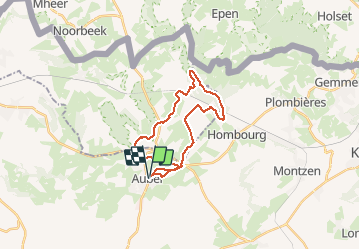

9,5 km | 12 km-effort


Plus vî, plus sot


Application GPS de randonnée GRATUITE
 SityTrail
IGN / Instituts géographiques
SityTrail World
Le monde est à vous
Randonnée V.T.T. de 22 km à découvrir à Wallonie, Liège, Aubel. Cette randonnée est proposée par Yeyette VTT team.
Une inédite qui arrive à éviter la ligne 38. Belle, tondue et pleine de courbes et vallons : comme nous les aimons !

Marche

Marche

Marche

Marche

Marche

Marche

Marche
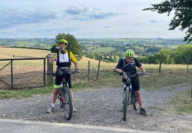
V.T.T.
Autre activité