![](/images/other/stat-length.png)
![Randonnée Marche Avignonet - Circuit des 3 Châteaux - Photo](https://media.geolcdn.com/t/1900/400/89ca6681-2cd7-4118-9588-52e735372338.jpg&format=pjpeg&maxdim=2)
Circuit des 3 Châteaux
Emelle
Utilisateur
![Longueur](/images/other/stat-length.png)
![Altitude max](https://static1.geolcdn.com/siteimages/upload/files/1508320355ic_sort_altitude_max_24dp.png)
![Dénivelé positif](https://static1.geolcdn.com/siteimages/upload/files/1508320355ic_sort_den_pos_24dp.png)
![Km-Effort](/images/other/stat-length.png)
![Altitude min](https://static1.geolcdn.com/siteimages/upload/files/1508320355ic_sort_altitude_min_24dp.png)
![Dénivelé négatif](https://static1.geolcdn.com/siteimages/upload/files/1508320355ic_sort_den_neg_24dp.png)
![Boucle](https://static1.geolcdn.com/siteimages/upload/files/16400158638029165_repeat_loop_refresh_sync_direction_icon.png)
![Marche](https://static1.geolcdn.com/sitytour/trail-icons/101.png)
5h55
Difficulté : Moyen
![Scannez ce code QR pour ouvrir la randonnée dans l'application SityTrail](https://capi.geolives.com/qq0zvz2zws4bq2lad0pu/sitytour/trails/3455917/qr.png?size=200)
Application GPS de randonnée GRATUITE
À propos
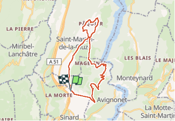
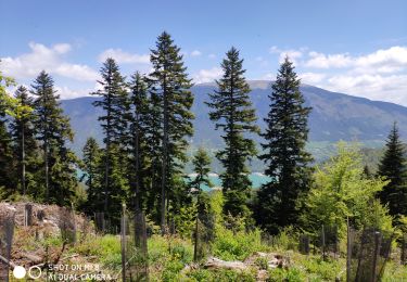
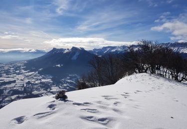
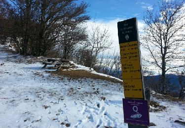
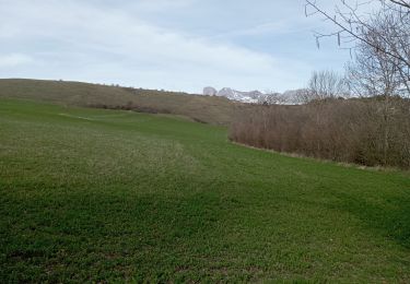
Randonnée Marche de 16,7 km à découvrir à Auvergne-Rhône-Alpes, Isère, Avignonet. Cette randonnée est proposée par Emelle.
Description
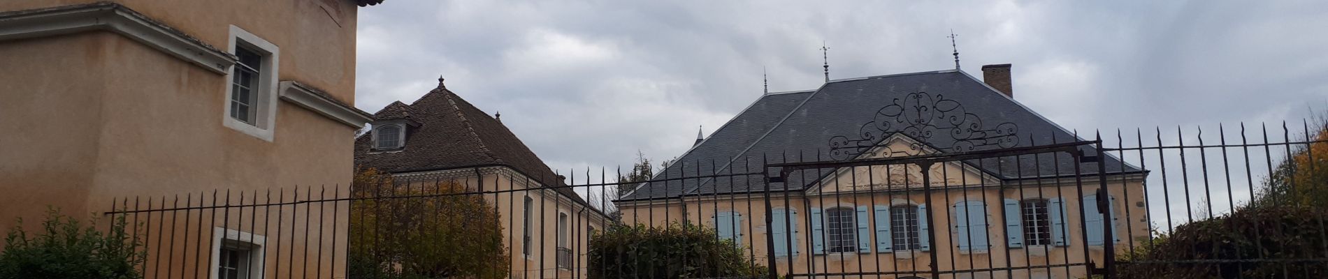
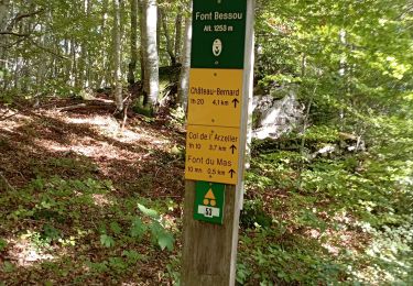
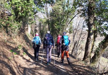
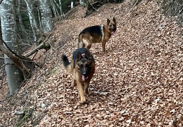
Pas de difficultés techniques sinon une descente soutenue sur la fin sur le lac de Monteynard et une belle remontée à la fin de la randonnée. Randonnée patrimoniale (les 3 châteaux mais aussi la Chapelle de Paquier) avec de beaux points de vue sur les massifs environnants. Randonnée campagnarde à faire au printemps ou à l'automne.
Localisation
Commentaires
Randonnées à proximité
![Randonnée Marche Château-Bernard - la soldanelle - Photo](https://media.geolcdn.com/t/375/260/75f3f6c9-7fa9-4e53-8263-c310156b3409.jpg&format=jpg&maxdim=2)
![Marche Marche](https://static1.geolcdn.com/sitytour/trail-icons/101.png)
Marche
![](/images/other/stat-length.png)
![](https://static1.geolcdn.com/siteimages/upload/files/16400158638029165_repeat_loop_refresh_sync_direction_icon.png)
![Randonnée Marche Château-Bernard - tête des chaudières et rocher de la Balme - Photo](https://media.geolcdn.com/t/375/260/0195d12b-3165-4d3f-81a6-2df422d450fa.jpg&format=jpg&maxdim=2)
![Marche Marche](https://static1.geolcdn.com/sitytour/trail-icons/101.png)
Marche
![](/images/other/stat-length.png)
![](https://static1.geolcdn.com/siteimages/upload/files/16400158638029165_repeat_loop_refresh_sync_direction_icon.png)
![Randonnée Marche La Motte-Saint-Martin - Sinepi - Photo](https://media.geolcdn.com/t/375/260/ext.jpg?maxdim=2&url=https%3A%2F%2Fstatic1.geolcdn.com%2Fsiteimages%2Fupload%2Ffiles%2F1553511878bg_sport_marche.png)
![Marche Marche](https://static1.geolcdn.com/sitytour/trail-icons/101.png)
Marche
![](/images/other/stat-length.png)
![](https://static1.geolcdn.com/siteimages/upload/files/16400158638029165_repeat_loop_refresh_sync_direction_icon.png)
![Randonnée Marche Miribel-Lanchâtre - Les crêtes de la Ferrière en circuit - Photo](https://media.geolcdn.com/t/375/260/cc21fc08-e5b4-4afc-a744-9afd01b9f9b1.jpg&format=jpg&maxdim=2)
![Marche Marche](https://static1.geolcdn.com/sitytour/trail-icons/101.png)
Marche
![](/images/other/stat-length.png)
![](https://static1.geolcdn.com/siteimages/upload/files/16400158638029165_repeat_loop_refresh_sync_direction_icon.png)
![Randonnée Marche nordique Treffort - sinard - lac de treffort - Photo](https://media.geolcdn.com/t/375/260/7b1f5e55-67c7-451c-bb3d-39e46a739845.jpg&format=jpg&maxdim=2)
![Marche nordique Marche nordique](https://static1.geolcdn.com/sitytour/trail-icons/102.png)
Marche nordique
![](/images/other/stat-length.png)
![](https://static1.geolcdn.com/siteimages/upload/files/16400158638029165_repeat_loop_refresh_sync_direction_icon.png)
![Randonnée Raquettes à neige Château-Bernard - Les Crêtes de La Ferrière - Photo](https://media.geolcdn.com/t/375/260/4241f7a1-7b34-48a1-9b18-1c0d317e29fe.jpg&format=jpg&maxdim=2)
![Raquettes à neige Raquettes à neige](https://static1.geolcdn.com/sitytour/trail-icons/504.png)
Raquettes à neige
![](/images/other/stat-length.png)
![](https://static1.geolcdn.com/siteimages/upload/files/16400158638029165_repeat_loop_refresh_sync_direction_icon.png)
![Randonnée Marche Miribel-Lanchâtre - Les crêtes de la Ferrière - Photo](https://media.geolcdn.com/t/375/260/ext.jpg?maxdim=2&url=https%3A%2F%2Fservices.sitytrail.com%2FGeolivesWS%2FDownloadMedia.ashx%3FTrailID%3D683639%26Media%3Dfix__20170112133023.jpg)
![Marche Marche](https://static1.geolcdn.com/sitytour/trail-icons/101.png)
Marche
![](/images/other/stat-length.png)
![](https://static1.geolcdn.com/siteimages/upload/files/16400158638029165_repeat_loop_refresh_sync_direction_icon.png)
![Randonnée Marche Monteynard - Monteynard - Photo](https://media.geolcdn.com/t/375/260/c552c6fb-7cf0-4adf-8eac-685863c2cd45.jpg&format=jpg&maxdim=2)
![Marche Marche](https://static1.geolcdn.com/sitytour/trail-icons/101.png)
Marche
![](/images/other/stat-length.png)
![](https://static1.geolcdn.com/siteimages/upload/files/16400158638029165_repeat_loop_refresh_sync_direction_icon.png)
![Randonnée Marche La Motte-Saint-Martin - Serre de la roche - Photo](https://media.geolcdn.com/t/375/260/00771906-6d51-4bdf-bb0c-75a53536efc1.jpg&format=jpg&maxdim=2)
![Marche Marche](https://static1.geolcdn.com/sitytour/trail-icons/101.png)
Marche
![](/images/other/stat-length.png)
![](https://static1.geolcdn.com/siteimages/upload/files/16400158638029165_repeat_loop_refresh_sync_direction_icon.png)
bucolique