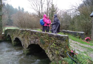
22 km | 26 km-effort
Saint THOIS
RonanDAGORN
Utilisateur
Longueur
17,7 km
Altitude max
196 m
Dénivelé positif
398 m
Km-Effort
23 km
Altitude min
32 m
Dénivelé négatif
396 m
Boucle
Oui
Date de création :
2022-11-06 08:55:20.472
Dernière modification :
2022-11-07 14:16:34.375
4h46
Difficulté : Difficile
Application GPS de randonnée GRATUITE
À propos
Randonnée Marche de 17,7 km à découvrir à Bretagne, Finistère, Saint-Thois. Cette randonnée est proposée par RonanDAGORN.
Localisation
Pays :
France
Région :
Bretagne
Département/Province :
Finistère
Commune :
Saint-Thois
Localité :
Unknown
Départ:(Dec)
Départ:(UTM)
434169 ; 5334973 (30U) N.
Commentaires
Randonnées à proximité
Rando drosera - Aulne Ster Goanez
A pied
Moyen
Châteauneuf-du-Faou,
Bretagne,
Finistère,
France
5h 58min
Oui
CHÂTEAUNEUF DU FAOU
Marche
Moyen
Châteauneuf-du-Faou,
Bretagne,
Finistère,
France
21 km | 26 km-effort
5h 27min
Oui
Les trois vallées
A pied
Facile
Saint-Thois,
Bretagne,
Finistère,
France
14 km | 18,5 km-effort
4h 12min
Oui
CHÂTEAUNEUF Du FAOU
Marche
Moyen
Châteauneuf-du-Faou,
Bretagne,
Finistère,
France
17,4 km | 21 km-effort
5h 6min
Oui
SAINT THOIS
Marche
Moyen
Saint-Thois,
Bretagne,
Finistère,
France
4,8 km | 6,1 km-effort
1h 23min
Oui
Châteauneuf du Faou
Marche
Facile
Châteauneuf-du-Faou,
Bretagne,
Finistère,
France
19,5 km | 24 km-effort
5h 21min
Oui
Canal Nantes/Brest à Lennon
Marche
Très facile
Gouézec,
Bretagne,
Finistère,
France
10,2 km | 12,1 km-effort
2h 32min
Oui
Châteauneuf du Faou
Marche
Moyen
Châteauneuf-du-Faou,
Bretagne,
Finistère,
France
18,8 km | 23 km-effort
5h 5min
Oui