![](/images/other/stat-length.png)
![Randonnée Marche Collobrières - collobrieres, Lambert, laquina - Photo](https://media.geolcdn.com/t/1900/400/78d47aeb-6feb-431a-8d9c-c509cc4e583c.jpg&format=pjpeg&maxdim=2)
collobrieres, Lambert, laquina
cdanielrando
Utilisateur
![Longueur](/images/other/stat-length.png)
![Altitude max](https://static1.geolcdn.com/siteimages/upload/files/1508320355ic_sort_altitude_max_24dp.png)
![Dénivelé positif](https://static1.geolcdn.com/siteimages/upload/files/1508320355ic_sort_den_pos_24dp.png)
![Km-Effort](/images/other/stat-length.png)
![Altitude min](https://static1.geolcdn.com/siteimages/upload/files/1508320355ic_sort_altitude_min_24dp.png)
![Dénivelé négatif](https://static1.geolcdn.com/siteimages/upload/files/1508320355ic_sort_den_neg_24dp.png)
![Boucle](https://static1.geolcdn.com/siteimages/upload/files/16400158638029165_repeat_loop_refresh_sync_direction_icon.png)
![Marche](https://static1.geolcdn.com/sitytour/trail-icons/101.png)
6h31
Difficulté : Moyen
![Scannez ce code QR pour ouvrir la randonnée dans l'application SityTrail](https://capi.geolives.com/qq0zvz2zws4bq2lad0pu/sitytour/trails/3444541/qr.png?size=200)
Application GPS de randonnée GRATUITE
À propos
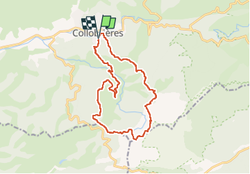
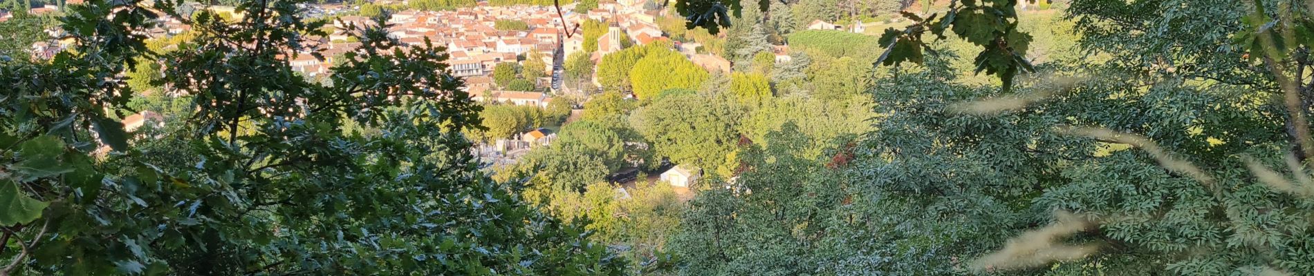
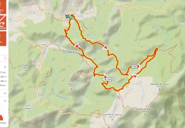
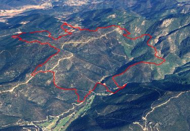
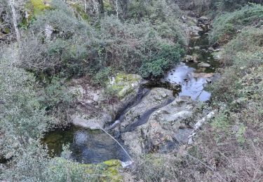
Randonnée Marche de 16,9 km à découvrir à Provence-Alpes-Côte d'Azur, Var, Collobrières. Cette randonnée est proposée par cdanielrando.
Description
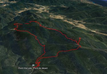
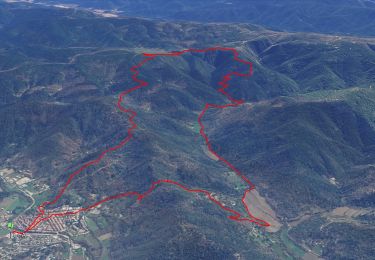
Du pk au cimetière, traverser le village pour rejoindre le Gr 90 qui vous conduit , en montée jusqu'au plateau Lambert. Les deux menhirs bien visibles sont dans une prairie clôturée. Continuer sur le Gr et le quitter avant d'arriver au sommet du Laquina. Vue mer imprenable. Prendre à droite sur la dfci en direction du col du Babaou. Du sommet de Pertuade en direction de la Malière, bien suivre le tracé car le sentier non balisé est moins visible. Passé le gué de la haute Malière, le sentier en balcon monte avant de redescendre au pk
Localisation
Commentaires
Randonnées à proximité
![Randonnée Marche Collobrières - Collobrières - Radar Météo - Chartreuse de La La Verne - Photo](https://media.geolcdn.com/t/375/260/da9d634a-9911-4550-a6f3-bff27c212c6d.jpg&format=jpg&maxdim=2)
![Marche Marche](https://static1.geolcdn.com/sitytour/trail-icons/101.png)
Marche
![](/images/other/stat-length.png)
![](https://static1.geolcdn.com/siteimages/upload/files/16400158638029165_repeat_loop_refresh_sync_direction_icon.png)
![Randonnée Marche Collobrières - Collobriéres - Plateau Lambert - Photo](https://media.geolcdn.com/t/375/260/72b69c29-7d29-4189-adbb-316e95f51f98.jpg&format=jpg&maxdim=2)
![Marche Marche](https://static1.geolcdn.com/sitytour/trail-icons/101.png)
Marche
![](/images/other/stat-length.png)
![](https://static1.geolcdn.com/siteimages/upload/files/16400158638029165_repeat_loop_refresh_sync_direction_icon.png)
![Randonnée V.T.T. Collobrières - Collobrières par pistes - Photo](https://media.geolcdn.com/t/375/260/ext.jpg?maxdim=2&url=https%3A%2F%2Fstatic1.geolcdn.com%2Fsiteimages%2Fupload%2Ffiles%2F1524743154velo.jpg)
![V.T.T. V.T.T.](https://static1.geolcdn.com/sitytour/trail-icons/202.png)
V.T.T.
![](/images/other/stat-length.png)
![](https://static1.geolcdn.com/siteimages/upload/files/16400158638029165_repeat_loop_refresh_sync_direction_icon.png)
![Randonnée Marche Collobrières - Plateau Lambert 2 - Photo](https://media.geolcdn.com/t/375/260/ext.jpg?maxdim=2&url=https%3A%2F%2Fstatic1.geolcdn.com%2Fsiteimages%2Fupload%2Ffiles%2F1553511878bg_sport_marche.png)
![Marche Marche](https://static1.geolcdn.com/sitytour/trail-icons/101.png)
Marche
![](/images/other/stat-length.png)
![](https://static1.geolcdn.com/siteimages/upload/files/16400158638029165_repeat_loop_refresh_sync_direction_icon.png)
![Randonnée Marche Collobrières - Verne - plateau Lambert - Photo](https://media.geolcdn.com/t/375/260/c4a3a8a8-b423-4008-8407-4394445c8024.jpg&format=jpg&maxdim=2)
![Marche Marche](https://static1.geolcdn.com/sitytour/trail-icons/101.png)
Marche
![](/images/other/stat-length.png)
![](https://static1.geolcdn.com/siteimages/upload/files/16400158638029165_repeat_loop_refresh_sync_direction_icon.png)
![Randonnée Marche Collobrières - plateau Lambert en partant de Collobrieres - Photo](https://media.geolcdn.com/t/375/260/0201a1ab-7db2-4574-9d4b-cd6077f68d1f.png&format=jpg&maxdim=2)
![Marche Marche](https://static1.geolcdn.com/sitytour/trail-icons/101.png)
Marche
![](/images/other/stat-length.png)
![](https://static1.geolcdn.com/siteimages/upload/files/16400158638029165_repeat_loop_refresh_sync_direction_icon.png)
![Randonnée Marche Collobrières - Les Maures-Collobrières-15-03-23 - Photo](https://media.geolcdn.com/t/375/260/17405386-717a-4f1d-adef-f081e285d037.jpg&format=jpg&maxdim=2)
![Marche Marche](https://static1.geolcdn.com/sitytour/trail-icons/101.png)
Marche
![](/images/other/stat-length.png)
![](https://static1.geolcdn.com/siteimages/upload/files/16400158638029165_repeat_loop_refresh_sync_direction_icon.png)
![Randonnée Marche Collobrières - Col du Babaou - Menhir de l'Avelan - Hameau st guillaume - Piste de la Rieille - Maravenne - Barrages - Jau de Peu - La pointe - Photo](https://media.geolcdn.com/t/375/260/c6bacdd0-ee98-427d-aed4-896ac2a549a6.jpg&format=jpg&maxdim=2)
![Marche Marche](https://static1.geolcdn.com/sitytour/trail-icons/101.png)
Marche
![](/images/other/stat-length.png)
![](https://static1.geolcdn.com/siteimages/upload/files/16400158638029165_repeat_loop_refresh_sync_direction_icon.png)
![Randonnée Marche Collobrières - La Verne - Cèdres de Ragusse by DAL - Photo](https://media.geolcdn.com/t/375/260/f7e1e88a-2b2e-4882-9eac-d0eeb8081eba.jpg&format=jpg&maxdim=2)
![Marche Marche](https://static1.geolcdn.com/sitytour/trail-icons/101.png)
Marche
![](/images/other/stat-length.png)
![](https://static1.geolcdn.com/siteimages/upload/files/16400158638029165_repeat_loop_refresh_sync_direction_icon.png)