![](/images/other/stat-length.png)
![Randonnée Marche Tournai - THIMOUGIES _ Marche Adeps _ HT _1/11/2022 - Photo](https://media.geolcdn.com/t/1900/400/bd45980c-c924-476b-84f7-03732067fd0b.jpg&format=pjpeg&maxdim=2)
THIMOUGIES _ Marche Adeps _ HT _1/11/2022
jeangulu
Utilisateur
![Longueur](/images/other/stat-length.png)
Longueur
20 km
![Altitude max](https://static1.geolcdn.com/siteimages/upload/files/1508320355ic_sort_altitude_max_24dp.png)
Altitude max
99 m
![Dénivelé positif](https://static1.geolcdn.com/siteimages/upload/files/1508320355ic_sort_den_pos_24dp.png)
Dénivelé positif
196 m
![Km-Effort](/images/other/stat-length.png)
Km-Effort
23 km
![Altitude min](https://static1.geolcdn.com/siteimages/upload/files/1508320355ic_sort_altitude_min_24dp.png)
Altitude min
25 m
![Dénivelé négatif](https://static1.geolcdn.com/siteimages/upload/files/1508320355ic_sort_den_neg_24dp.png)
Dénivelé négatif
196 m
![Boucle](https://static1.geolcdn.com/siteimages/upload/files/16400158638029165_repeat_loop_refresh_sync_direction_icon.png)
Boucle
Oui
Date de création :
2022-11-01 10:11:24.392
Dernière modification :
2022-11-01 14:40:45.35
![Marche](https://static1.geolcdn.com/sitytour/trail-icons/101.png)
4h28
Difficulté : Facile
![Scannez ce code QR pour ouvrir la randonnée dans l'application SityTrail](https://capi.geolives.com/qq0zvz2zws4bq2lad0pu/sitytour/trails/3443466/qr.png?size=200)
Application GPS de randonnée GRATUITE
À propos
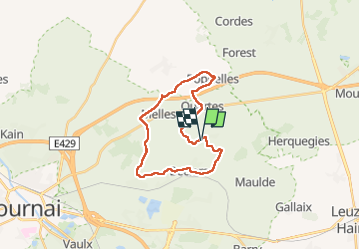
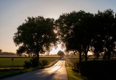
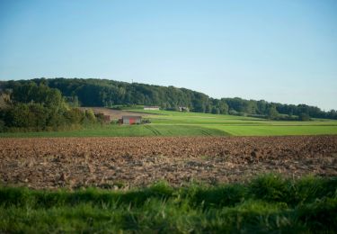
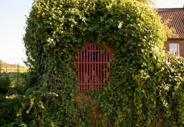
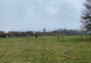
Randonnée Marche de 20 km à découvrir à Wallonie, Hainaut, Tournai. Cette randonnée est proposée par jeangulu.
Description
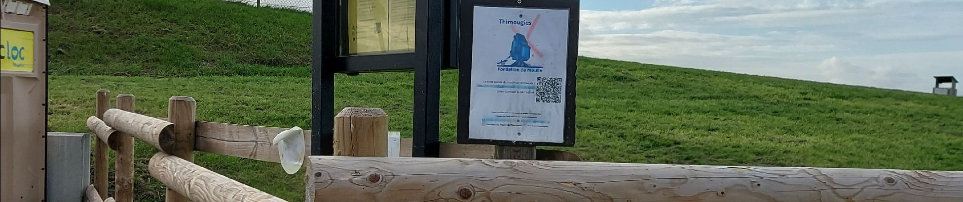
Point de départ : Salle du Moulin à Van, place 32.
Organisateur : Mont-Marche Tournai - André Delhaie - 0498 401 840.
Localité : THIMOUGIES.
Province: Hainaut
Entité : Tournai.
Carte IGN 37/7.
Localisation
Pays :
Belgique
Région :
Wallonie
Département/Province :
Hainaut
Commune :
Tournai
Localité :
Unknown
Départ:(Dec)
Départ:(UTM)
536137 ; 5609365 (31U) N.
Commentaires
Randonnées à proximité
![Randonnée Marche Frasnes-lez-Anvaing - Wapi 2.22 - Balade du](https://media.geolcdn.com/t/375/260/0bed65af-f238-4675-b618-450df0465c65.jpg&format=jpg&maxdim=2)
![Marche Marche](https://static1.geolcdn.com/sitytour/trail-icons/101.png)
Wapi 2.22 - Balade du "Trou Robin"
Marche
Moyen
(1)
Frasnes-lez-Anvaing,
Wallonie,
Hainaut,
Belgique
![](/images/other/stat-length.png)
7,3 km | 8,7 km-effort
1h 54min
![](https://static1.geolcdn.com/siteimages/upload/files/16400158638029165_repeat_loop_refresh_sync_direction_icon.png)
Oui
![Randonnée Marche Tournai - Balade à Thimougies - Promenade de la Croix de la Grise - Photo](https://media.geolcdn.com/t/375/260/4c698c66-ba41-481f-bd5a-416db4e961f5.jpg&format=jpg&maxdim=2)
![Marche Marche](https://static1.geolcdn.com/sitytour/trail-icons/101.png)
Balade à Thimougies - Promenade de la Croix de la Grise
Marche
Difficile
Tournai,
Wallonie,
Hainaut,
Belgique
![](/images/other/stat-length.png)
11,1 km | 13 km-effort
2h 57min
![](https://static1.geolcdn.com/siteimages/upload/files/16400158638029165_repeat_loop_refresh_sync_direction_icon.png)
Oui
![Randonnée A pied Frasnes-lez-Anvaing - Balade du 'Trou Robin' - Photo](https://media.geolcdn.com/t/375/260/ext.jpg?maxdim=2&url=https%3A%2F%2Fpivotmedia.tourismewallonie.be%2FANX-02-04JL-015N%2FANX-02-04JL-015N.jpg)
![A pied A pied](https://static1.geolcdn.com/sitytour/trail-icons/100.png)
Balade du 'Trou Robin'
A pied
Facile
Frasnes-lez-Anvaing,
Wallonie,
Hainaut,
Belgique
![](/images/other/stat-length.png)
7,2 km | 8,6 km-effort
1h 56min
![](https://static1.geolcdn.com/siteimages/upload/files/16400158638029165_repeat_loop_refresh_sync_direction_icon.png)
Oui
![Randonnée A pied Tournai - Promenade des fermes - Photo](https://media.geolcdn.com/t/375/260/ext.jpg?maxdim=2&url=https%3A%2F%2Fpivotmedia.tourismewallonie.be%2FANX-02-04OL-0020%2FANX-02-04OL-0020.JPG)
![A pied A pied](https://static1.geolcdn.com/sitytour/trail-icons/100.png)
Promenade des fermes
A pied
Facile
Tournai,
Wallonie,
Hainaut,
Belgique
![](/images/other/stat-length.png)
12,4 km | 14 km-effort
3h 11min
![](https://static1.geolcdn.com/siteimages/upload/files/16400158638029165_repeat_loop_refresh_sync_direction_icon.png)
Oui
![Randonnée A pied Tournai - Promenade du Vert bois - Photo](https://media.geolcdn.com/t/375/260/ext.jpg?maxdim=2&url=https%3A%2F%2Fpivotmedia.tourismewallonie.be%2FANX-02-03VU-01FQ%2FANX-02-03VU-01FQ.jpg)
![A pied A pied](https://static1.geolcdn.com/sitytour/trail-icons/100.png)
Promenade du Vert bois
A pied
Facile
Tournai,
Wallonie,
Hainaut,
Belgique
![](/images/other/stat-length.png)
5,4 km | 6,3 km-effort
1h 26min
![](https://static1.geolcdn.com/siteimages/upload/files/16400158638029165_repeat_loop_refresh_sync_direction_icon.png)
Oui
![Randonnée A pied Tournai - Promenade des chapelles - Photo](https://media.geolcdn.com/t/375/260/ext.jpg?maxdim=2&url=https%3A%2F%2Fpivotmedia.tourismewallonie.be%2FANX-02-04OH-006X%2FANX-02-04OH-006X.JPG)
![A pied A pied](https://static1.geolcdn.com/sitytour/trail-icons/100.png)
Promenade des chapelles
A pied
Facile
Tournai,
Wallonie,
Hainaut,
Belgique
![](/images/other/stat-length.png)
8,1 km | 9,7 km-effort
2h 12min
![](https://static1.geolcdn.com/siteimages/upload/files/16400158638029165_repeat_loop_refresh_sync_direction_icon.png)
Oui
![Randonnée A pied Tournai - Promenade de la Croix de la Grise - Photo](https://media.geolcdn.com/t/375/260/ext.jpg?maxdim=2&url=https%3A%2F%2Fpivotmedia.tourismewallonie.be%2FANX-02-04OI-004Y%2FANX-02-04OI-004Y.JPG)
![A pied A pied](https://static1.geolcdn.com/sitytour/trail-icons/100.png)
Promenade de la Croix de la Grise
A pied
Facile
Tournai,
Wallonie,
Hainaut,
Belgique
![](/images/other/stat-length.png)
9,8 km | 11,6 km-effort
2h 38min
![](https://static1.geolcdn.com/siteimages/upload/files/16400158638029165_repeat_loop_refresh_sync_direction_icon.png)
Oui
![Randonnée A pied Tournai - Promenade du moulin - Photo](https://media.geolcdn.com/t/375/260/ext.jpg?maxdim=2&url=https%3A%2F%2Fpivotmedia.tourismewallonie.be%2FOTH-A0-005M-08ZT%2FOTH-A0-005M-08ZT.jpg)
![A pied A pied](https://static1.geolcdn.com/sitytour/trail-icons/100.png)
Promenade du moulin
A pied
Facile
Tournai,
Wallonie,
Hainaut,
Belgique
![](/images/other/stat-length.png)
1,2 km | 1,5 km-effort
19min
![](https://static1.geolcdn.com/siteimages/upload/files/16400158638029165_repeat_loop_refresh_sync_direction_icon.png)
Oui
![Randonnée Marche Tournai - Thimougies moulin 7,7 km - Photo](https://media.geolcdn.com/t/375/260/4d0a7a8e-6be2-4b98-9f4e-8e53c6ca71fb.jpg&format=jpg&maxdim=2)
![Marche Marche](https://static1.geolcdn.com/sitytour/trail-icons/101.png)
Thimougies moulin 7,7 km
Marche
Très facile
Tournai,
Wallonie,
Hainaut,
Belgique
![](/images/other/stat-length.png)
7,7 km | 9,1 km-effort
1h 48min
![](https://static1.geolcdn.com/siteimages/upload/files/16400158638029165_repeat_loop_refresh_sync_direction_icon.png)
Oui