![](/images/other/stat-length.png)
![Randonnée Marche Burg-Reuland - Balade à Burg-Reuland - Photo](https://media.geolcdn.com/t/1900/400/4a1fc727-7ca9-43e9-9048-777c0d3a2d5c.jpeg&format=pjpeg&maxdim=2)
Balade à Burg-Reuland
Desrumaux
Utilisateur GUIDE
![Longueur](/images/other/stat-length.png)
![Altitude max](https://static1.geolcdn.com/siteimages/upload/files/1508320355ic_sort_altitude_max_24dp.png)
![Dénivelé positif](https://static1.geolcdn.com/siteimages/upload/files/1508320355ic_sort_den_pos_24dp.png)
![Km-Effort](/images/other/stat-length.png)
![Altitude min](https://static1.geolcdn.com/siteimages/upload/files/1508320355ic_sort_altitude_min_24dp.png)
![Dénivelé négatif](https://static1.geolcdn.com/siteimages/upload/files/1508320355ic_sort_den_neg_24dp.png)
![Boucle](https://static1.geolcdn.com/siteimages/upload/files/16400158638029165_repeat_loop_refresh_sync_direction_icon.png)
![Marche](https://static1.geolcdn.com/sitytour/trail-icons/101.png)
6h40
Difficulté : Difficile
![Scannez ce code QR pour ouvrir la randonnée dans l'application SityTrail](https://capi.geolives.com/qq0zvz2zws4bq2lad0pu/sitytour/trails/3442863/qr.png?size=200)
Application GPS de randonnée GRATUITE
À propos
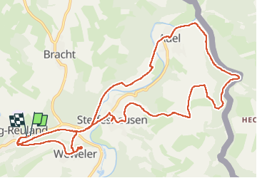
Randonnée Marche de 13,4 km à découvrir à Wallonie, Liège, Burg-Reuland. Cette randonnée est proposée par Desrumaux.
Description
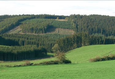
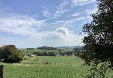
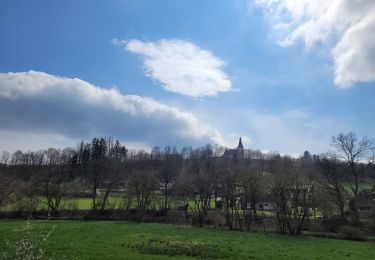
Burg-Reuland, située au point de trois frontières, est la commune la plus méridionale des Cantons de l’Est
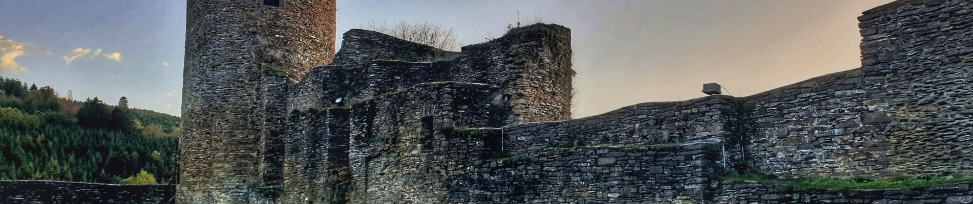
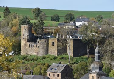
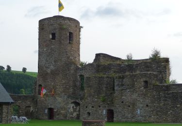
Un château fort légendaire, des églises et chapelles romantiques ainsi que le coin des trois frontières entre la Belgique, l'Allemagne et le Luxembourg font de Burg-Reuland un lieu unique.
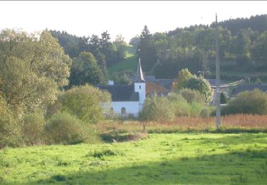
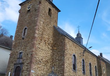
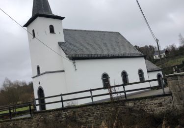
La chapelle Saint-Hubert à Weweler est un joyau parmi les nombreuses et riches églises des Cantons de l'Est. Son emplacement exceptionnel, surplombant la vallée de l'Our, la rend digne d'intérêt.
Localisation
Commentaires
Randonnées à proximité
![Randonnée Marche Saint-Vith - RB-Lg-08_Lommersweiler_via-racc - Photo](https://media.geolcdn.com/t/375/260/ext.jpg?maxdim=2&url=https%3A%2F%2Fservices.sitytrail.com%2FGeolivesWS%2FDownloadMedia.ashx%3FTrailID%3D209419%26Media%3D8658b813-efb8-4716-8028-e5a806af61f9.jpg)
![Marche Marche](https://static1.geolcdn.com/sitytour/trail-icons/101.png)
Marche
![](/images/other/stat-length.png)
![](https://static1.geolcdn.com/siteimages/upload/files/16400158638029165_repeat_loop_refresh_sync_direction_icon.png)
![Randonnée Marche Saint-Vith - RB-Lg-08_Lommersweiler - Photo](https://media.geolcdn.com/t/375/260/ext.jpg?maxdim=2&url=https%3A%2F%2Fservices.sitytrail.com%2FGeolivesWS%2FDownloadMedia.ashx%3FTrailID%3D179566%26Media%3D34b93d32-cd75-4b58-b84c-dd7aa7c61885.jpg)
![Marche Marche](https://static1.geolcdn.com/sitytour/trail-icons/101.png)
Marche
![](/images/other/stat-length.png)
![](https://static1.geolcdn.com/siteimages/upload/files/16400158638029165_repeat_loop_refresh_sync_direction_icon.png)
![Randonnée Marche Burg-Reuland - Grufflngen - Photo](https://media.geolcdn.com/t/375/260/10cbd4be-8c1f-4424-9db5-3cea24db22bb.jpg&format=jpg&maxdim=2)
![Marche Marche](https://static1.geolcdn.com/sitytour/trail-icons/101.png)
Marche
![](/images/other/stat-length.png)
![](https://static1.geolcdn.com/siteimages/upload/files/16400158638029165_repeat_loop_refresh_sync_direction_icon.png)
![Marche Marche](https://static1.geolcdn.com/sitytour/trail-icons/101.png)
Marche
![](/images/other/stat-length.png)
![](https://static1.geolcdn.com/siteimages/upload/files/16400158638029165_repeat_loop_refresh_sync_direction_icon.png)
![A pied A pied](https://static1.geolcdn.com/sitytour/trail-icons/100.png)
A pied
![](/images/other/stat-length.png)
![](https://static1.geolcdn.com/siteimages/upload/files/16400158638029165_repeat_loop_refresh_sync_direction_icon.png)
![Randonnée Marche Burg-Reuland - Burg Reuland 180423 - Photo](https://media.geolcdn.com/t/375/260/3c36ae65-aa52-40a7-a98c-9e9f1b9442b7.jpg&format=jpg&maxdim=2)
![Marche Marche](https://static1.geolcdn.com/sitytour/trail-icons/101.png)
Marche
![](/images/other/stat-length.png)
![](https://static1.geolcdn.com/siteimages/upload/files/16400158638029165_repeat_loop_refresh_sync_direction_icon.png)
![Randonnée Marche Burg-Reuland - rando burg reuland 18-04-2023 - Photo](https://media.geolcdn.com/t/375/260/0fdf5f0f-107a-404c-aa26-b0989bd639a9.jpg&format=jpg&maxdim=2)
![Marche Marche](https://static1.geolcdn.com/sitytour/trail-icons/101.png)
Marche
![](/images/other/stat-length.png)
![](https://static1.geolcdn.com/siteimages/upload/files/16400158638029165_repeat_loop_refresh_sync_direction_icon.png)
![Randonnée Marche Saint-Vith - Burgknof circuit - Photo](https://media.geolcdn.com/t/375/260/5a026696-2e2c-4f0f-9029-84aee82d1ade.jpg&format=jpg&maxdim=2)
![Marche Marche](https://static1.geolcdn.com/sitytour/trail-icons/101.png)
Marche
![](/images/other/stat-length.png)
![](https://static1.geolcdn.com/siteimages/upload/files/16400158638029165_repeat_loop_refresh_sync_direction_icon.png)
![Randonnée Marche Saint-Vith - Lommersweiler vallées de l’Our - Photo](https://media.geolcdn.com/t/375/260/de82a9b0-77ed-4a0f-afff-125e7ce57cdb.jpg&format=jpg&maxdim=2)
![Marche Marche](https://static1.geolcdn.com/sitytour/trail-icons/101.png)
Marche
![](/images/other/stat-length.png)
![](https://static1.geolcdn.com/siteimages/upload/files/16400158638029165_repeat_loop_refresh_sync_direction_icon.png)