![](/images/other/stat-length.png)
![Randonnée Marche nordique Salins - 29/10/22 - Photo](https://media.geolcdn.com/t/1900/400/ext.pjpeg?maxdim=2&url=https%3A%2F%2Fstatic1.geolcdn.com%2Fsiteimages%2Fupload%2Ffiles%2F1545311037marcheuse_200dpi.jpg)
29/10/22
joelinou
Utilisateur
![Longueur](/images/other/stat-length.png)
Longueur
13,7 km
![Altitude max](https://static1.geolcdn.com/siteimages/upload/files/1508320355ic_sort_altitude_max_24dp.png)
Altitude max
133 m
![Dénivelé positif](https://static1.geolcdn.com/siteimages/upload/files/1508320355ic_sort_den_pos_24dp.png)
Dénivelé positif
172 m
![Km-Effort](/images/other/stat-length.png)
Km-Effort
16 km
![Altitude min](https://static1.geolcdn.com/siteimages/upload/files/1508320355ic_sort_altitude_min_24dp.png)
Altitude min
73 m
![Dénivelé négatif](https://static1.geolcdn.com/siteimages/upload/files/1508320355ic_sort_den_neg_24dp.png)
Dénivelé négatif
171 m
![Boucle](https://static1.geolcdn.com/siteimages/upload/files/16400158638029165_repeat_loop_refresh_sync_direction_icon.png)
Boucle
Oui
Date de création :
2022-10-29 09:55:30.0
Dernière modification :
2022-10-29 12:37:04.681
![Marche nordique](https://static1.geolcdn.com/sitytour/trail-icons/102.png)
2h40
Difficulté : Inconnu
![Scannez ce code QR pour ouvrir la randonnée dans l'application SityTrail](https://capi.geolives.com/qq0zvz2zws4bq2lad0pu/sitytour/trails/3439402/qr.png?size=200)
Application GPS de randonnée GRATUITE
À propos
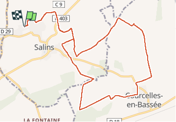
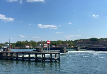
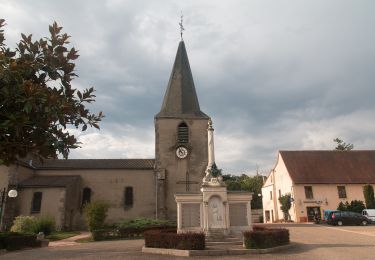
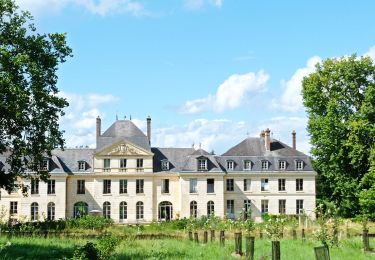
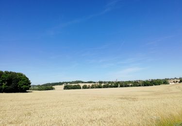
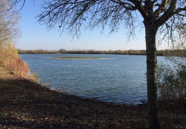
Randonnée Marche nordique de 13,7 km à découvrir à Île-de-France, Seine-et-Marne, Salins. Cette randonnée est proposée par joelinou.
Description
Encore 22 degrés un temps d été magnifique
On ve peut être le payer ensuite on verra
Localisation
Pays :
France
Région :
Île-de-France
Département/Province :
Seine-et-Marne
Commune :
Salins
Localité :
Unknown
Départ:(Dec)
Départ:(UTM)
501006 ; 5363784 (31U) N.
Commentaires
Randonnées à proximité
![Randonnée Marche Montigny-Lencoup - Boucle Montigny Lencoup - Donnemarie 30 km - Photo](https://media.geolcdn.com/t/375/260/b981e295-e152-41fe-b93f-ed478876f2d5.jpg&format=jpg&maxdim=2)
![Marche Marche](https://static1.geolcdn.com/sitytour/trail-icons/101.png)
Boucle Montigny Lencoup - Donnemarie 30 km
Marche
Très difficile
Montigny-Lencoup,
Île-de-France,
Seine-et-Marne,
France
![](/images/other/stat-length.png)
30 km | 35 km-effort
6h 6min
![](https://static1.geolcdn.com/siteimages/upload/files/16400158638029165_repeat_loop_refresh_sync_direction_icon.png)
Oui
![Randonnée Marche Montigny-Lencoup - Boucle Montigny Lencoup - Donnemarie - Dontilly - Preuilly - Photo](https://media.geolcdn.com/t/375/260/ffeb9e28-9fb6-4c09-9cf5-ed58c94e548f.jpg&format=jpg&maxdim=2)
![Marche Marche](https://static1.geolcdn.com/sitytour/trail-icons/101.png)
Boucle Montigny Lencoup - Donnemarie - Dontilly - Preuilly
Marche
Facile
Montigny-Lencoup,
Île-de-France,
Seine-et-Marne,
France
![](/images/other/stat-length.png)
33 km | 39 km-effort
6h 34min
![](https://static1.geolcdn.com/siteimages/upload/files/16400158638029165_repeat_loop_refresh_sync_direction_icon.png)
Oui
![Randonnée Vélo de route Salins - Sortie vélo la tombe - Photo](https://media.geolcdn.com/t/375/260/ext.jpg?maxdim=2&url=https%3A%2F%2Fstatic1.geolcdn.com%2Fsiteimages%2Fupload%2Ffiles%2F1524743154velo.jpg)
![Vélo de route Vélo de route](https://static1.geolcdn.com/sitytour/trail-icons/201.png)
Sortie vélo la tombe
Vélo de route
Très difficile
(1)
Salins,
Île-de-France,
Seine-et-Marne,
France
![](/images/other/stat-length.png)
45 km | 50 km-effort
2h 59min
![](https://static1.geolcdn.com/siteimages/upload/files/16400158638029165_repeat_loop_refresh_sync_direction_icon.png)
Oui
![Randonnée Marche Montigny-Lencoup - Boucle Montigny Lencoup - Donnemarie - Sigy - Photo](https://media.geolcdn.com/t/375/260/178755b8-d008-4058-b06d-82df06cd2cd5.jpg&format=jpg&maxdim=2)
![Marche Marche](https://static1.geolcdn.com/sitytour/trail-icons/101.png)
Boucle Montigny Lencoup - Donnemarie - Sigy
Marche
Moyen
Montigny-Lencoup,
Île-de-France,
Seine-et-Marne,
France
![](/images/other/stat-length.png)
32 km | 38 km-effort
5h 59min
![](https://static1.geolcdn.com/siteimages/upload/files/16400158638029165_repeat_loop_refresh_sync_direction_icon.png)
Non
![Randonnée Marche nordique Montereau-Fault-Yonne - Boucle les deux fleuves - Photo](https://media.geolcdn.com/t/375/260/47404431-dde2-4b75-ab49-5ba32ced1efd.jpg&format=jpg&maxdim=2)
![Marche nordique Marche nordique](https://static1.geolcdn.com/sitytour/trail-icons/102.png)
Boucle les deux fleuves
Marche nordique
Montereau-Fault-Yonne,
Île-de-France,
Seine-et-Marne,
France
![](/images/other/stat-length.png)
18,6 km | 20 km-effort
3h 38min
![](https://static1.geolcdn.com/siteimages/upload/files/16400158638029165_repeat_loop_refresh_sync_direction_icon.png)
Oui
![Randonnée A pied Montereau-Fault-Yonne - Les sentiers de la Préhistoire - Photo](https://media.geolcdn.com/t/375/260/76260e32-28fd-40b5-9b70-0a902399cf72.jpeg&format=jpg&maxdim=2)
![A pied A pied](https://static1.geolcdn.com/sitytour/trail-icons/100.png)
Les sentiers de la Préhistoire
A pied
Facile
Montereau-Fault-Yonne,
Île-de-France,
Seine-et-Marne,
France
![](/images/other/stat-length.png)
11,5 km | 13,2 km-effort
2h 59min
![](https://static1.geolcdn.com/siteimages/upload/files/16400158638029165_repeat_loop_refresh_sync_direction_icon.png)
Non
![Randonnée A pied Montereau-Fault-Yonne - Sur les pas de Napoleon - Photo](https://media.geolcdn.com/t/375/260/a07de2b5-06db-436c-9de9-69de166f0e89.jpeg&format=jpg&maxdim=2)
![A pied A pied](https://static1.geolcdn.com/sitytour/trail-icons/100.png)
Sur les pas de Napoleon
A pied
Facile
Montereau-Fault-Yonne,
Île-de-France,
Seine-et-Marne,
France
![](/images/other/stat-length.png)
12 km | 13,5 km-effort
3h 3min
![](https://static1.geolcdn.com/siteimages/upload/files/16400158638029165_repeat_loop_refresh_sync_direction_icon.png)
Non
![Randonnée Marche nordique Salins - Salin jc à l'ombre R - Photo](https://media.geolcdn.com/t/375/260/1d6e0bfb-2946-401b-acf2-cbfe61065054.jpg&format=jpg&maxdim=2)
![Marche nordique Marche nordique](https://static1.geolcdn.com/sitytour/trail-icons/102.png)
Salin jc à l'ombre R
Marche nordique
Très facile
Salins,
Île-de-France,
Seine-et-Marne,
France
![](/images/other/stat-length.png)
16,2 km | 19,3 km-effort
5h 34min
![](https://static1.geolcdn.com/siteimages/upload/files/16400158638029165_repeat_loop_refresh_sync_direction_icon.png)
Oui
![Randonnée Marche nordique Montereau-Fault-Yonne - Boucle des deux fleuves - Photo](https://media.geolcdn.com/t/375/260/646fd3a8-ed10-401d-ac12-4f57b15f5f59.jpg&format=jpg&maxdim=2)
![Marche nordique Marche nordique](https://static1.geolcdn.com/sitytour/trail-icons/102.png)
Boucle des deux fleuves
Marche nordique
Très difficile
(1)
Montereau-Fault-Yonne,
Île-de-France,
Seine-et-Marne,
France
![](/images/other/stat-length.png)
18,5 km | 20 km-effort
3h 17min
![](https://static1.geolcdn.com/siteimages/upload/files/16400158638029165_repeat_loop_refresh_sync_direction_icon.png)
Oui