

Cirque d'Embans - Etang bleu

toutankhcarton
Utilisateur GUIDE

Longueur
10,1 km

Altitude max
1813 m

Dénivelé positif
767 m

Km-Effort
20 km

Altitude min
1035 m

Dénivelé négatif
763 m
Boucle
Oui
Date de création :
2022-10-27 07:45:12.344
Dernière modification :
2022-10-28 02:57:26.86
4h01
Difficulté : Moyen

Application GPS de randonnée GRATUITE
À propos
Randonnée Marche de 10,1 km à découvrir à Occitanie, Ariège, Rabat-les-Trois-Seigneurs. Cette randonnée est proposée par toutankhcarton.
Description
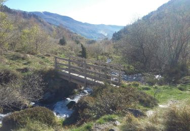
Montée assez raide par Bois du Cirier jusqu'au cirque d'Embans.
Etang long et Etang Bleu. Descente par jasse de l'Étang Bleu et Bois Debès.
Localisation
Pays :
France
Région :
Occitanie
Département/Province :
Ariège
Commune :
Rabat-les-Trois-Seigneurs
Localité :
Unknown
Départ:(Dec)
Départ:(UTM)
376219 ; 4744194 (31T) N.
Commentaires
Randonnées à proximité
Pyrénées-120910 - EtangBleu


Marche
Moyen
(1)
Rabat-les-Trois-Seigneurs,
Occitanie,
Ariège,
France

11,9 km | 23 km-effort
7h 45min
Oui
04/06/2014 Rando Etang d'Artax


Marche
Difficile
(1)
Gourbit,
Occitanie,
Ariège,
France

10,8 km | 24 km-effort
2h 53min
Oui

Cirque D'Embans


Marche
Moyen
(2)
Rabat-les-Trois-Seigneurs,
Occitanie,
Ariège,
France

8,8 km | 18,4 km-effort
3h 52min
Oui

pic du Pioulou en boucle


Marche
Difficile
Rabat-les-Trois-Seigneurs,
Occitanie,
Ariège,
France

15,7 km | 32 km-effort
6h 45min
Non
Gourbit- rochers Carlong


Marche
Moyen
Gourbit,
Occitanie,
Ariège,
France

11,1 km | 19,7 km-effort
4h 15min
Oui

22/04/2017 Rando Etang d'Artax


Marche
Difficile
(1)
Gourbit,
Occitanie,
Ariège,
France

12,2 km | 25 km-effort
5h 4min
Oui
balade sauratoise


Marche
Moyen
Saurat,
Occitanie,
Ariège,
France

11,3 km | 19,4 km-effort
3h 46min
Oui

Le Pic des Trois Seigneurs par l'étang bleu - La Freyte


Marche
Très difficile
Rabat-les-Trois-Seigneurs,
Occitanie,
Ariège,
France

16,8 km | 34 km-effort
7h 0min
Oui


 SityTrail


