Randonnée Marche Oltingue - Oltingue  Landskron - Photo
 Alain28/01
Alain28/01

Utilisateur

© OpenStreetMap contributors
Longueur
Longueur
24 km
Altitude max
Altitude max
532 m
Dénivelé positif
Dénivelé positif
689 m
Km-Effort
Km-Effort  
33 km
Altitude min
Altitude min
329 m
Dénivelé négatif
Dénivelé négatif
689 m
Boucle
Boucle
Oui
Date de création :
2022-10-17 10:30:00.414
Dernière modification :
2022-10-17 10:31:23.468

(0 Avis)

Marche
Marche
7h36
Difficulté : Très difficile

Scannez ce code QR pour ouvrir la randonnée dans l'application SityTrail

Application GPS de randonnée GRATUITE

Logo SityTrail SityTrail

IGN / Instituts géographiques

Télécharger SityTrail sur l'App Store Télécharger SityTrail sur Google Play

Logo SityTrail SityTrail World

Le monde est à vous

Télécharger SityTrail sur l'App Store Télécharger SityTrail sur Google Play Télécharger SityTrail sur Huawei AppGallery

À propos

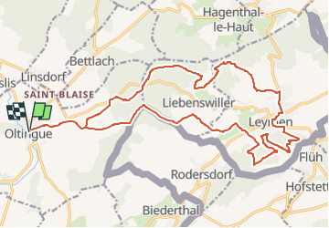
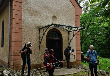
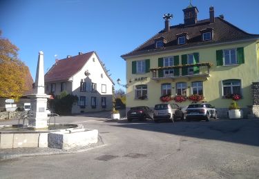
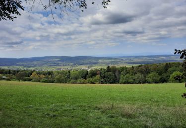
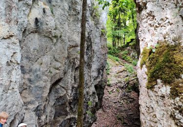
Randonnée Marche de 24 km à découvrir à Grand Est, Haut-Rhin, Oltingue. Cette randonnée est proposée par Alain28/01.

Profil altimétrique

Localisation

Pays :
France
Région :
Grand Est
Département/Province :
Haut-Rhin
Commune :
Oltingue
Localité :
Unknown
Départ:(UTM)
378874 ; 5261040 (32T) N.

Randonnées à proximité

Randonnée Marche Biederthal - JD 15/20 Pedibus Biederthal - Photo
Marche
argonneuweg

Marche

(1)
Biederthal, Grand Est, Haut-Rhin, France
8,2 km | 11,4 km-effort
2h 33min
Oui
Randonnée Marche Wolschwiller - Rando CLAS du 09/05/202..par PBo - Photo
Marche
boubou68

Marche

Très difficile
Wolschwiller, Grand Est, Haut-Rhin, France
20 km | 30 km-effort
4h 24min
Oui
Randonnée Marche Wolschwiller - Reco Rando CLAS du 09/05/2024 - Photo
Marche
boubou68

Marche

Très difficile
Wolschwiller, Grand Est, Haut-Rhin, France
18,9 km | 28 km-effort
3h 54min
Oui
Randonnée Marche Wolschwiller - Le sentier des douaniers - Wolschwiller - Photo
Marche
helmut68

Marche

Moyen
(1)
Wolschwiller, Grand Est, Haut-Rhin, France
12,2 km | 18,1 km-effort
3h 30min
Oui
Randonnée Marche Lutter - rdpr 20200929 lutter - Photo
Marche
GUIDE
stempfel52

Marche

Difficile
Lutter, Grand Est, Haut-Rhin, France
15,8 km | 23 km-effort
4h 52min
Oui
Randonnée Marche Wolschwiller - wolschwiller - Photo
Marche
jcguew

Marche

Facile
Wolschwiller, Grand Est, Haut-Rhin, France
7,3 km | 12,7 km-effort
4h 15min
Non
Randonnée Cheval Bouxwiller - Bouxwiller Doubs Franche Montagne - Photo
Cheval
meggstone

Cheval

Difficile
(1)
Bouxwiller, Grand Est, Haut-Rhin, France
104 km | 146 km-effort
18h 22min
Non
Randonnée Marche Oltingue - randonnée au départ d'Oltingue chapelle St Martin - Photo
Marche
sitykathy

Marche

Difficile
Oltingue, Grand Est, Haut-Rhin, France
13,4 km | 18,2 km-effort
3h 25min
Oui
Randonnée Vélo électrique Bouxwiller - sortie vtt 08052024 Bouxwiller suisse - Photo
Vélo électrique
GUIDE
fabwin

Vélo électrique

Moyen
Bouxwiller, Grand Est, Haut-Rhin, France
43 km | 51 km-effort
2h 43min
Oui


Fermer
Mes abonnements