Randonnée Cheval Saint-Jeure-d'Ay - Castagnades 2022 - St Jeurre d'Ay - Chantelermuze - Photo

Castagnades 2022 - St Jeurre d'Ay - Chantelermuze

 AnaisLambert
AnaisLambert

Utilisateur

© OpenStreetMap contributors
Longueur
Longueur
31 km
Altitude max
Altitude max
793 m
Dénivelé positif
Dénivelé positif
911 m
Km-Effort
Km-Effort  
43 km
Altitude min
Altitude min
378 m
Dénivelé négatif
Dénivelé négatif
911 m
Boucle
Boucle
Oui
Date de création :
2022-10-11 14:30:55.106
Dernière modification :
2022-12-05 13:27:57.696

(0 Avis)

Cheval
Cheval
0m
Difficulté : Facile

Scannez ce code QR pour ouvrir la randonnée dans l'application SityTrail

Application GPS de randonnée GRATUITE

Logo SityTrail SityTrail

IGN / Instituts géographiques

Télécharger SityTrail sur l'App Store Télécharger SityTrail sur Google Play

Logo SityTrail SityTrail World

Le monde est à vous

Télécharger SityTrail sur l'App Store Télécharger SityTrail sur Google Play Télécharger SityTrail sur Huawei AppGallery

À propos

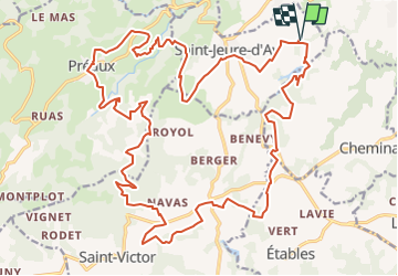
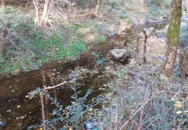
Randonnée Cheval de 31 km à découvrir à Auvergne-Rhône-Alpes, Ardèche, Saint-Jeure-d'Ay. Cette randonnée est proposée par AnaisLambert.

Profil altimétrique

Localisation

Pays :
France
Région :
Auvergne-Rhône-Alpes
Département/Province :
Ardèche
Commune :
Saint-Jeure-d'Ay
Localité :
Unknown
Départ:(UTM)
635949 ; 5000955 (31T) N.

Randonnées à proximité

Randonnée Marche Sécheras - 07 secheras organise - Photo
Marche
GUIDE
randodyssée

Marche

Facile
Sécheras, Auvergne-Rhône-Alpes, Ardèche, France
18,8 km | 25 km-effort
5h 4min
Oui
Randonnée Moteur Cheminas - quad 12/05/2013 - Photo
Moteur
babar07

Moteur

Moyen
(3)
Cheminas, Auvergne-Rhône-Alpes, Ardèche, France
11,8 km | 14,8 km-effort
33min
Oui
Randonnée sport Cheminas - Lac de Meinettes de Cheminas - Photo
sport
alinetpierre

sport

Très facile
Cheminas, Auvergne-Rhône-Alpes, Ardèche, France
13,5 km | 16,1 km-effort
Inconnu
Oui
Randonnée Cheval Saint-Jeure-d'Ay - Castagnades 2022 - St Jeurre d'Ay-Chantelermuze - Château d'Iseran - Photo
Cheval
AnaisLambert

Cheval

Facile
(1)
Saint-Jeure-d'Ay, Auvergne-Rhône-Alpes, Ardèche, France
24 km | 32 km-effort
Inconnu
Oui
Randonnée Marche Cheminas - lac des meinettes  - Photo
Marche
Steph0726

Marche

Très facile
(1)
Cheminas, Auvergne-Rhône-Alpes, Ardèche, France
10,3 km | 12,4 km-effort
3h 6min
Oui
Randonnée Marche Saint-Victor - chantelermuze - Photo
Marche
fayard

Marche

Moyen
(1)
Saint-Victor, Auvergne-Rhône-Alpes, Ardèche, France
9,8 km | 14,5 km-effort
2h 30min
Oui
Randonnée Marche Sécheras - Telethon Sécheras - Photo
Marche
cousam

Marche

Facile
Sécheras, Auvergne-Rhône-Alpes, Ardèche, France
17,2 km | 23 km-effort
4h 36min
Non
Randonnée Marche Ardoix - 07 ardoix - Photo
Marche
GUIDE
randodyssée

Marche

Facile
Ardoix, Auvergne-Rhône-Alpes, Ardèche, France
18,2 km | 24 km-effort
4h 29min
Oui
Randonnée Marche Ardoix - 07 ardoix - Photo
Marche
GUIDE
randodyssée

Marche

Moyen
Ardoix, Auvergne-Rhône-Alpes, Ardèche, France
22 km | 30 km-effort
5h 55min
Oui


Fermer
Mes abonnements