


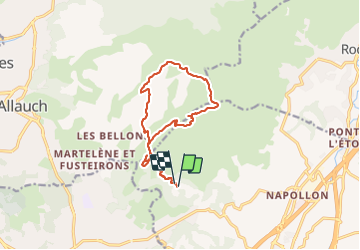


14,2 km | 24 km-effort

Utilisateur


Application GPS de randonnée GRATUITE
 SityTrail
IGN / Instituts géographiques
SityTrail World
Le monde est à vous
Randonnée Marche de 14,2 km à découvrir à Provence-Alpes-Côte d'Azur, Bouches-du-Rhône, Aubagne. Cette randonnée est proposée par cousam.
Puits de Raimu
Maison d'Angèle et de Panturle
Arche du Village d'Aubignagne
grotte de Manon
Grotte du cerf (empruntes des mains de Marcel Pagnol 1934)
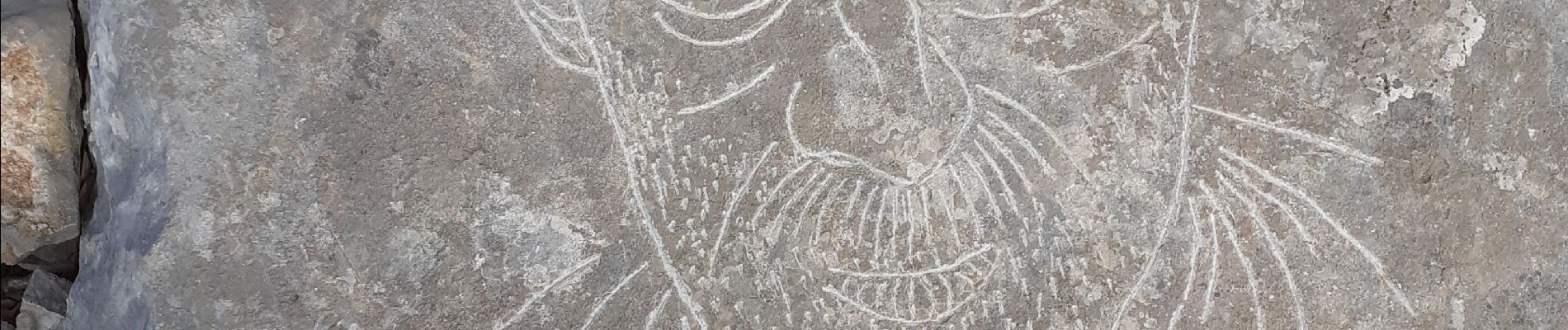
gravures de Louis Drouard
la Baume Saourne
la grotte grosibou


37 photos au total. Cliquez sur une photo pour les afficher toutes dans la galerie.

Marche

Marche

A pied

Marche

Marche

Marche
Marche
Autre activité
Marche