![](/images/other/stat-length.png)
![Randonnée Marche Nasbinals - J2 réel - Nasbinals à Saint Chely d'Aubrac 16 270m +277m - Photo](https://media.geolcdn.com/t/1900/400/ext.pjpeg?maxdim=2&url=https%3A%2F%2Fstatic1.geolcdn.com%2Fsiteimages%2Fupload%2Ffiles%2F1553511878bg_sport_marche.png)
J2 réel - Nasbinals à Saint Chely d'Aubrac 16 270m +277m
DanielROLLET
Utilisateur
![Longueur](/images/other/stat-length.png)
Longueur
16,3 km
![Altitude max](https://static1.geolcdn.com/siteimages/upload/files/1508320355ic_sort_altitude_max_24dp.png)
Altitude max
1368 m
![Dénivelé positif](https://static1.geolcdn.com/siteimages/upload/files/1508320355ic_sort_den_pos_24dp.png)
Dénivelé positif
277 m
![Km-Effort](/images/other/stat-length.png)
Km-Effort
21 km
![Altitude min](https://static1.geolcdn.com/siteimages/upload/files/1508320355ic_sort_altitude_min_24dp.png)
Altitude min
812 m
![Dénivelé négatif](https://static1.geolcdn.com/siteimages/upload/files/1508320355ic_sort_den_neg_24dp.png)
Dénivelé négatif
644 m
![Boucle](https://static1.geolcdn.com/siteimages/upload/files/16400158638029165_repeat_loop_refresh_sync_direction_icon.png)
Boucle
Non
Date de création :
2022-09-28 07:14:41.905
Dernière modification :
2022-10-06 16:48:23.059
![Marche](https://static1.geolcdn.com/sitytour/trail-icons/101.png)
5h35
Difficulté : Moyen
![Scannez ce code QR pour ouvrir la randonnée dans l'application SityTrail](https://capi.geolives.com/qq0zvz2zws4bq2lad0pu/sitytour/trails/3406128/qr.png?size=200)
Application GPS de randonnée GRATUITE
À propos
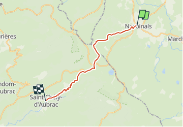
Randonnée Marche de 16,3 km à découvrir à Occitanie, Lozère, Nasbinals. Cette randonnée est proposée par DanielROLLET.
Description
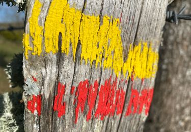
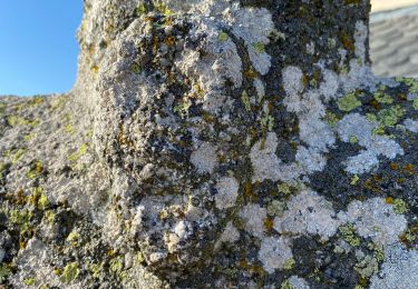
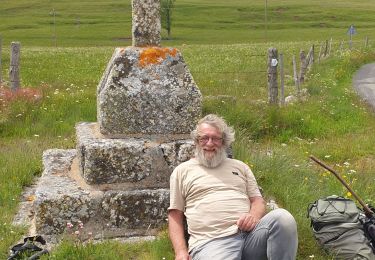
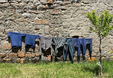
2022 09 14 GR65 toujours sur le Chemin de Compostelle
Départ Hôtel de France à Nasbinals.
Arrivée Hôtel "Les Coudercous" à Saint Chély-d'Aubrac.
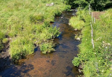
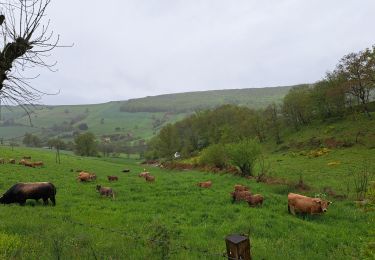
Étape plus variée que la veille, en descente à partir d' Aubrac.
8h15 à 13h50
Étape facile
Localisation
Pays :
France
Région :
Occitanie
Département/Province :
Lozère
Commune :
Nasbinals
Localité :
Unknown
Départ:(Dec)
Départ:(UTM)
503580 ; 4945476 (31T) N.
Commentaires
Randonnées à proximité
![Randonnée Marche Marchastel - Rieutort lac san andeol cascade deroc - Photo](https://media.geolcdn.com/t/375/260/33c320b5-cb8a-49f6-87c9-e02583e6c71a.jpg&format=jpg&maxdim=2)
![Marche Marche](https://static1.geolcdn.com/sitytour/trail-icons/101.png)
Rieutort lac san andeol cascade deroc
Marche
Facile
(1)
Marchastel,
Occitanie,
Lozère,
France
![](/images/other/stat-length.png)
17,5 km | 20 km-effort
4h 52min
![](https://static1.geolcdn.com/siteimages/upload/files/16400158638029165_repeat_loop_refresh_sync_direction_icon.png)
Oui
![Randonnée Marche Saint-Chély-d'Aubrac - Aubrac - St Côme d'Olt - Chemin de St-Jacques de Compostelle - Photo](https://media.geolcdn.com/t/375/260/ext.jpg?maxdim=2&url=https%3A%2F%2Fservices.sitytrail.com%2FGeolivesWS%2FDownloadMedia.ashx%3FTrailID%3D108743%26Media%3D1838_2.jpg)
![Marche Marche](https://static1.geolcdn.com/sitytour/trail-icons/101.png)
Aubrac - St Côme d'Olt - Chemin de St-Jacques de Compostelle
Marche
Très difficile
(1)
Saint-Chély-d'Aubrac,
Occitanie,
Aveyron,
France
![](/images/other/stat-length.png)
23 km | 30 km-effort
5h 0min
![](https://static1.geolcdn.com/siteimages/upload/files/16400158638029165_repeat_loop_refresh_sync_direction_icon.png)
Non
![Randonnée Marche Nasbinals - Nasbinals Montorzier Aubrac GR65 - Photo](https://media.geolcdn.com/t/375/260/1ac3a438-86b6-472c-99e2-7da904ac9db5.jpg&format=jpg&maxdim=2)
![Marche Marche](https://static1.geolcdn.com/sitytour/trail-icons/101.png)
Nasbinals Montorzier Aubrac GR65
Marche
Moyen
Nasbinals,
Occitanie,
Lozère,
France
![](/images/other/stat-length.png)
25 km | 31 km-effort
6h 28min
![](https://static1.geolcdn.com/siteimages/upload/files/16400158638029165_repeat_loop_refresh_sync_direction_icon.png)
Oui
![Randonnée Marche Saint-Chély-d'Aubrac - Mon chemin de St Guilhem étape 3 - Photo](https://media.geolcdn.com/t/375/260/decc6e0e-cc63-493a-98a1-a20926931e85.jpg&format=jpg&maxdim=2)
![Marche Marche](https://static1.geolcdn.com/sitytour/trail-icons/101.png)
Mon chemin de St Guilhem étape 3
Marche
Moyen
Saint-Chély-d'Aubrac,
Occitanie,
Aveyron,
France
![](/images/other/stat-length.png)
24 km | 29 km-effort
5h 53min
![](https://static1.geolcdn.com/siteimages/upload/files/16400158638029165_repeat_loop_refresh_sync_direction_icon.png)
Non
![Randonnée A pied Nasbinals - chemin de Saint-Jacques-de-Compostelle pour randonneurs avec animaux (chien, ane, cheval) ou VTT - Photo](https://media.geolcdn.com/t/375/260/ce1c8375-c87d-45df-90e9-7235318ed55e.jpeg&format=jpg&maxdim=2)
![A pied A pied](https://static1.geolcdn.com/sitytour/trail-icons/100.png)
chemin de Saint-Jacques-de-Compostelle pour randonneurs avec animaux (chien, ...
A pied
Facile
Nasbinals,
Occitanie,
Lozère,
France
![](/images/other/stat-length.png)
5,7 km | 7,3 km-effort
1h 38min
![](https://static1.geolcdn.com/siteimages/upload/files/16400158638029165_repeat_loop_refresh_sync_direction_icon.png)
Non
![Randonnée Marche Saint-Urcize - St Urcize Carbonade Goutal Recoules - Photo](https://media.geolcdn.com/t/375/260/d5696f6e-bd72-472a-8c47-6bfe1d54378a.jpg&format=jpg&maxdim=2)
![Marche Marche](https://static1.geolcdn.com/sitytour/trail-icons/101.png)
St Urcize Carbonade Goutal Recoules
Marche
Facile
Saint-Urcize,
Auvergne-Rhône-Alpes,
Cantal,
France
![](/images/other/stat-length.png)
18,8 km | 24 km-effort
5h 7min
![](https://static1.geolcdn.com/siteimages/upload/files/16400158638029165_repeat_loop_refresh_sync_direction_icon.png)
Oui
![Randonnée Marche Recoules-d'Aubrac - Pont de Gourmier Grandval - Photo](https://media.geolcdn.com/t/375/260/ffa21da4-3882-4a5f-ba26-03b7d7246554.jpg&format=jpg&maxdim=2)
![Marche Marche](https://static1.geolcdn.com/sitytour/trail-icons/101.png)
Pont de Gourmier Grandval
Marche
Facile
Recoules-d'Aubrac,
Occitanie,
Lozère,
France
![](/images/other/stat-length.png)
18,6 km | 23 km-effort
5h 19min
![](https://static1.geolcdn.com/siteimages/upload/files/16400158638029165_repeat_loop_refresh_sync_direction_icon.png)
Oui
![Randonnée Marche Saint-Urcize - St urcize - Photo](https://media.geolcdn.com/t/375/260/84e5b137-319d-4d6f-808d-85721d4634b7.jpg&format=jpg&maxdim=2)
![Marche Marche](https://static1.geolcdn.com/sitytour/trail-icons/101.png)
St urcize
Marche
Facile
Saint-Urcize,
Auvergne-Rhône-Alpes,
Cantal,
France
![](/images/other/stat-length.png)
16,4 km | 22 km-effort
5h 55min
![](https://static1.geolcdn.com/siteimages/upload/files/16400158638029165_repeat_loop_refresh_sync_direction_icon.png)
Non
![Randonnée Marche Recoules-d'Aubrac - Au temps des fleurs et des genêts - Photo](https://media.geolcdn.com/t/375/260/5a185ad9-06d4-44d6-9906-03e9d4e1b2f0.jpg&format=jpg&maxdim=2)
![Marche Marche](https://static1.geolcdn.com/sitytour/trail-icons/101.png)
Au temps des fleurs et des genêts
Marche
Facile
Recoules-d'Aubrac,
Occitanie,
Lozère,
France
![](/images/other/stat-length.png)
16,6 km | 21 km-effort
4h 24min
![](https://static1.geolcdn.com/siteimages/upload/files/16400158638029165_repeat_loop_refresh_sync_direction_icon.png)
Oui