![](/images/other/stat-length.png)
![Randonnée Marche Le Tampon - La Réunion - Grand Bassin - Photo](https://media.geolcdn.com/t/1900/400/ext.pjpeg?maxdim=2&url=https%3A%2F%2Fservices.sitytrail.com%2FGeolivesWS%2FDownloadMedia.ashx%3FTrailID%3D339519%26Media%3Da0d5c9f6-1bc3-4502-9e69-96bbcc409475.jpg)
La Réunion - Grand Bassin
olive2b
Utilisateur
![Longueur](/images/other/stat-length.png)
Longueur
5,8 km
![Altitude max](https://static1.geolcdn.com/siteimages/upload/files/1508320355ic_sort_altitude_max_24dp.png)
Altitude max
1402 m
![Dénivelé positif](https://static1.geolcdn.com/siteimages/upload/files/1508320355ic_sort_den_pos_24dp.png)
Dénivelé positif
111 m
![Km-Effort](/images/other/stat-length.png)
Km-Effort
10 km
![Altitude min](https://static1.geolcdn.com/siteimages/upload/files/1508320355ic_sort_altitude_min_24dp.png)
Altitude min
599 m
![Dénivelé négatif](https://static1.geolcdn.com/siteimages/upload/files/1508320355ic_sort_den_neg_24dp.png)
Dénivelé négatif
902 m
![Boucle](https://static1.geolcdn.com/siteimages/upload/files/16400158638029165_repeat_loop_refresh_sync_direction_icon.png)
Boucle
Non
Date de création :
2016-03-09 00:00:00.0
Dernière modification :
2016-03-09 00:00:00.0
![Marche](https://static1.geolcdn.com/sitytour/trail-icons/101.png)
2h56
Difficulté : Moyen
![Scannez ce code QR pour ouvrir la randonnée dans l'application SityTrail](https://capi.geolives.com/qq0zvz2zws4bq2lad0pu/sitytour/trails/339519/qr.png?size=200)
Application GPS de randonnée GRATUITE
À propos
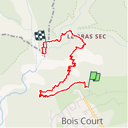
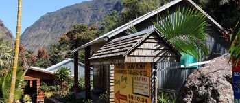
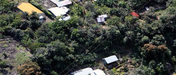
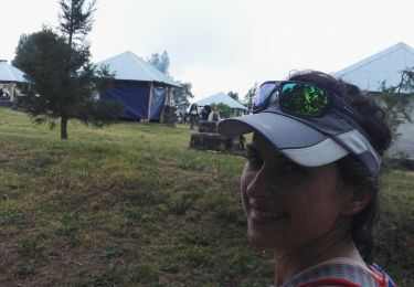
Randonnée Marche de 5,8 km à découvrir à La Réunion, Inconnu, Le Tampon. Cette randonnée est proposée par olive2b.
Description
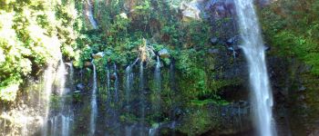
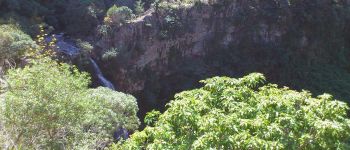
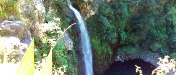
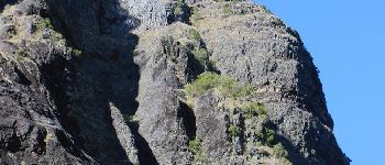
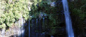
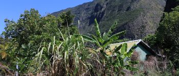
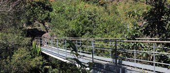
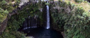
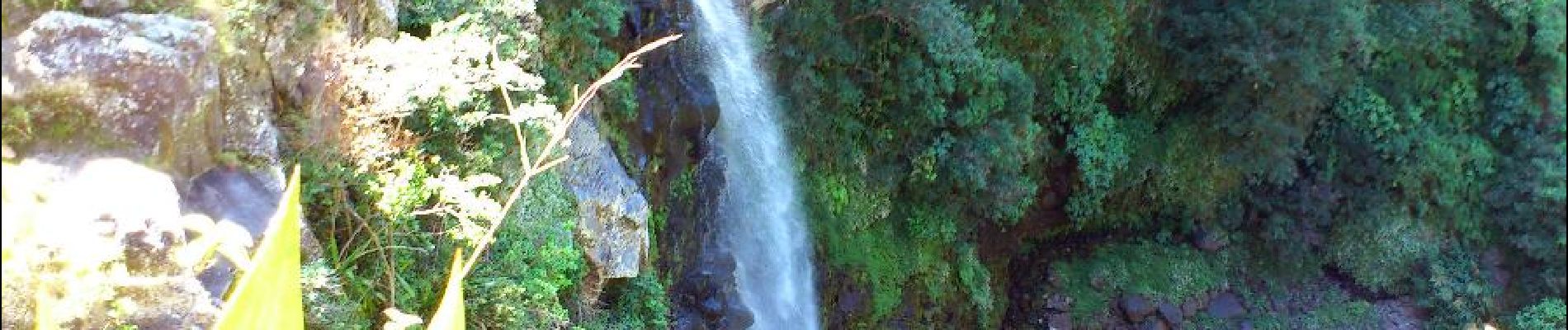
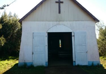
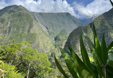
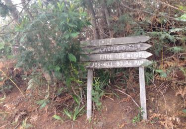
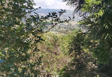
Trajet aller. Le circuit (en descente principalement) commence au départ du Belvédère de Bois Court. Vue plongeante sur Grand Bassin, et la cascade le voile de la mariée. A mi-chemin, un ravitaillement en eau est possible.
Points d'intérêt
Localisation
Pays :
France
Région :
La Réunion
Département/Province :
Inconnu
Commune :
Le Tampon
Localité :
Unknown
Départ:(Dec)
Départ:(UTM)
348182 ; 7655987 (40K) S.
Commentaires
Randonnées à proximité
![Randonnée Marche Entre-Deux - La Réunion - Le Dimitile (aller-retour) par le sentier de la chapelle. - Photo](https://media.geolcdn.com/t/375/260/ext.jpg?maxdim=2&url=https%3A%2F%2Fservices.sitytrail.com%2FGeolivesWS%2FDownloadMedia.ashx%3FTrailID%3D449274%26Media%3Dfix__20150724090014.jpg)
![Marche Marche](https://static1.geolcdn.com/sitytour/trail-icons/101.png)
La Réunion - Le Dimitile (aller-retour) par le sentier de la chapelle.
Marche
Moyen
(1)
Entre-Deux,
La Réunion,
Inconnu,
France
![](/images/other/stat-length.png)
11,9 km | 24 km-effort
5h 29min
![](https://static1.geolcdn.com/siteimages/upload/files/16400158638029165_repeat_loop_refresh_sync_direction_icon.png)
Oui
![Randonnée Marche Le Tampon - Grand Bassin à partir de Bois Court - Photo](https://media.geolcdn.com/t/375/260/546c7d2f-db6d-45ed-ad24-b006fb8e00d4.jpg&format=jpg&maxdim=2)
![Marche Marche](https://static1.geolcdn.com/sitytour/trail-icons/101.png)
Grand Bassin à partir de Bois Court
Marche
Difficile
(1)
Le Tampon,
La Réunion,
Inconnu,
France
![](/images/other/stat-length.png)
9,5 km | 22 km-effort
4h 23min
![](https://static1.geolcdn.com/siteimages/upload/files/16400158638029165_repeat_loop_refresh_sync_direction_icon.png)
Oui
![Randonnée Marche Entre-Deux - boucle citrons galets - Photo](https://media.geolcdn.com/t/375/260/ext.jpg?maxdim=2&url=https%3A%2F%2Fservices.sitytrail.com%2FGeolivesWS%2FDownloadMedia.ashx%3FTrailID%3D361878%26Media%3D20141111140014.jpg)
![Marche Marche](https://static1.geolcdn.com/sitytour/trail-icons/101.png)
boucle citrons galets
Marche
Moyen
(1)
Entre-Deux,
La Réunion,
Inconnu,
France
![](/images/other/stat-length.png)
17,4 km | 33 km-effort
6h 50min
![](https://static1.geolcdn.com/siteimages/upload/files/16400158638029165_repeat_loop_refresh_sync_direction_icon.png)
Oui
![Randonnée Marche Entre-Deux - Jacky Inard jusqu'à la 1ere echelle - Photo](https://media.geolcdn.com/t/375/260/52d3adaa-62d7-4e1e-b244-a796f216ad55.jpg&format=jpg&maxdim=2)
![Marche Marche](https://static1.geolcdn.com/sitytour/trail-icons/101.png)
Jacky Inard jusqu'à la 1ere echelle
Marche
Très difficile
Entre-Deux,
La Réunion,
Inconnu,
France
![](/images/other/stat-length.png)
17 km | 37 km-effort
8h 19min
![](https://static1.geolcdn.com/siteimages/upload/files/16400158638029165_repeat_loop_refresh_sync_direction_icon.png)
Oui
![Randonnée Trail Le Tampon - Voile de la Mariée par Grand Bassin - Photo](https://media.geolcdn.com/t/375/260/5427d8f3-02fa-4d1e-bfb5-4fd763fbd394.jpg&format=jpg&maxdim=2)
![Trail Trail](https://static1.geolcdn.com/sitytour/trail-icons/104.png)
Voile de la Mariée par Grand Bassin
Trail
Difficile
Le Tampon,
La Réunion,
Inconnu,
France
![](/images/other/stat-length.png)
10,4 km | 25 km-effort
3h 20min
![](https://static1.geolcdn.com/siteimages/upload/files/16400158638029165_repeat_loop_refresh_sync_direction_icon.png)
Oui
![Randonnée A pied Le Tampon - 3 pitons à Bourg Murat - Photo](https://media.geolcdn.com/t/375/260/970bad91-7bf9-4096-b52f-d8b7555be2f2.jpg&format=jpg&maxdim=2)
![A pied A pied](https://static1.geolcdn.com/sitytour/trail-icons/100.png)
3 pitons à Bourg Murat
A pied
Moyen
Le Tampon,
La Réunion,
Inconnu,
France
![](/images/other/stat-length.png)
12,4 km | 16,4 km-effort
Inconnu
![](https://static1.geolcdn.com/siteimages/upload/files/16400158638029165_repeat_loop_refresh_sync_direction_icon.png)
Oui
![Randonnée Marche Le Tampon - grand bassin mollaret piton rando - Photo](https://media.geolcdn.com/t/375/260/ext.jpg?maxdim=2&url=https%3A%2F%2Fstatic1.geolcdn.com%2Fsiteimages%2Fupload%2Ffiles%2F1553511878bg_sport_marche.png)
![Marche Marche](https://static1.geolcdn.com/sitytour/trail-icons/101.png)
grand bassin mollaret piton rando
Marche
Difficile
(1)
Le Tampon,
La Réunion,
Inconnu,
France
![](/images/other/stat-length.png)
18,9 km | 37 km-effort
7h 30min
![](https://static1.geolcdn.com/siteimages/upload/files/16400158638029165_repeat_loop_refresh_sync_direction_icon.png)
Oui
![Randonnée Marche Le Tampon - Murat nez de bœuf - Photo](https://media.geolcdn.com/t/375/260/ext.jpg?maxdim=2&url=https%3A%2F%2Fstatic1.geolcdn.com%2Fsiteimages%2Fupload%2Ffiles%2F1553511878bg_sport_marche.png)
![Marche Marche](https://static1.geolcdn.com/sitytour/trail-icons/101.png)
Murat nez de bœuf
Marche
Très facile
(1)
Le Tampon,
La Réunion,
Inconnu,
France
![](/images/other/stat-length.png)
15,9 km | 23 km-effort
5h 23min
![](https://static1.geolcdn.com/siteimages/upload/files/16400158638029165_repeat_loop_refresh_sync_direction_icon.png)
Oui
![Randonnée Marche Le Tampon - Coteau Maigre - Photo](https://media.geolcdn.com/t/375/260/ext.jpg?maxdim=2&url=https%3A%2F%2Fstatic1.geolcdn.com%2Fsiteimages%2Fupload%2Ffiles%2F1553511878bg_sport_marche.png)
![Marche Marche](https://static1.geolcdn.com/sitytour/trail-icons/101.png)
Coteau Maigre
Marche
Difficile
(2)
Le Tampon,
La Réunion,
Inconnu,
France
![](/images/other/stat-length.png)
16,8 km | 26 km-effort
5h 26min
![](https://static1.geolcdn.com/siteimages/upload/files/16400158638029165_repeat_loop_refresh_sync_direction_icon.png)
Oui
le grand bassin