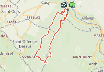
![](/images/other/stat-length.png)
![Randonnée Marche Cusy - 13-09-2022 La Grand-Raie au Col de la Cochette - Photo](https://media.geolcdn.com/t/1900/400/6cba586f-c088-48b0-8a7d-67e2ef29bd8a.jpg&format=pjpeg&maxdim=2)
13-09-2022 La Grand-Raie au Col de la Cochette
Kargil
Utilisateur GUIDE
![Longueur](/images/other/stat-length.png)
![Altitude max](https://static1.geolcdn.com/siteimages/upload/files/1508320355ic_sort_altitude_max_24dp.png)
![Dénivelé positif](https://static1.geolcdn.com/siteimages/upload/files/1508320355ic_sort_den_pos_24dp.png)
![Km-Effort](/images/other/stat-length.png)
![Altitude min](https://static1.geolcdn.com/siteimages/upload/files/1508320355ic_sort_altitude_min_24dp.png)
![Dénivelé négatif](https://static1.geolcdn.com/siteimages/upload/files/1508320355ic_sort_den_neg_24dp.png)
![Boucle](https://static1.geolcdn.com/siteimages/upload/files/16400158638029165_repeat_loop_refresh_sync_direction_icon.png)
![Marche](https://static1.geolcdn.com/sitytour/trail-icons/101.png)
5h24
Difficulté : Très difficile
![Scannez ce code QR pour ouvrir la randonnée dans l'application SityTrail](https://capi.geolives.com/qq0zvz2zws4bq2lad0pu/sitytour/trails/3389646/qr.png?size=200)
Application GPS de randonnée GRATUITE
À propos
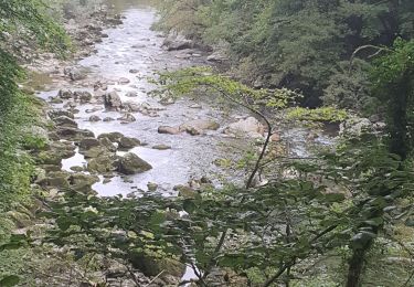
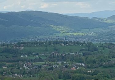
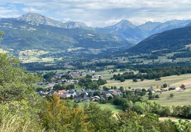
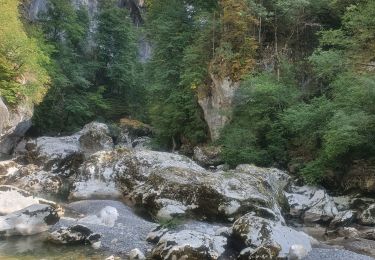
Randonnée Marche de 18,2 km à découvrir à Auvergne-Rhône-Alpes, Haute-Savoie, Cusy. Cette randonnée est proposée par Kargil.
Description
Aucune difficulté technique mais un dénivelé important et une longueur conséquente.
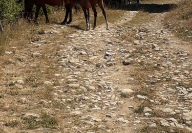
Les pentes raides sont concentrées au 400m de dénivelé à proximité du col de la Cochette.
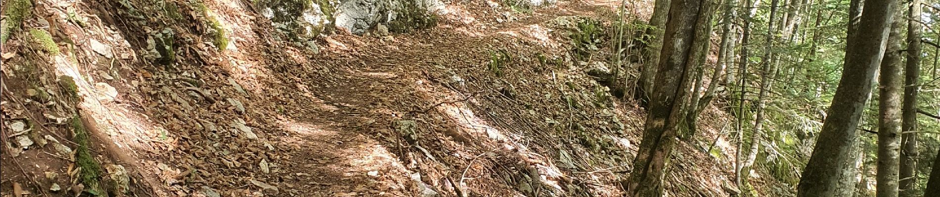
Pour le reste des pentes "confortables" y compris dans la descente terminale où l'on prend même plaisir à trottiner ! Attention, rester vigilant car toutes chutes ne seraient pas sans conséquence.
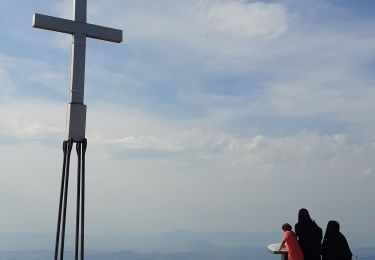
Le petit refuge des Daudes en gestion libre est un bijou pour un casse-croûte inoubliable (Tables, Gazinière, Vaisselle, poêle avec même des pics pour la viande) face au Lac du Bourget. Prenez en soin et merci de redescendre vos poubelles pour éviter la saturation de celle du refuge.
Localisation
Commentaires
Randonnées à proximité
![Randonnée Marche Arith - La Montagne de Bange 1434m, depuis Montagny - Photo](https://media.geolcdn.com/t/375/260/ext.jpg?maxdim=2&url=https%3A%2F%2Fservices.sitytrail.com%2FGeolivesWS%2FDownloadMedia.ashx%3FTrailID%3D317290%26Media%3D16482_1.jpg)
![Marche Marche](https://static1.geolcdn.com/sitytour/trail-icons/101.png)
Marche
![](/images/other/stat-length.png)
![](https://static1.geolcdn.com/siteimages/upload/files/16400158638029165_repeat_loop_refresh_sync_direction_icon.png)
![Randonnée Marche Allèves - 06-09-2022 Tours Saint Jacques-Grottes de Bange - Photo](https://media.geolcdn.com/t/375/260/7a87734e-615b-4914-a2f6-8cd0e03da331.jpg&format=jpg&maxdim=2)
![Marche Marche](https://static1.geolcdn.com/sitytour/trail-icons/101.png)
Marche
![](/images/other/stat-length.png)
![](https://static1.geolcdn.com/siteimages/upload/files/16400158638029165_repeat_loop_refresh_sync_direction_icon.png)
![Randonnée Marche Cusy - Les chaos de Cheran - Photo](https://media.geolcdn.com/t/375/260/7e19bf6d-564b-481b-864d-0e6de1762649.jpg&format=jpg&maxdim=2)
![Marche Marche](https://static1.geolcdn.com/sitytour/trail-icons/101.png)
Marche
![](/images/other/stat-length.png)
![](https://static1.geolcdn.com/siteimages/upload/files/16400158638029165_repeat_loop_refresh_sync_direction_icon.png)
![Randonnée Marche Cusy - Chaos. du Cheran - Photo](https://media.geolcdn.com/t/375/260/ext.jpg?maxdim=2&url=https%3A%2F%2Fstatic1.geolcdn.com%2Fsiteimages%2Fupload%2Ffiles%2F1553511878bg_sport_marche.png)
![Marche Marche](https://static1.geolcdn.com/sitytour/trail-icons/101.png)
Marche
![](/images/other/stat-length.png)
![](https://static1.geolcdn.com/siteimages/upload/files/16400158638029165_repeat_loop_refresh_sync_direction_icon.png)
![Randonnée Marche Saint-Offenge - Saint-Offenge-Dessous Cusy - Photo](https://media.geolcdn.com/t/375/260/9922806d-4eb0-4835-85fc-26210664b335.jpg&format=jpg&maxdim=2)
![Marche Marche](https://static1.geolcdn.com/sitytour/trail-icons/101.png)
Marche
![](/images/other/stat-length.png)
![](https://static1.geolcdn.com/siteimages/upload/files/16400158638029165_repeat_loop_refresh_sync_direction_icon.png)
![Randonnée Marche Arith - Col de la couchette en boucle avec passage au refuge - Photo](https://media.geolcdn.com/t/375/260/5494724c-8476-4b53-a696-21ced4d7d42a.jpg&format=jpg&maxdim=2)
![Marche Marche](https://static1.geolcdn.com/sitytour/trail-icons/101.png)
Marche
![](/images/other/stat-length.png)
![](https://static1.geolcdn.com/siteimages/upload/files/16400158638029165_repeat_loop_refresh_sync_direction_icon.png)
![Randonnée Marche Cusy - 14-08-2022 Pont de Cusy - Pont de l'abîme - Photo](https://media.geolcdn.com/t/375/260/afefb47b-f53a-4dff-bf88-24c102fec5de.jpg&format=jpg&maxdim=2)
![Marche Marche](https://static1.geolcdn.com/sitytour/trail-icons/101.png)
Marche
![](/images/other/stat-length.png)
![](https://static1.geolcdn.com/siteimages/upload/files/16400158638029165_repeat_loop_refresh_sync_direction_icon.png)
![Randonnée Marche Arith - Chalet de la Plate, col de la Cochette... - Photo](https://media.geolcdn.com/t/375/260/c233407c-b230-42c5-905d-b3bc22e6c05b.jpg&format=jpg&maxdim=2)
![Marche Marche](https://static1.geolcdn.com/sitytour/trail-icons/101.png)
Marche
![](/images/other/stat-length.png)
![](https://static1.geolcdn.com/siteimages/upload/files/16400158638029165_repeat_loop_refresh_sync_direction_icon.png)
![Randonnée Marche Viuz-la-Chiésaz - Semnoz, mon tour des lacs et des crêts - Photo](https://media.geolcdn.com/t/375/260/783af83e-3511-42c6-b5b4-a812fdab5578.jpg&format=jpg&maxdim=2)
![Marche Marche](https://static1.geolcdn.com/sitytour/trail-icons/101.png)
Marche
![](/images/other/stat-length.png)
![](https://static1.geolcdn.com/siteimages/upload/files/16400158638029165_repeat_loop_refresh_sync_direction_icon.png)