![](/images/other/stat-length.png)
![Randonnée Marche Eysines - GR Bordeaux Métropole. EYSINES MAGUDAS. - Photo](https://media.geolcdn.com/t/1900/400/91b4e53c-8028-4e29-8bf2-0ff221a4fcc2.jpeg&format=pjpeg&maxdim=2)
GR Bordeaux Métropole. EYSINES MAGUDAS.
piba2
Utilisateur
![Longueur](/images/other/stat-length.png)
![Altitude max](https://static1.geolcdn.com/siteimages/upload/files/1508320355ic_sort_altitude_max_24dp.png)
![Dénivelé positif](https://static1.geolcdn.com/siteimages/upload/files/1508320355ic_sort_den_pos_24dp.png)
![Km-Effort](/images/other/stat-length.png)
![Altitude min](https://static1.geolcdn.com/siteimages/upload/files/1508320355ic_sort_altitude_min_24dp.png)
![Dénivelé négatif](https://static1.geolcdn.com/siteimages/upload/files/1508320355ic_sort_den_neg_24dp.png)
![Boucle](https://static1.geolcdn.com/siteimages/upload/files/16400158638029165_repeat_loop_refresh_sync_direction_icon.png)
![Marche](https://static1.geolcdn.com/sitytour/trail-icons/101.png)
3h37
Difficulté : Très facile
![Scannez ce code QR pour ouvrir la randonnée dans l'application SityTrail](https://capi.geolives.com/qq0zvz2zws4bq2lad0pu/sitytour/trails/3387122/qr.png?size=200)
Application GPS de randonnée GRATUITE
À propos
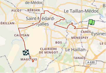
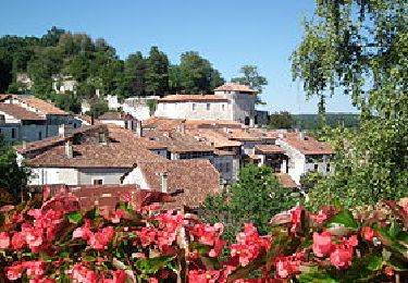
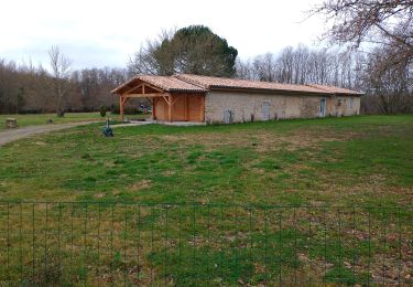
Randonnée Marche de 16,1 km à découvrir à Nouvelle-Aquitaine, Gironde, Eysines. Cette randonnée est proposée par piba2.
Description
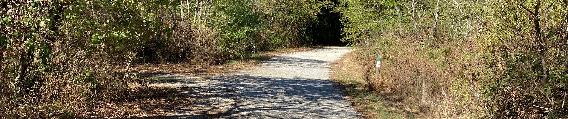
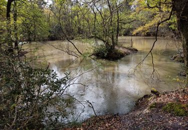
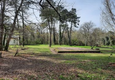
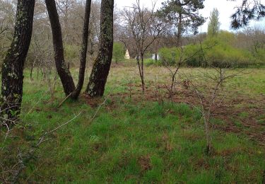
Marche souvent à l'ombre des arbres, en forêt, en sous-bois, sauf le dernier tiers, en zone périurbaine, mais qui reste agréable.
On arrive par le tram D, Les Sources.
On repart vers Bordeaux par le bus 71, Village de Magudas. Le dimanche, un bus toutes les heures seulement.
Localisation
Commentaires
Randonnées à proximité
![Randonnée Marche Blanquefort - Pnl Tanais - Photo](https://media.geolcdn.com/t/375/260/d5d98c98-c615-4cb3-9bf4-916690b17932.jpg&format=jpg&maxdim=2)
![Marche Marche](https://static1.geolcdn.com/sitytour/trail-icons/101.png)
Marche
![](/images/other/stat-length.png)
![](https://static1.geolcdn.com/siteimages/upload/files/16400158638029165_repeat_loop_refresh_sync_direction_icon.png)
![Randonnée Marche Blanquefort - Circuit autour de Blanquefort - Photo](https://media.geolcdn.com/t/375/260/e929d0b7-3df3-414f-8052-5790c33dbb56.jpg&format=jpg&maxdim=2)
![Marche Marche](https://static1.geolcdn.com/sitytour/trail-icons/101.png)
Marche
![](/images/other/stat-length.png)
![](https://static1.geolcdn.com/siteimages/upload/files/16400158638029165_repeat_loop_refresh_sync_direction_icon.png)
![Randonnée Marche Blanquefort - Blanquefort/ Le Pian-Medoc - Photo](https://media.geolcdn.com/t/375/260/661631f6-1335-49e9-a8c6-69d8a45a6939.jpg&format=jpg&maxdim=2)
![Marche Marche](https://static1.geolcdn.com/sitytour/trail-icons/101.png)
Marche
![](/images/other/stat-length.png)
![](https://static1.geolcdn.com/siteimages/upload/files/16400158638029165_repeat_loop_refresh_sync_direction_icon.png)
![Randonnée Marche Blanquefort - Tanais finalisé - Photo](https://media.geolcdn.com/t/375/260/65129eed-45b3-4fa6-9c6a-476d886a3a2f.jpg&format=jpg&maxdim=2)
![Marche Marche](https://static1.geolcdn.com/sitytour/trail-icons/101.png)
Marche
![](/images/other/stat-length.png)
![](https://static1.geolcdn.com/siteimages/upload/files/16400158638029165_repeat_loop_refresh_sync_direction_icon.png)
![Randonnée Marche Bruges - JFT YB ETAPE 15 13-5-2014 - Photo](https://media.geolcdn.com/t/375/260/ext.jpg?maxdim=2&url=https%3A%2F%2Fservices.sitytrail.com%2FGeolivesWS%2FDownloadMedia.ashx%3FTrailID%3D301267%26Media%3Dfix__20140513144815.jpg)
![Marche Marche](https://static1.geolcdn.com/sitytour/trail-icons/101.png)
Marche
![](/images/other/stat-length.png)
![](https://static1.geolcdn.com/siteimages/upload/files/16400158638029165_repeat_loop_refresh_sync_direction_icon.png)
![Randonnée Moteur Bruges - Escapade en Charente 2012 - Photo](https://media.geolcdn.com/t/375/260/ext.jpg?maxdim=2&url=https%3A%2F%2Fservices.sitytrail.com%2FGeolivesWS%2FDownloadMedia.ashx%3FTrailID%3D141858%26Media%3D52823fb7-1ddd-4b13-b35d-27ae7b597f4d.jpg)
![Moteur Moteur](https://static1.geolcdn.com/sitytour/trail-icons/400.png)
Moteur
![](/images/other/stat-length.png)
![](https://static1.geolcdn.com/siteimages/upload/files/16400158638029165_repeat_loop_refresh_sync_direction_icon.png)
![Randonnée Marche Le Taillan-Médoc - 2010-09-02 - 19h41m27 - Photo](https://media.geolcdn.com/t/375/260/ext.jpg?maxdim=2&url=https%3A%2F%2Fservices.sitytrail.com%2FGeolivesWS%2FDownloadMedia.ashx%3FTrailID%3D45181%26Media%3Dimage2.jpg)
![Marche Marche](https://static1.geolcdn.com/sitytour/trail-icons/101.png)
Marche
![](/images/other/stat-length.png)
![](https://static1.geolcdn.com/siteimages/upload/files/16400158638029165_repeat_loop_refresh_sync_direction_icon.png)
![Randonnée Marche Saint-Médard-en-Jalles - Dehes - Photo](https://media.geolcdn.com/t/375/260/e1c74e07-5af3-4c24-b4d0-3b4d9bd8c189.jpg&format=jpg&maxdim=2)
![Marche Marche](https://static1.geolcdn.com/sitytour/trail-icons/101.png)
Marche
![](/images/other/stat-length.png)
![](https://static1.geolcdn.com/siteimages/upload/files/16400158638029165_repeat_loop_refresh_sync_direction_icon.png)
![Randonnée Marche Le Taillan-Médoc - le Taillan - Photo](https://media.geolcdn.com/t/375/260/77418fbb-a3e1-4c2e-919b-dd8588ff5855.jpg&format=jpg&maxdim=2)
![Marche Marche](https://static1.geolcdn.com/sitytour/trail-icons/101.png)
Marche
![](/images/other/stat-length.png)
![](https://static1.geolcdn.com/siteimages/upload/files/16400158638029165_repeat_loop_refresh_sync_direction_icon.png)