


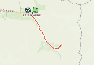

6,3 km | 11,2 km-effort


Utilisateur


Application GPS de randonnée GRATUITE
 SityTrail
IGN / Instituts géographiques
SityTrail World
Le monde est à vous
Randonnée Marche de 13,4 km à découvrir à Auvergne-Rhône-Alpes, Isère, Saint-Christophe-en-Oisans. Cette randonnée est proposée par rapako.
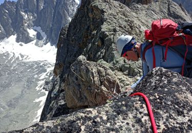
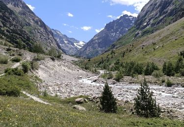
Accueil très sympathique au Refuge.
Les chemins sont très bien entretenus.
L'usage des bâtons est conseillé surtout pour la descente.

Marche

Marche

Marche

Marche

Marche
Marche
Marche

Marche

Marche