![](/images/other/stat-length.png)
![Randonnée Marche Waremme - La vallée du Geer à Waremme : promenade du Wachnet - Photo](https://media.geolcdn.com/t/1900/400/268bcfb1-bebe-41f7-9369-4099f3cd380c.jpeg&format=pjpeg&maxdim=2)
La vallée du Geer à Waremme : promenade du Wachnet
Benjamin27
Utilisateur GUIDE
![Longueur](/images/other/stat-length.png)
![Altitude max](https://static1.geolcdn.com/siteimages/upload/files/1508320355ic_sort_altitude_max_24dp.png)
![Dénivelé positif](https://static1.geolcdn.com/siteimages/upload/files/1508320355ic_sort_den_pos_24dp.png)
![Km-Effort](/images/other/stat-length.png)
![Altitude min](https://static1.geolcdn.com/siteimages/upload/files/1508320355ic_sort_altitude_min_24dp.png)
![Dénivelé négatif](https://static1.geolcdn.com/siteimages/upload/files/1508320355ic_sort_den_neg_24dp.png)
![Boucle](https://static1.geolcdn.com/siteimages/upload/files/16400158638029165_repeat_loop_refresh_sync_direction_icon.png)
![Marche](https://static1.geolcdn.com/sitytour/trail-icons/101.png)
37m
Difficulté : Facile
![Scannez ce code QR pour ouvrir la randonnée dans l'application SityTrail](https://capi.geolives.com/qq0zvz2zws4bq2lad0pu/sitytour/trails/3369601/qr.png?size=200)
Application GPS de randonnée GRATUITE
À propos
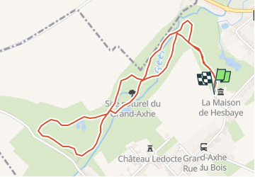
Randonnée Marche de 2,6 km à découvrir à Wallonie, Liège, Waremme. Cette randonnée est proposée par Benjamin27.
Description
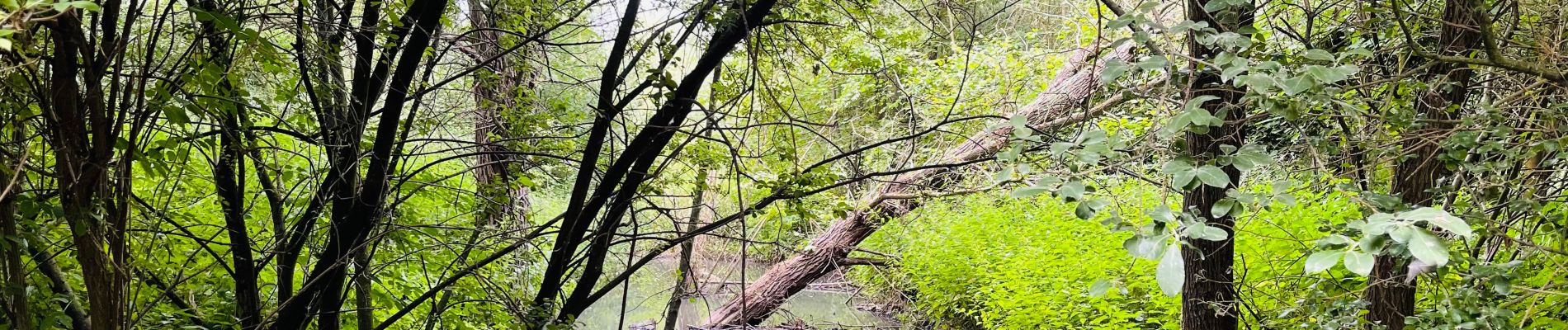
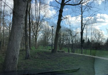
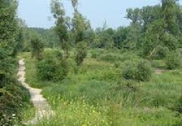
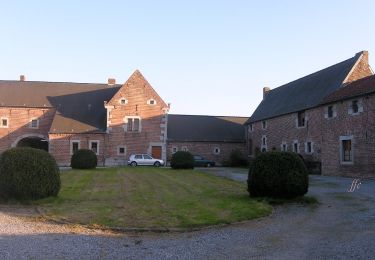
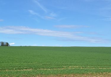
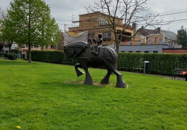
Au cœur de la Hesbaye et du bassin du Geer, entre champs et cours d’eau, le bois du Wachnet à Waremme regorge d’une nature luxuriante et diversifiée. Courte promenade ressourçante et très calme.
👣 Distance : 2,5km - non balisé.
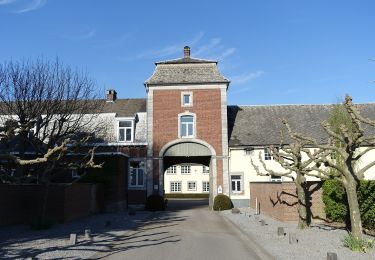
📍Départ : maison de Hesbaye, rue de Petit-Axhe 45 - 4300 Waremme.
🚂🚍 Aller à la gare de Waremme et prendre le bus TEC 128 ou 145 jusqu’à l’arrêt « Waremme - Petit Axhe ».
Localisation
Commentaires
Randonnées à proximité
![Randonnée Marche Geer - Promenade le long du Geer et réserve - Photo](https://media.geolcdn.com/t/375/260/4fc37dda-e21b-43f8-a27a-3af14e8a0d8e.jpg&format=jpg&maxdim=2)
![Marche Marche](https://static1.geolcdn.com/sitytour/trail-icons/101.png)
Marche
![](/images/other/stat-length.png)
![](https://static1.geolcdn.com/siteimages/upload/files/16400158638029165_repeat_loop_refresh_sync_direction_icon.png)
![Randonnée Marche Waremme - WACHNET WAREMME - Photo](https://media.geolcdn.com/t/375/260/9402a055-337f-4143-8a11-4cda7b0783be.png&format=jpg&maxdim=2)
![Marche Marche](https://static1.geolcdn.com/sitytour/trail-icons/101.png)
Marche
![](/images/other/stat-length.png)
![](https://static1.geolcdn.com/siteimages/upload/files/16400158638029165_repeat_loop_refresh_sync_direction_icon.png)
![Randonnée Marche Waremme - Lantremange - Photo](https://media.geolcdn.com/t/375/260/ext.jpg?maxdim=2&url=https%3A%2F%2Fstatic1.geolcdn.com%2Fsiteimages%2Fupload%2Ffiles%2F1553511878bg_sport_marche.png)
![Marche Marche](https://static1.geolcdn.com/sitytour/trail-icons/101.png)
![Randonnée A pied Geer - Promenade des Peupliers - Photo](https://media.geolcdn.com/t/375/260/f68fd01a-6493-4bfb-8eb0-00aa4284b467.jpeg&format=jpg&maxdim=2)
![A pied A pied](https://static1.geolcdn.com/sitytour/trail-icons/100.png)
A pied
![](/images/other/stat-length.png)
![](https://static1.geolcdn.com/siteimages/upload/files/16400158638029165_repeat_loop_refresh_sync_direction_icon.png)
![Randonnée A pied Geer - Promenade du Geer - Photo](https://media.geolcdn.com/t/375/260/b73edfb0-f782-4f6f-af6c-98fa8486e229.jpeg&format=jpg&maxdim=2)
![A pied A pied](https://static1.geolcdn.com/sitytour/trail-icons/100.png)
A pied
![](/images/other/stat-length.png)
![](https://static1.geolcdn.com/siteimages/upload/files/16400158638029165_repeat_loop_refresh_sync_direction_icon.png)
![Randonnée Cyclotourisme Waremme - WAR LIGN V WAL FALLAIS AVEN L S S G AXHE WAR - Photo](https://media.geolcdn.com/t/375/260/ext.jpg?maxdim=2&url=https%3A%2F%2Fstatic1.geolcdn.com%2Fsiteimages%2Fupload%2Ffiles%2F1524743154velo.jpg)
![Cyclotourisme Cyclotourisme](https://static1.geolcdn.com/sitytour/trail-icons/204.png)
Cyclotourisme
![](/images/other/stat-length.png)
![](https://static1.geolcdn.com/siteimages/upload/files/16400158638029165_repeat_loop_refresh_sync_direction_icon.png)
![Randonnée Marche Waremme - Waremme ( autour de la vallée du Geer) - Photo](https://media.geolcdn.com/t/375/260/e56e87e8-dda3-4c10-9253-9701ae5a37ab.jpg&format=jpg&maxdim=2)
![Marche Marche](https://static1.geolcdn.com/sitytour/trail-icons/101.png)
Marche
![](/images/other/stat-length.png)
![](https://static1.geolcdn.com/siteimages/upload/files/16400158638029165_repeat_loop_refresh_sync_direction_icon.png)
![Randonnée Marche Waremme - Oleye - bous de Horne - Photo](https://media.geolcdn.com/t/375/260/1a016a95-1857-49e8-88fe-ed16c9189e3e.jpg&format=jpg&maxdim=2)
![Marche Marche](https://static1.geolcdn.com/sitytour/trail-icons/101.png)
Marche
![](/images/other/stat-length.png)
![](https://static1.geolcdn.com/siteimages/upload/files/16400158638029165_repeat_loop_refresh_sync_direction_icon.png)
![Randonnée Marche Waremme - WAREMME _ Marche Fédérale _ LG _ 29/04/2023 - Photo](https://media.geolcdn.com/t/375/260/5f155266-fac2-4ae1-b976-114cbadef2b5.jpg&format=jpg&maxdim=2)
![Marche Marche](https://static1.geolcdn.com/sitytour/trail-icons/101.png)
Marche
![](/images/other/stat-length.png)
![](https://static1.geolcdn.com/siteimages/upload/files/16400158638029165_repeat_loop_refresh_sync_direction_icon.png)