


 - Photo 21")
 - Photo 22")
 - Photo 23")
 - Photo 24")
 - Photo 25")
 - Photo 26")
 - Photo 27")
 - Photo 28")
 - Photo 29")
 - Photo 30")
 - Photo 31")
 - Photo 32")
 - Photo 33")
 - Photo 34")
 - Photo 35")
 - Photo 36")
 - Photo 37")
 - Photo 38")

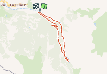
7,2 km | 11 km-effort

Utilisateur


Application GPS de randonnée GRATUITE
 SityTrail
IGN / Instituts géographiques
SityTrail World
Le monde est à vous
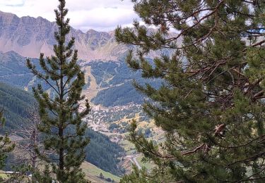
Randonnée Marche de 7,3 km à découvrir à Provence-Alpes-Côte d'Azur, Hautes-Alpes, Crévoux. Cette randonnée est proposée par gildascb.
Promenade très facile et idéale en famille (même avec des jeunes enfants).
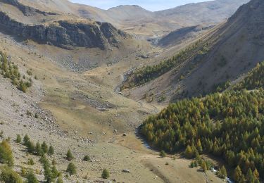
La promenade est une boucle, dont la montée se fait dans les bois (à l'ombre) avec des groseilliers (si si) le long du chemin dans sa partie basse, jusqu'à une trés jolie cascade (avec une petite grimpette sur la fin). Au retour, on passe dans le vallon et on peut admirer le Parcours des Fées, exposition d'art contemporain en extérieur.
40 œuvres à découvrir dont 5 à 6 nouvelles chaque année (la plupart prise dans les photos de cette promenade).
Le site du Parcours des Fées est disponible ici.
http://parcours-des-fees.fr/
 - Photo 1")
 - Photo 2")
 - Photo 3")
 - Photo 4")
 - Photo 5")
 - Photo 6")
 - Photo 7")
 - Photo 8")
 - Photo 9")
 - Photo 10")
 - Photo 11")
 - Photo 12")
 - Photo 13")
 - Photo 14")
 - Photo 15")
 - Photo 16")
 - Photo 17")
 - Photo 18")
 - Photo 19")
 - Photo 20")
38 photos au total. Cliquez sur une photo pour les afficher toutes dans la galerie.

Marche

Autre activité

Marche

Marche

Marche

Marche

Marche
Marche
Vélo électrique