![](/images/other/stat-length.png)
![Randonnée Marche Saint-Trond - La reserve naturelle Op d’Hei à Runkelen - Photo](https://media.geolcdn.com/t/1900/400/66426e65-b121-47ad-be3c-c041b27709ce.jpeg&format=pjpeg&maxdim=2)
La reserve naturelle Op d’Hei à Runkelen
Benjamin27
Utilisateur GUIDE
![Longueur](/images/other/stat-length.png)
![Altitude max](https://static1.geolcdn.com/siteimages/upload/files/1508320355ic_sort_altitude_max_24dp.png)
![Dénivelé positif](https://static1.geolcdn.com/siteimages/upload/files/1508320355ic_sort_den_pos_24dp.png)
![Km-Effort](/images/other/stat-length.png)
![Altitude min](https://static1.geolcdn.com/siteimages/upload/files/1508320355ic_sort_altitude_min_24dp.png)
![Dénivelé négatif](https://static1.geolcdn.com/siteimages/upload/files/1508320355ic_sort_den_neg_24dp.png)
![Boucle](https://static1.geolcdn.com/siteimages/upload/files/16400158638029165_repeat_loop_refresh_sync_direction_icon.png)
![Marche](https://static1.geolcdn.com/sitytour/trail-icons/101.png)
22m
Difficulté : Facile
![Scannez ce code QR pour ouvrir la randonnée dans l'application SityTrail](https://capi.geolives.com/qq0zvz2zws4bq2lad0pu/sitytour/trails/3362402/qr.png?size=200)
Application GPS de randonnée GRATUITE
À propos
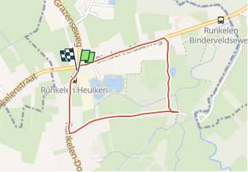
Randonnée Marche de 1,6 km à découvrir à Flandre, Limbourg, Saint-Trond. Cette randonnée est proposée par Benjamin27.
Description
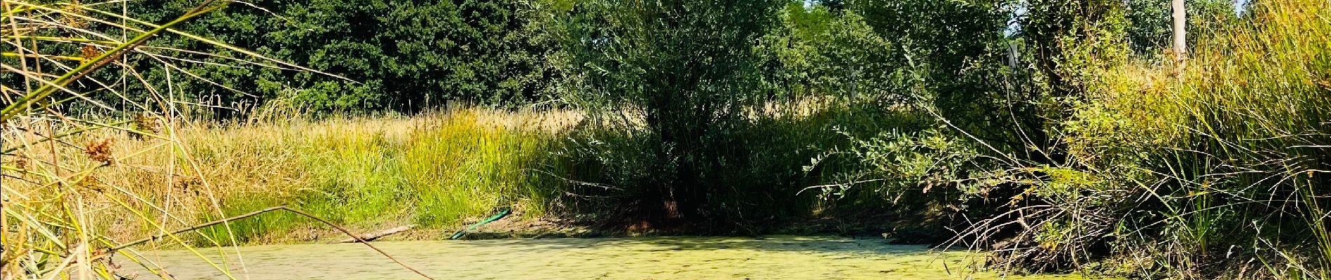
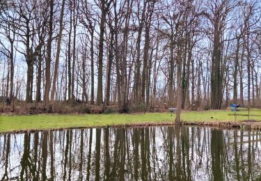
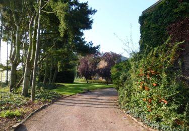
Très petite promenade autour d’une jolie réserve naturelle très calme. Idéal pour se reposer et profiter de la nature, notamment avec un animal. Le petit étang est également très joli.
👣 Distance : 1,5km - balisage carré rouge.
🗺️ Carte / Fichier GPX en bio.
📍Départ : parking Runkelen dorp 143 - 3803 Runkelen.
🚂🚍 Aller jusqu´à la gare de Hasselt ou Saint-Trond et prendre le bus DE LIJN 5 jusqu’à l’arrêt « Runkelen - Heulken ».
Localisation
Commentaires
Randonnées à proximité
![Randonnée Marche Léau - Zoutleeuw 16 km - Photo](https://media.geolcdn.com/t/375/260/b3a37ac3-8fca-4eba-bd9d-831054990cdb.jpg&format=jpg&maxdim=2)
![Marche Marche](https://static1.geolcdn.com/sitytour/trail-icons/101.png)
Marche
![](/images/other/stat-length.png)
![](https://static1.geolcdn.com/siteimages/upload/files/16400158638029165_repeat_loop_refresh_sync_direction_icon.png)
![Randonnée Marche Saint-Trond - Promenade dans le domaine provincial](https://media.geolcdn.com/t/375/260/b90730e6-26e4-40d2-a400-559a79179cf5.jpg&format=jpg&maxdim=2)
![Marche Marche](https://static1.geolcdn.com/sitytour/trail-icons/101.png)
Marche
![](/images/other/stat-length.png)
![](https://static1.geolcdn.com/siteimages/upload/files/16400158638029165_repeat_loop_refresh_sync_direction_icon.png)
![Randonnée A pied Saint-Trond - Bernissem wandeling - Photo](https://media.geolcdn.com/t/375/260/da47f886-95ef-4a45-a44c-87cd8463dff7.jpeg&format=jpg&maxdim=2)
![A pied A pied](https://static1.geolcdn.com/sitytour/trail-icons/100.png)
A pied
![](/images/other/stat-length.png)
![](https://static1.geolcdn.com/siteimages/upload/files/16400158638029165_repeat_loop_refresh_sync_direction_icon.png)
![Randonnée A pied Saint-Trond - Nieuwenhoven Oranje bol - Photo](https://media.geolcdn.com/t/375/260/b2e64be1-e82e-4959-ae54-cebd0419e976.jpeg&format=jpg&maxdim=2)
![A pied A pied](https://static1.geolcdn.com/sitytour/trail-icons/100.png)
A pied
![](/images/other/stat-length.png)
![](https://static1.geolcdn.com/siteimages/upload/files/16400158638029165_repeat_loop_refresh_sync_direction_icon.png)
![Randonnée A pied Saint-Trond - Nieuwenhoven Blauwe ruit - Photo](https://media.geolcdn.com/t/375/260/b2e64be1-e82e-4959-ae54-cebd0419e976.jpeg&format=jpg&maxdim=2)
![A pied A pied](https://static1.geolcdn.com/sitytour/trail-icons/100.png)
A pied
![](/images/other/stat-length.png)
![](https://static1.geolcdn.com/siteimages/upload/files/16400158638029165_repeat_loop_refresh_sync_direction_icon.png)
![Randonnée A pied Saint-Trond - Nieuwenhoven rode driehoek - Photo](https://media.geolcdn.com/t/375/260/ba036578-e487-412c-9b56-087ce0b67338.jpeg&format=jpg&maxdim=2)
![A pied A pied](https://static1.geolcdn.com/sitytour/trail-icons/100.png)
A pied
![](/images/other/stat-length.png)
![](https://static1.geolcdn.com/siteimages/upload/files/16400158638029165_repeat_loop_refresh_sync_direction_icon.png)
![Randonnée Marche Saint-Trond - La petite église de Guvelingen à Saint-Trond - Photo](https://media.geolcdn.com/t/375/260/2dfbb9e1-f6fd-446e-ac63-6ef5fef7f407.jpeg&format=jpg&maxdim=2)
![Marche Marche](https://static1.geolcdn.com/sitytour/trail-icons/101.png)
Marche
![](/images/other/stat-length.png)
![](https://static1.geolcdn.com/siteimages/upload/files/16400158638029165_repeat_loop_refresh_sync_direction_icon.png)
![Randonnée Marche Saint-Trond - La vallée fruitière à Saint-Trond - Photo](https://media.geolcdn.com/t/375/260/1eb5917c-9ec1-4729-bf31-3ca14ced1caa.jpg&format=jpg&maxdim=2)
![Marche Marche](https://static1.geolcdn.com/sitytour/trail-icons/101.png)
Marche
![](/images/other/stat-length.png)
![](https://static1.geolcdn.com/siteimages/upload/files/16400158638029165_repeat_loop_refresh_sync_direction_icon.png)
![Randonnée Marche Saint-Trond - Evenement](https://media.geolcdn.com/t/375/260/af01bbc1-1427-44e0-8703-722b0cf9517e.jpeg&format=jpg&maxdim=2)
![Marche Marche](https://static1.geolcdn.com/sitytour/trail-icons/101.png)
Marche
![](/images/other/stat-length.png)
![](https://static1.geolcdn.com/siteimages/upload/files/16400158638029165_repeat_loop_refresh_sync_direction_icon.png)