![](/images/other/stat-length.png)
![Randonnée Marche Kortessem - Le bois Bellevue à Kortessem - Photo](https://media.geolcdn.com/t/1900/400/5f642756-3013-4d97-ba18-8fae43cebfc7.jpeg&format=pjpeg&maxdim=2)
Le bois Bellevue à Kortessem
Benjamin27
Utilisateur GUIDE
![Longueur](/images/other/stat-length.png)
![Altitude max](https://static1.geolcdn.com/siteimages/upload/files/1508320355ic_sort_altitude_max_24dp.png)
![Dénivelé positif](https://static1.geolcdn.com/siteimages/upload/files/1508320355ic_sort_den_pos_24dp.png)
![Km-Effort](/images/other/stat-length.png)
![Altitude min](https://static1.geolcdn.com/siteimages/upload/files/1508320355ic_sort_altitude_min_24dp.png)
![Dénivelé négatif](https://static1.geolcdn.com/siteimages/upload/files/1508320355ic_sort_den_neg_24dp.png)
![Boucle](https://static1.geolcdn.com/siteimages/upload/files/16400158638029165_repeat_loop_refresh_sync_direction_icon.png)
![Marche](https://static1.geolcdn.com/sitytour/trail-icons/101.png)
1h26
Difficulté : Moyen
![Scannez ce code QR pour ouvrir la randonnée dans l'application SityTrail](https://capi.geolives.com/qq0zvz2zws4bq2lad0pu/sitytour/trails/3350293/qr.png?size=200)
Application GPS de randonnée GRATUITE
À propos
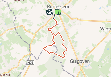
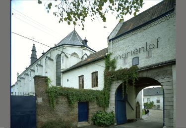
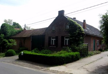
Randonnée Marche de 5,7 km à découvrir à Flandre, Limbourg, Kortessem. Cette randonnée est proposée par Benjamin27.
Description
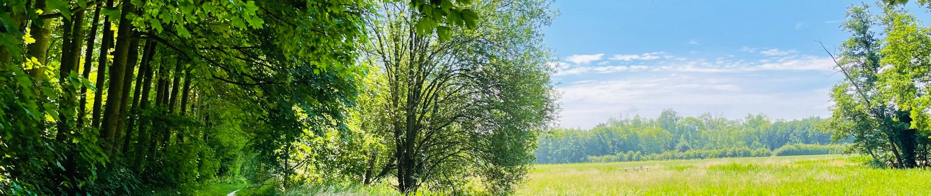
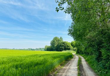
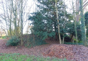
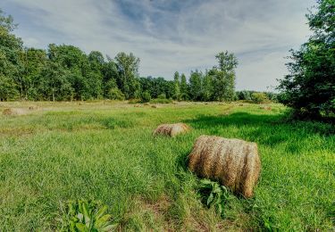
Le bois Bellevue est un magnifique bois bien caché. Après un bref passage dans un domaine récréatif, arpentez les vergers de pommes et de poires pour vous perdre dans ce bois paisible et revigorant.
👣 Distance : 6km - balisage flèche rouge.
🗺️ Carte / Fichier GPX en bio.
📍Départ : parking du Hemelspark, opeindestraat - 3720 Kortessem.
🚂🚍 Aller à la gare de Hasselt et prendre le bus DE LIJN 38 jusqu’à l’arrêt « Kortessem - Hemelspark ».
Localisation
Commentaires
Randonnées à proximité
![Randonnée Marche Looz - Promenade vers l'Aeneas Wilder - Photo](https://media.geolcdn.com/t/375/260/8625d454-03fc-46d2-bafa-261470717766.jpg&format=jpg&maxdim=2)
![Marche Marche](https://static1.geolcdn.com/sitytour/trail-icons/101.png)
Marche
![](/images/other/stat-length.png)
![](https://static1.geolcdn.com/siteimages/upload/files/16400158638029165_repeat_loop_refresh_sync_direction_icon.png)
![Randonnée A pied Kortessem - La vallée du ruisseau Sint-Anna à Zammelen - Photo](https://media.geolcdn.com/t/375/260/fc718cb3-95ec-485f-a77f-edadc1be0696.jpeg&format=jpg&maxdim=2)
![A pied A pied](https://static1.geolcdn.com/sitytour/trail-icons/100.png)
A pied
![](/images/other/stat-length.png)
![](https://static1.geolcdn.com/siteimages/upload/files/16400158638029165_repeat_loop_refresh_sync_direction_icon.png)
![Randonnée A pied Looz - Mariënlof Rode pijl - Photo](https://media.geolcdn.com/t/375/260/f9353f39-8b13-4a24-b09a-7fe4cf454715.jpeg&format=jpg&maxdim=2)
![A pied A pied](https://static1.geolcdn.com/sitytour/trail-icons/100.png)
A pied
![](/images/other/stat-length.png)
![](https://static1.geolcdn.com/siteimages/upload/files/16400158638029165_repeat_loop_refresh_sync_direction_icon.png)
![Randonnée A pied Hasselt - Mombeekvallei Rode pijl (vanuit Sint-Lambrechts-Herk) - Photo](https://media.geolcdn.com/t/375/260/c19127bd-cbbf-45c8-9b57-70604adcc44c.jpeg&format=jpg&maxdim=2)
![A pied A pied](https://static1.geolcdn.com/sitytour/trail-icons/100.png)
A pied
![](/images/other/stat-length.png)
![](https://static1.geolcdn.com/siteimages/upload/files/16400158638029165_repeat_loop_refresh_sync_direction_icon.png)
![Randonnée A pied Wellen - Alken-Wellen verbinding - Photo](https://media.geolcdn.com/t/375/260/3e82e838-81f6-4f4d-83f3-4708a8447d05.jpeg&format=jpg&maxdim=2)
![A pied A pied](https://static1.geolcdn.com/sitytour/trail-icons/100.png)
A pied
![](/images/other/stat-length.png)
![](https://static1.geolcdn.com/siteimages/upload/files/16400158638029165_repeat_loop_refresh_sync_direction_icon.png)
![Randonnée A pied Kortessem - 3-Bekenroute Eggeringen - Photo](https://media.geolcdn.com/t/375/260/348e48f1-e1dd-48a8-8fb5-7a592d6db187.jpeg&format=jpg&maxdim=2)
![A pied A pied](https://static1.geolcdn.com/sitytour/trail-icons/100.png)
A pied
![](/images/other/stat-length.png)
![](https://static1.geolcdn.com/siteimages/upload/files/16400158638029165_repeat_loop_refresh_sync_direction_icon.png)
![Randonnée A pied Hasselt - Mombeekpad W700 geel - Photo](https://media.geolcdn.com/t/375/260/d91aeff8-4d52-4b35-a08b-6ff9055d6a9b.jpeg&format=jpg&maxdim=2)
![A pied A pied](https://static1.geolcdn.com/sitytour/trail-icons/100.png)
A pied
![](/images/other/stat-length.png)
![](https://static1.geolcdn.com/siteimages/upload/files/16400158638029165_repeat_loop_refresh_sync_direction_icon.png)
![Randonnée A pied Hasselt - Grenspad W700 groen - Photo](https://media.geolcdn.com/t/375/260/a249397e-a5bf-4478-b685-36c36b1d5139.jpeg&format=jpg&maxdim=2)
![A pied A pied](https://static1.geolcdn.com/sitytour/trail-icons/100.png)
A pied
![](/images/other/stat-length.png)
![](https://static1.geolcdn.com/siteimages/upload/files/16400158638029165_repeat_loop_refresh_sync_direction_icon.png)
![Randonnée A pied Hoeselt - Tweekruizenwandeling gele zeshoek - Photo](https://media.geolcdn.com/t/375/260/2653ece4-549d-4211-a1fa-9bd3ba924b80.jpeg&format=jpg&maxdim=2)
![A pied A pied](https://static1.geolcdn.com/sitytour/trail-icons/100.png)
A pied
![](/images/other/stat-length.png)
![](https://static1.geolcdn.com/siteimages/upload/files/16400158638029165_repeat_loop_refresh_sync_direction_icon.png)