![](/images/other/stat-length.png)
![Randonnée Marche Alken - La vallée du ruisseau Mombeek à Alken - Photo](https://media.geolcdn.com/t/1900/400/37eadaf1-02f9-4a3d-a07c-c4b016c2089e.jpg&format=pjpeg&maxdim=2)
La vallée du ruisseau Mombeek à Alken
Benjamin27
Utilisateur GUIDE
![Longueur](/images/other/stat-length.png)
![Altitude max](https://static1.geolcdn.com/siteimages/upload/files/1508320355ic_sort_altitude_max_24dp.png)
![Dénivelé positif](https://static1.geolcdn.com/siteimages/upload/files/1508320355ic_sort_den_pos_24dp.png)
![Km-Effort](/images/other/stat-length.png)
![Altitude min](https://static1.geolcdn.com/siteimages/upload/files/1508320355ic_sort_altitude_min_24dp.png)
![Dénivelé négatif](https://static1.geolcdn.com/siteimages/upload/files/1508320355ic_sort_den_neg_24dp.png)
![Boucle](https://static1.geolcdn.com/siteimages/upload/files/16400158638029165_repeat_loop_refresh_sync_direction_icon.png)
![Marche](https://static1.geolcdn.com/sitytour/trail-icons/101.png)
1h28
Difficulté : Moyen
![Scannez ce code QR pour ouvrir la randonnée dans l'application SityTrail](https://capi.geolives.com/qq0zvz2zws4bq2lad0pu/sitytour/trails/3350285/qr.png?size=200)
Application GPS de randonnée GRATUITE
À propos
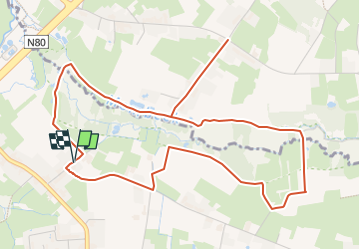
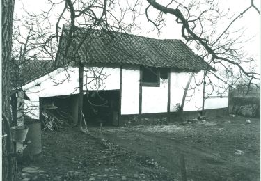
Randonnée Marche de 5,8 km à découvrir à Flandre, Limbourg, Alken. Cette randonnée est proposée par Benjamin27.
Description
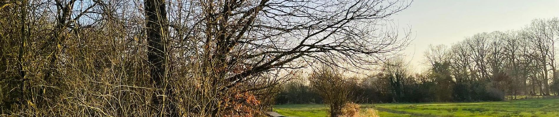
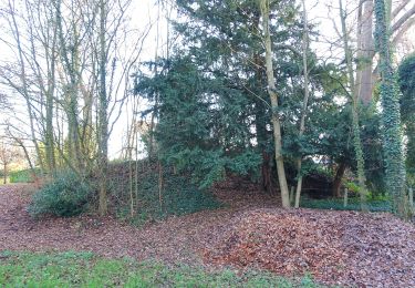
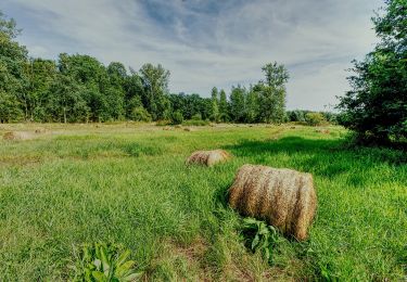
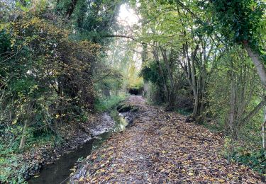
Le long du ruisseau, vous rencontrerez de jolis bois, d’agréables terrains marécageux à parcourir sur caillebotis et, si vous avez de la chance, vous apercevrez de magnifiques animaux qui viendront, à distance, vous dire bonjour.
👣 Distance : 6km - balisage flèche rouge.
📍Départ : muntelbeekstraat 1 à 3500 Hasselt.
🚂🚍 Aller à la gare de Hasselt et prendre le bus DE LIJN H71 jusqu’à l’arrêt « Hasselt - Muntelbeekstraat ».
Localisation
Commentaires
Randonnées à proximité
![Randonnée A pied Hasselt - Mombeekvallei Rode pijl (vanuit Sint-Lambrechts-Herk) - Photo](https://media.geolcdn.com/t/375/260/c19127bd-cbbf-45c8-9b57-70604adcc44c.jpeg&format=jpg&maxdim=2)
![A pied A pied](https://static1.geolcdn.com/sitytour/trail-icons/100.png)
A pied
![](/images/other/stat-length.png)
![](https://static1.geolcdn.com/siteimages/upload/files/16400158638029165_repeat_loop_refresh_sync_direction_icon.png)
![Randonnée A pied Wellen - Alken-Wellen verbinding - Photo](https://media.geolcdn.com/t/375/260/3e82e838-81f6-4f4d-83f3-4708a8447d05.jpeg&format=jpg&maxdim=2)
![A pied A pied](https://static1.geolcdn.com/sitytour/trail-icons/100.png)
A pied
![](/images/other/stat-length.png)
![](https://static1.geolcdn.com/siteimages/upload/files/16400158638029165_repeat_loop_refresh_sync_direction_icon.png)
![Randonnée A pied Hasselt - Mombeekpad W700 geel - Photo](https://media.geolcdn.com/t/375/260/d91aeff8-4d52-4b35-a08b-6ff9055d6a9b.jpeg&format=jpg&maxdim=2)
![A pied A pied](https://static1.geolcdn.com/sitytour/trail-icons/100.png)
A pied
![](/images/other/stat-length.png)
![](https://static1.geolcdn.com/siteimages/upload/files/16400158638029165_repeat_loop_refresh_sync_direction_icon.png)
![Randonnée A pied Hasselt - Grenspad W700 groen - Photo](https://media.geolcdn.com/t/375/260/a249397e-a5bf-4478-b685-36c36b1d5139.jpeg&format=jpg&maxdim=2)
![A pied A pied](https://static1.geolcdn.com/sitytour/trail-icons/100.png)
A pied
![](/images/other/stat-length.png)
![](https://static1.geolcdn.com/siteimages/upload/files/16400158638029165_repeat_loop_refresh_sync_direction_icon.png)
![Randonnée A pied Alken - Mombeekvallei Rode pijl (vanuit Alken) - Photo](https://media.geolcdn.com/t/375/260/a7d8db3d-2688-4705-a78c-05946b0d29f0.jpeg&format=jpg&maxdim=2)
![A pied A pied](https://static1.geolcdn.com/sitytour/trail-icons/100.png)
A pied
![](/images/other/stat-length.png)
![](https://static1.geolcdn.com/siteimages/upload/files/16400158638029165_repeat_loop_refresh_sync_direction_icon.png)
![Randonnée A pied Hasselt - Mombeekvallei Geel - Photo](https://media.geolcdn.com/t/375/260/1564a310-bc78-4cc9-b58d-5e56e18c6483.jpeg&format=jpg&maxdim=2)
![A pied A pied](https://static1.geolcdn.com/sitytour/trail-icons/100.png)
A pied
![](/images/other/stat-length.png)
![](https://static1.geolcdn.com/siteimages/upload/files/16400158638029165_repeat_loop_refresh_sync_direction_icon.png)
![Randonnée A pied Diepenbeek - Nietelbroeken - Photo](https://media.geolcdn.com/t/375/260/7541b859-d97b-4d1a-892d-184d3aaca5b8.jpeg&format=jpg&maxdim=2)
![A pied A pied](https://static1.geolcdn.com/sitytour/trail-icons/100.png)
A pied
![](/images/other/stat-length.png)
![](https://static1.geolcdn.com/siteimages/upload/files/16400158638029165_repeat_loop_refresh_sync_direction_icon.png)
![Randonnée Marche Kortessem - Le bois Bellevue à Kortessem - Photo](https://media.geolcdn.com/t/375/260/5f642756-3013-4d97-ba18-8fae43cebfc7.jpeg&format=jpg&maxdim=2)
![Marche Marche](https://static1.geolcdn.com/sitytour/trail-icons/101.png)
Marche
![](/images/other/stat-length.png)
![](https://static1.geolcdn.com/siteimages/upload/files/16400158638029165_repeat_loop_refresh_sync_direction_icon.png)
![Randonnée Marche Diepenbeek - La réserve naturelle Nietelbroeken à Kortessem - Photo](https://media.geolcdn.com/t/375/260/feb436bf-26a9-4a84-b1fa-04fcda8330b1.jpeg&format=jpg&maxdim=2)
![Marche Marche](https://static1.geolcdn.com/sitytour/trail-icons/101.png)
Marche
![](/images/other/stat-length.png)
![](https://static1.geolcdn.com/siteimages/upload/files/16400158638029165_repeat_loop_refresh_sync_direction_icon.png)