Randonnée Marche Saint-Trond - La réserve naturelle Egoven à Saint-Trond - Photo

La réserve naturelle Egoven à Saint-Trond

 Benjamin27
Benjamin27

Utilisateur GUIDE

© OpenStreetMap contributors
Longueur
Longueur
5,1 km
Altitude max
Altitude max
97 m
Dénivelé positif
Dénivelé positif
48 m
Km-Effort
Km-Effort  
5,7 km
Altitude min
Altitude min
66 m
Dénivelé négatif
Dénivelé négatif
48 m
Boucle
Boucle
Oui
Date de création :
2022-08-11 00:14:52.676
Dernière modification :
2024-07-07 15:51:42.269

(0 Avis)

Marche
Marche
1h18
Difficulté : Facile

Scannez ce code QR pour ouvrir la randonnée dans l'application SityTrail

Application GPS de randonnée GRATUITE

Logo SityTrail SityTrail

IGN / Instituts géographiques

Télécharger SityTrail sur l'App Store Télécharger SityTrail sur Google Play

Logo SityTrail SityTrail World

Le monde est à vous

Télécharger SityTrail sur l'App Store Télécharger SityTrail sur Google Play Télécharger SityTrail sur Huawei AppGallery

À propos

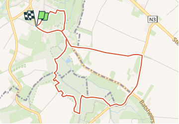
Randonnée Marche de 5,1 km à découvrir à Flandre, Limbourg, Saint-Trond. Cette randonnée est proposée par Benjamin27.

Description

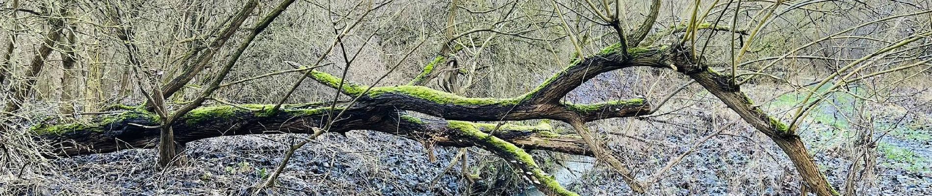
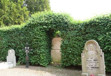
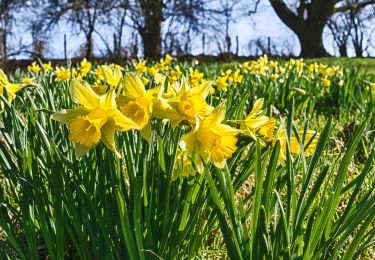
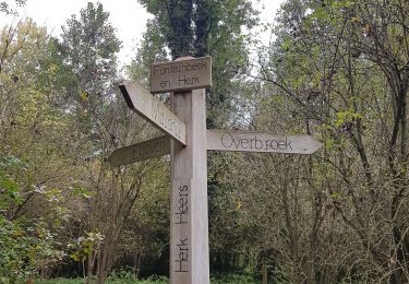
Vous contournerez cette très jolie réserve naturelle via des bois et au bord de cours d’eau : l’endroit où se jette le ruisseau « fonteinbeek » dans la rivière « Herk » est tout simplement magnifique et magique!

👣 Distance : 5km - balisage rond orange.

📍Départ : maison de la nature de Hesbaye, Kleinveldstraat 54 à 3800 Sint-Truiden.

🚂🚍 Aller à la gare de Saint-Trond, prendre le bus DE LIJN 26 jusqu’à l’arrêt « Gelinden - Dorp » et marcher 21 minutes jusqu’au point de départ.

💡 Combinez cette promenade avec celle de la réserve naturelle Overbroek.

Profil altimétrique

Photos

Localisation

Pays :
Belgique
Région :
Flandre
Département/Province :
Limbourg
Commune :
Saint-Trond
Localité :
Gelinden
Départ:(UTM)
659379 ; 5625318 (31U) N.

Randonnées à proximité

Randonnée Marche Saint-Trond - Aalst Dorp - Photo
Marche
JanBekaert

Marche

Facile
(1)
Saint-Trond, Flandre, Limbourg, Belgique
18,2 km | 19,5 km-effort
4h 17min
Oui
Randonnée A pied Heers - Hornbos Groen - Photo
A pied
GUIDE+

A pied

Facile
Heers, Flandre, Limbourg, Belgique
7,1 km | 8,2 km-effort
1h 52min
Non
Randonnée A pied Saint-Trond - Groot-Gelmen oranje bol - Photo
A pied
GUIDE+

A pied

Facile
Saint-Trond, Flandre, Limbourg, Belgique
4,9 km | 5,8 km-effort
1h 19min
Oui
Randonnée A pied Saint-Trond - Gelinden rode driehoek - Photo
A pied
GUIDE+

A pied

Facile
Saint-Trond, Flandre, Limbourg, Belgique
8,7 km | 10,3 km-effort
2h 20min
Oui
Randonnée A pied Heers - Mettekoven Oranje bol - Photo
A pied
GUIDE+

A pied

Facile
Heers, Flandre, Limbourg, Belgique
4,3 km | 5 km-effort
1h 8min
Oui
Randonnée A pied Heers - Mettekoven Rode driehoek - Photo
A pied
GUIDE+

A pied

Facile
Heers, Flandre, Limbourg, Belgique
6,3 km | 7,4 km-effort
1h 40min
Oui
Randonnée Marche Heers - Klein-Gelmen - Photo
Marche
GUIDE
mumu.larandonneuse

Marche

Très facile
Heers, Flandre, Limbourg, Belgique
15,4 km | 17,9 km-effort
3h 0min
Oui
Randonnée Marche Heers - Mechelen - Bovelingen (Heers) - Photo
Marche
GUIDE
mumu.larandonneuse

Marche

Très facile
(1)
Heers, Flandre, Limbourg, Belgique
16,6 km | 18,3 km-effort
3h 10min
Oui
Randonnée Marche Waremme - Oleye - bous de Horne  - Photo
Marche
GUIDE
stef789

Marche

Très facile
Waremme, Wallonie, Liège, Belgique
8,9 km | 9,8 km-effort
2h 12min
Oui


Fermer
Mes abonnements