![](/images/other/stat-length.png)
![Randonnée Marche Lummen - La digue du lac de Schulen - Photo](https://media.geolcdn.com/t/1900/400/54678e9b-45f5-40fb-ba6f-4e678ffbf33b.jpeg&format=pjpeg&maxdim=2)
La digue du lac de Schulen
Benjamin27
Utilisateur GUIDE
![Longueur](/images/other/stat-length.png)
![Altitude max](https://static1.geolcdn.com/siteimages/upload/files/1508320355ic_sort_altitude_max_24dp.png)
![Dénivelé positif](https://static1.geolcdn.com/siteimages/upload/files/1508320355ic_sort_den_pos_24dp.png)
![Km-Effort](/images/other/stat-length.png)
![Altitude min](https://static1.geolcdn.com/siteimages/upload/files/1508320355ic_sort_altitude_min_24dp.png)
![Dénivelé négatif](https://static1.geolcdn.com/siteimages/upload/files/1508320355ic_sort_den_neg_24dp.png)
![Boucle](https://static1.geolcdn.com/siteimages/upload/files/16400158638029165_repeat_loop_refresh_sync_direction_icon.png)
![Marche](https://static1.geolcdn.com/sitytour/trail-icons/101.png)
32m
Difficulté : Facile
![Scannez ce code QR pour ouvrir la randonnée dans l'application SityTrail](https://capi.geolives.com/qq0zvz2zws4bq2lad0pu/sitytour/trails/3350280/qr.png?size=200)
Application GPS de randonnée GRATUITE
À propos
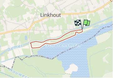
Randonnée Marche de 2,3 km à découvrir à Flandre, Limbourg, Lummen. Cette randonnée est proposée par Benjamin27.
Description
Photo de profil de lesbaladesdebenja
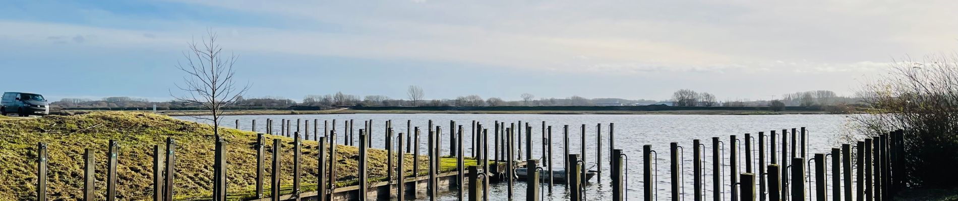
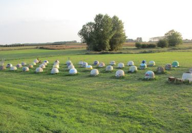
La digue du lac de Schulen.
Vous longerez le magnifique lac de Schulen pour rejoindre ensuite les abords de la rivière « Démer ». C’est un très chouette endroit pour déconnecter et se ressourcer.
👣 Distance : 2km - balisage rectangle vert.
📍Départ : parking prévu au fond de la Demerstraat - 3560 Linkhout (Lummen).
🚂🚍 Aller à la gare de Diest et prendre le bus DE LIJN 35c ou 92 jusqu’à l’arrêt « Linkhout - Schansstraat » et marcher 7 minutes jusqu’au point de départ.
Localisation
Commentaires
Randonnées à proximité
![Randonnée A pied Lummen - Lummensbroek rode driehoek - Photo](https://media.geolcdn.com/t/375/260/da9a5d6a-8877-4c5a-bca2-fdd50203b419.jpeg&format=jpg&maxdim=2)
![A pied A pied](https://static1.geolcdn.com/sitytour/trail-icons/100.png)
A pied
![](/images/other/stat-length.png)
![](https://static1.geolcdn.com/siteimages/upload/files/16400158638029165_repeat_loop_refresh_sync_direction_icon.png)
![Randonnée A pied Lummen - Lummense Parels Blauwe ruit - Photo](https://media.geolcdn.com/t/375/260/3f6dc320-e729-4d4d-9db7-571f5c09e396.jpeg&format=jpg&maxdim=2)
![A pied A pied](https://static1.geolcdn.com/sitytour/trail-icons/100.png)
A pied
![](/images/other/stat-length.png)
![](https://static1.geolcdn.com/siteimages/upload/files/16400158638029165_repeat_loop_refresh_sync_direction_icon.png)
![Randonnée A pied Halen - Zilveren Helmenwandeling - Photo](https://media.geolcdn.com/t/375/260/5671e5b0-70b4-4d41-9e57-848b60eb02ae.jpeg&format=jpg&maxdim=2)
![A pied A pied](https://static1.geolcdn.com/sitytour/trail-icons/100.png)
A pied
![](/images/other/stat-length.png)
![](https://static1.geolcdn.com/siteimages/upload/files/16400158638029165_repeat_loop_refresh_sync_direction_icon.png)
![Randonnée A pied Halen - Zelk Oranje bol - Photo](https://media.geolcdn.com/t/375/260/54f67bfb-93a4-4273-8a07-b47b83b202cf.jpeg&format=jpg&maxdim=2)
![A pied A pied](https://static1.geolcdn.com/sitytour/trail-icons/100.png)
A pied
![](/images/other/stat-length.png)
![](https://static1.geolcdn.com/siteimages/upload/files/16400158638029165_repeat_loop_refresh_sync_direction_icon.png)
![Randonnée A pied Halen - Kartuizerspatiamentum Oranje bol - Photo](https://media.geolcdn.com/t/375/260/9bcbcf4b-6db4-4abd-8824-a8ed4639b90d.jpeg&format=jpg&maxdim=2)
![A pied A pied](https://static1.geolcdn.com/sitytour/trail-icons/100.png)
A pied
![](/images/other/stat-length.png)
![](https://static1.geolcdn.com/siteimages/upload/files/16400158638029165_repeat_loop_refresh_sync_direction_icon.png)
![Randonnée A pied Lummen - Venusberg Oranje bol - Photo](https://media.geolcdn.com/t/375/260/e018a3b8-b1ce-46da-9114-cd30959fdec5.jpeg&format=jpg&maxdim=2)
![A pied A pied](https://static1.geolcdn.com/sitytour/trail-icons/100.png)
A pied
![](/images/other/stat-length.png)
![](https://static1.geolcdn.com/siteimages/upload/files/16400158638029165_repeat_loop_refresh_sync_direction_icon.png)
![Randonnée A pied Diest - Kelbergenwandeling - Photo](https://media.geolcdn.com/t/375/260/1996b687-8a6d-4199-83b2-a87c4a3538b0.jpeg&format=jpg&maxdim=2)
![A pied A pied](https://static1.geolcdn.com/sitytour/trail-icons/100.png)
A pied
![](/images/other/stat-length.png)
![](https://static1.geolcdn.com/siteimages/upload/files/16400158638029165_repeat_loop_refresh_sync_direction_icon.png)
![Randonnée A pied Lummen - Lummense Parels Groene rechthoek - Photo](https://media.geolcdn.com/t/375/260/da9a5d6a-8877-4c5a-bca2-fdd50203b419.jpeg&format=jpg&maxdim=2)
![A pied A pied](https://static1.geolcdn.com/sitytour/trail-icons/100.png)
A pied
![](/images/other/stat-length.png)
![](https://static1.geolcdn.com/siteimages/upload/files/16400158638029165_repeat_loop_refresh_sync_direction_icon.png)
![Randonnée A pied Herck-la-Ville - Schulensmeer Blauwe ruit - Photo](https://media.geolcdn.com/t/375/260/f4488938-1fcd-43c9-a4d1-6a2825bf5bb5.jpeg&format=jpg&maxdim=2)
![A pied A pied](https://static1.geolcdn.com/sitytour/trail-icons/100.png)
A pied
![](/images/other/stat-length.png)
![](https://static1.geolcdn.com/siteimages/upload/files/16400158638029165_repeat_loop_refresh_sync_direction_icon.png)