


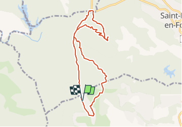


17,3 km | 26 km-effort


Utilisateur


Application GPS de randonnée GRATUITE
 SityTrail
IGN / Instituts géographiques
SityTrail World
Le monde est à vous
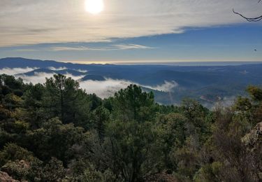
Randonnée Marche de 9,1 km à découvrir à Provence-Alpes-Côte d'Azur, Var, Bagnols-en-Forêt. Cette randonnée est proposée par Martînati.
Parking le long des maisons avant la barrière de la piste de la forêt royale, chemin de Bargemon.
GPS: 43,5476 ; 6,6596

Marche

Marche

Marche

A pied

Marche


sport

sport

sport
Marche