![](/images/other/stat-length.png)
![Randonnée Marche Daverdisse - Haut-Fays - Sclassin (HF2) - Photo](https://media.geolcdn.com/t/1900/400/ext.pjpeg?maxdim=2&url=https%3A%2F%2Fstatic1.geolcdn.com%2Fsiteimages%2Fupload%2Ffiles%2F1553511878bg_sport_marche.png)
Haut-Fays - Sclassin (HF2)
La Grande Forêt de Saint-Hubert
Randonnées de la Grande Forêt de Saint-Hubert GUIDE+
![Longueur](/images/other/stat-length.png)
Longueur
6,4 km
![Altitude max](https://static1.geolcdn.com/siteimages/upload/files/1508320355ic_sort_altitude_max_24dp.png)
Altitude max
436 m
![Dénivelé positif](https://static1.geolcdn.com/siteimages/upload/files/1508320355ic_sort_den_pos_24dp.png)
Dénivelé positif
104 m
![Km-Effort](/images/other/stat-length.png)
Km-Effort
7,8 km
![Altitude min](https://static1.geolcdn.com/siteimages/upload/files/1508320355ic_sort_altitude_min_24dp.png)
Altitude min
348 m
![Dénivelé négatif](https://static1.geolcdn.com/siteimages/upload/files/1508320355ic_sort_den_neg_24dp.png)
Dénivelé négatif
104 m
![Boucle](https://static1.geolcdn.com/siteimages/upload/files/16400158638029165_repeat_loop_refresh_sync_direction_icon.png)
Boucle
Oui
![Balise](https://services.sitytrail.com/GeolivesWS/DownloadMedia.ashx?TrailID=334461&Media=balise.png)
Balise
Date de création :
2017-09-16 00:00:00.0
Dernière modification :
2017-09-16 00:00:00.0
![Marche](https://static1.geolcdn.com/sitytour/trail-icons/101.png)
1h41
Difficulté : Moyen
![Scannez ce code QR pour ouvrir la randonnée dans l'application SityTrail](https://capi.geolives.com/qq0zvz2zws4bq2lad0pu/sitytour/trails/334461/qr.png?size=200)
Application GPS de randonnée GRATUITE
À propos
Randonnée Marche de 6,4 km à découvrir à Wallonie, Luxembourg, Daverdisse. Cette randonnée est proposée par La Grande Forêt de Saint-Hubert.
Description
Promenade campagnarde passant par le petit hameau de Sclassin.
Localisation
Pays :
Belgique
Région :
Wallonie
Département/Province :
Luxembourg
Commune :
Daverdisse
Localité :
Haut-Fays
Départ:(Dec)
Départ:(UTM)
644595 ; 5540800 (31U) N.
Commentaires
Randonnées à proximité
![Randonnée A pied Daverdisse - HF 2 - Sclassin - Photo](https://media.geolcdn.com/t/375/260/a939f2bf-d01d-4679-8080-aa7e1bc351e7.jpg&format=jpg&maxdim=2)
![A pied A pied](https://static1.geolcdn.com/sitytour/trail-icons/100.png)
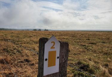
HF 2 - Sclassin
A pied
Facile
(1)
Daverdisse,
Wallonie,
Luxembourg,
Belgique
![](/images/other/stat-length.png)
6,4 km | 7,8 km-effort
1h 46min
![](https://static1.geolcdn.com/siteimages/upload/files/16400158638029165_repeat_loop_refresh_sync_direction_icon.png)
Oui
![Randonnée Marche Daverdisse - Porcheresse Grinchi - Photo](https://media.geolcdn.com/t/375/260/60793136-a8a5-412f-98a4-b91886d74636.jpg&format=jpg&maxdim=2)
![Marche Marche](https://static1.geolcdn.com/sitytour/trail-icons/101.png)
Porcheresse Grinchi
Marche
Moyen
(1)
Daverdisse,
Wallonie,
Luxembourg,
Belgique
![](/images/other/stat-length.png)
7,1 km | 9,3 km-effort
2h 6min
![](https://static1.geolcdn.com/siteimages/upload/files/16400158638029165_repeat_loop_refresh_sync_direction_icon.png)
Oui
![Randonnée Marche Daverdisse - Porcheresse - Le Gros Bois (P1) - Photo](https://media.geolcdn.com/t/375/260/ext.jpg?maxdim=2&url=https%3A%2F%2Fservices.sitytrail.com%2FGeolivesWS%2FDownloadMedia.ashx%3FTrailID%3D334464%26Media%3D63060b0b-b07c-4065-a8bb-125fd5bf9bab.jpg)
![Marche Marche](https://static1.geolcdn.com/sitytour/trail-icons/101.png)
Porcheresse - Le Gros Bois (P1)
Marche
Moyen
(4)
Daverdisse,
Wallonie,
Luxembourg,
Belgique
![](/images/other/stat-length.png)
7 km | 9,4 km-effort
2h 2min
![](https://static1.geolcdn.com/siteimages/upload/files/16400158638029165_repeat_loop_refresh_sync_direction_icon.png)
Oui
![Randonnée équestre Randonnée équestre](https://static1.geolcdn.com/sitytour/trail-icons/301.png)
Graide manege 10km
Randonnée équestre
Facile
(2)
Bièvre,
Wallonie,
Namur,
Belgique
![](/images/other/stat-length.png)
10,1 km | 13,1 km-effort
1h 43min
![](https://static1.geolcdn.com/siteimages/upload/files/16400158638029165_repeat_loop_refresh_sync_direction_icon.png)
Oui
![Randonnée Marche Daverdisse - Gembes - kleine toer - Photo](https://media.geolcdn.com/t/375/260/ext.jpg?maxdim=2&url=https%3A%2F%2Fservices.sitytrail.com%2FGeolivesWS%2FDownloadMedia.ashx%3FTrailID%3D148906%26Media%3D20120820165026.jpg)
![Marche Marche](https://static1.geolcdn.com/sitytour/trail-icons/101.png)
Gembes - kleine toer
Marche
Moyen
(2)
Daverdisse,
Wallonie,
Luxembourg,
Belgique
![](/images/other/stat-length.png)
6 km | 7,7 km-effort
1h 51min
![](https://static1.geolcdn.com/siteimages/upload/files/16400158638029165_repeat_loop_refresh_sync_direction_icon.png)
Oui
![Randonnée Marche Wellin - Fays-Famenne - Rogifosse_Variante 2 (WE 08) - Photo](https://media.geolcdn.com/t/375/260/ext.jpg?maxdim=2&url=https%3A%2F%2Fservices.sitytrail.com%2FGeolivesWS%2FDownloadMedia.ashx%3FTrailID%3D334446%26Media%3Dd2c53188-561b-4559-bd04-d5b0ced7de7c.jpg)
![Marche Marche](https://static1.geolcdn.com/sitytour/trail-icons/101.png)
Fays-Famenne - Rogifosse_Variante 2 (WE 08)
Marche
Difficile
(3)
Wellin,
Wallonie,
Luxembourg,
Belgique
![](/images/other/stat-length.png)
9,7 km | 13,2 km-effort
2h 46min
![](https://static1.geolcdn.com/siteimages/upload/files/16400158638029165_repeat_loop_refresh_sync_direction_icon.png)
Oui
![Randonnée Marche Wellin - Fays-Famenne - Rogifosse_Variante 1 (WE 08) - Photo](https://media.geolcdn.com/t/375/260/ext.jpg?maxdim=2&url=https%3A%2F%2Fservices.sitytrail.com%2FGeolivesWS%2FDownloadMedia.ashx%3FTrailID%3D334444%26Media%3Deaed1872-6150-453d-9c7e-4b9ef0917692.jpg)
![Marche Marche](https://static1.geolcdn.com/sitytour/trail-icons/101.png)
Fays-Famenne - Rogifosse_Variante 1 (WE 08)
Marche
Moyen
(3)
Wellin,
Wallonie,
Luxembourg,
Belgique
![](/images/other/stat-length.png)
8,1 km | 11,1 km-effort
2h 10min
![](https://static1.geolcdn.com/siteimages/upload/files/16400158638029165_repeat_loop_refresh_sync_direction_icon.png)
Oui
![Randonnée Marche Daverdisse - Gembes. Natura 2000, des sites qui valent le détour. Lx6 - Photo](https://media.geolcdn.com/t/375/260/ext.jpg?maxdim=2&url=https%3A%2F%2Fservices.sitytrail.com%2FGeolivesWS%2FDownloadMedia.ashx%3FTrailID%3D163716%26Media%3Dbe0573da-e9bd-437c-b981-3b179daa912b.JPG)
![Marche Marche](https://static1.geolcdn.com/sitytour/trail-icons/101.png)
Gembes. Natura 2000, des sites qui valent le détour. Lx6
Marche
Facile
(6)
Daverdisse,
Wallonie,
Luxembourg,
Belgique
![](/images/other/stat-length.png)
4,8 km | 6,7 km-effort
1h 25min
![](https://static1.geolcdn.com/siteimages/upload/files/16400158638029165_repeat_loop_refresh_sync_direction_icon.png)
Oui
![Randonnée Marche Gedinne - Balade à Malvoisin - Gedinne - Photo](https://media.geolcdn.com/t/375/260/d0ef5110-1a6d-4a12-ba4f-4365dc035d50.jpeg&format=jpg&maxdim=2)
![Marche Marche](https://static1.geolcdn.com/sitytour/trail-icons/101.png)
Balade à Malvoisin - Gedinne
Marche
Difficile
Gedinne,
Wallonie,
Namur,
Belgique
![](/images/other/stat-length.png)
9,2 km | 12,1 km-effort
2h 44min
![](https://static1.geolcdn.com/siteimages/upload/files/16400158638029165_repeat_loop_refresh_sync_direction_icon.png)
Oui