![](/images/other/stat-length.png)
![Randonnée Marche Wellin - Fays-Famenne - Rogifosse_Variante 1 (WE 08) - Photo](https://media.geolcdn.com/t/1900/400/ext.pjpeg?maxdim=2&url=https%3A%2F%2Fservices.sitytrail.com%2FGeolivesWS%2FDownloadMedia.ashx%3FTrailID%3D334444%26Media%3Deaed1872-6150-453d-9c7e-4b9ef0917692.jpg)
Fays-Famenne - Rogifosse_Variante 1 (WE 08)
La Grande Forêt de Saint-Hubert
Randonnées de la Grande Forêt de Saint-Hubert GUIDE+
![Longueur](/images/other/stat-length.png)
Longueur
8,1 km
![Altitude max](https://static1.geolcdn.com/siteimages/upload/files/1508320355ic_sort_altitude_max_24dp.png)
Altitude max
415 m
![Dénivelé positif](https://static1.geolcdn.com/siteimages/upload/files/1508320355ic_sort_den_pos_24dp.png)
Dénivelé positif
222 m
![Km-Effort](/images/other/stat-length.png)
Km-Effort
11,1 km
![Altitude min](https://static1.geolcdn.com/siteimages/upload/files/1508320355ic_sort_altitude_min_24dp.png)
Altitude min
249 m
![Dénivelé négatif](https://static1.geolcdn.com/siteimages/upload/files/1508320355ic_sort_den_neg_24dp.png)
Dénivelé négatif
222 m
![Boucle](https://static1.geolcdn.com/siteimages/upload/files/16400158638029165_repeat_loop_refresh_sync_direction_icon.png)
Boucle
Oui
Date de création :
2016-11-10 00:00:00.0
Dernière modification :
2016-11-10 00:00:00.0
![Marche](https://static1.geolcdn.com/sitytour/trail-icons/101.png)
2h10
Difficulté : Moyen
![Scannez ce code QR pour ouvrir la randonnée dans l'application SityTrail](https://capi.geolives.com/qq0zvz2zws4bq2lad0pu/sitytour/trails/334444/qr.png?size=200)
Application GPS de randonnée GRATUITE
À propos
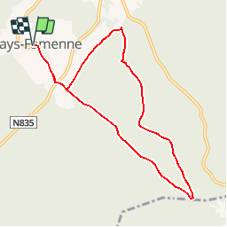
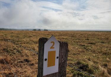
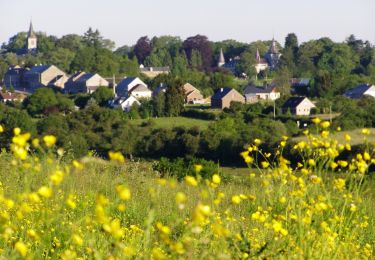
Randonnée Marche de 8,1 km à découvrir à Wallonie, Luxembourg, Wellin. Cette randonnée est proposée par La Grande Forêt de Saint-Hubert.
Description
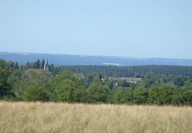
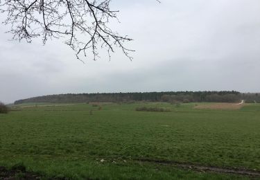
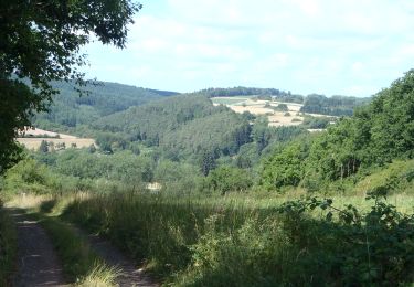
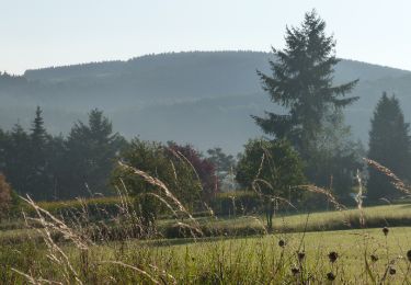
Promenade en partance de Fays-Famenne entre rivière et foret.
Points d'intérêt
Localisation
Pays :
Belgique
Région :
Wallonie
Département/Province :
Luxembourg
Commune :
Wellin
Localité :
Sohier
Départ:(Dec)
Départ:(UTM)
648231 ; 5545464 (31U) N.
Commentaires
Randonnées à proximité
![Marche Marche](https://static1.geolcdn.com/sitytour/trail-icons/101.png)
RB-Lu-25_Wellin
Marche
Très facile
(6)
Wellin,
Wallonie,
Luxembourg,
Belgique
![](/images/other/stat-length.png)
26 km | 33 km-effort
6h 46min
![](https://static1.geolcdn.com/siteimages/upload/files/16400158638029165_repeat_loop_refresh_sync_direction_icon.png)
Oui
![Randonnée Marche Wellin - Wellin - Wéry_Variante (WE 06) - Photo](https://media.geolcdn.com/t/375/260/ext.jpg?maxdim=2&url=https%3A%2F%2Fservices.sitytrail.com%2FGeolivesWS%2FDownloadMedia.ashx%3FTrailID%3D334441%26Media%3D69ef9e8a-0435-41bc-a5d3-d329c2516b48.JPG)
![Marche Marche](https://static1.geolcdn.com/sitytour/trail-icons/101.png)
Wellin - Wéry_Variante (WE 06)
Marche
Difficile
(5)
Wellin,
Wallonie,
Luxembourg,
Belgique
![](/images/other/stat-length.png)
11,4 km | 15,5 km-effort
3h 30min
![](https://static1.geolcdn.com/siteimages/upload/files/16400158638029165_repeat_loop_refresh_sync_direction_icon.png)
Oui
![Randonnée A pied Daverdisse - HF 2 - Sclassin - Photo](https://media.geolcdn.com/t/375/260/a939f2bf-d01d-4679-8080-aa7e1bc351e7.jpg&format=jpg&maxdim=2)
![A pied A pied](https://static1.geolcdn.com/sitytour/trail-icons/100.png)
HF 2 - Sclassin
A pied
Facile
(1)
Daverdisse,
Wallonie,
Luxembourg,
Belgique
![](/images/other/stat-length.png)
6,4 km | 7,8 km-effort
1h 46min
![](https://static1.geolcdn.com/siteimages/upload/files/16400158638029165_repeat_loop_refresh_sync_direction_icon.png)
Oui
![Randonnée Marche Wellin - Balade de Wellin à Froidlieu - Photo](https://media.geolcdn.com/t/375/260/ext.jpg?maxdim=2&url=https%3A%2F%2Fservices.sitytrail.com%2FGeolivesWS%2FDownloadMedia.ashx%3FTrailID%3D550482%26Media%3D6bfae291-bc04-4a99-8008-dd078d6a2b97.jpg)
![Marche Marche](https://static1.geolcdn.com/sitytour/trail-icons/101.png)
Balade de Wellin à Froidlieu
Marche
Facile
(3)
Wellin,
Wallonie,
Luxembourg,
Belgique
![](/images/other/stat-length.png)
8,8 km | 10,9 km-effort
2h 20min
![](https://static1.geolcdn.com/siteimages/upload/files/16400158638029165_repeat_loop_refresh_sync_direction_icon.png)
Oui
![Marche Marche](https://static1.geolcdn.com/sitytour/trail-icons/101.png)
RB-Lu-25_Wellin_via-racc-1-et-var
Marche
Très difficile
(1)
Wellin,
Wallonie,
Luxembourg,
Belgique
![](/images/other/stat-length.png)
25 km | 33 km-effort
7h 23min
![](https://static1.geolcdn.com/siteimages/upload/files/16400158638029165_repeat_loop_refresh_sync_direction_icon.png)
Oui
![Randonnée A pied Wellin - Wellin, A la découverte de la Calestienne - Photo](https://media.geolcdn.com/t/375/260/edbffe01-088a-4464-814f-81b660e2febb.jpg&format=jpg&maxdim=2)
![A pied A pied](https://static1.geolcdn.com/sitytour/trail-icons/100.png)
Wellin, A la découverte de la Calestienne
A pied
Très facile
(4)
Wellin,
Wallonie,
Luxembourg,
Belgique
![](/images/other/stat-length.png)
7,6 km | 9,5 km-effort
Inconnu
![](https://static1.geolcdn.com/siteimages/upload/files/16400158638029165_repeat_loop_refresh_sync_direction_icon.png)
Oui
![Marche Marche](https://static1.geolcdn.com/sitytour/trail-icons/101.png)
RB-Lu-25_Wellin_via-racc-2
Marche
Très difficile
(1)
Wellin,
Wallonie,
Luxembourg,
Belgique
![](/images/other/stat-length.png)
19,5 km | 26 km-effort
5h 48min
![](https://static1.geolcdn.com/siteimages/upload/files/16400158638029165_repeat_loop_refresh_sync_direction_icon.png)
Oui
![Randonnée Marche Wellin - Halma-Molinchamps (WE 09) - Photo](https://media.geolcdn.com/t/375/260/ext.jpg?maxdim=2&url=https%3A%2F%2Fservices.sitytrail.com%2FGeolivesWS%2FDownloadMedia.ashx%3FTrailID%3D334447%26Media%3Db767bb81-ddcb-4855-ac9a-38d9bb9528a3.JPG)
![Marche Marche](https://static1.geolcdn.com/sitytour/trail-icons/101.png)
Halma-Molinchamps (WE 09)
Marche
Moyen
(1)
Wellin,
Wallonie,
Luxembourg,
Belgique
![](/images/other/stat-length.png)
5,1 km | 6,4 km-effort
1h 27min
![](https://static1.geolcdn.com/siteimages/upload/files/16400158638029165_repeat_loop_refresh_sync_direction_icon.png)
Oui
![Randonnée Marche Wellin - Sohier-Croix Victoire (WE 07) - Photo](https://media.geolcdn.com/t/375/260/ext.jpg?maxdim=2&url=https%3A%2F%2Fservices.sitytrail.com%2FGeolivesWS%2FDownloadMedia.ashx%3FTrailID%3D334442%26Media%3Dcac70fbd-4e44-4001-acfb-64c156e03ff0.JPG)
![Marche Marche](https://static1.geolcdn.com/sitytour/trail-icons/101.png)
Sohier-Croix Victoire (WE 07)
Marche
Moyen
(2)
Wellin,
Wallonie,
Luxembourg,
Belgique
![](/images/other/stat-length.png)
7,9 km | 10 km-effort
2h 9min
![](https://static1.geolcdn.com/siteimages/upload/files/16400158638029165_repeat_loop_refresh_sync_direction_icon.png)
Oui
Heel mooi en pittig.
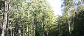
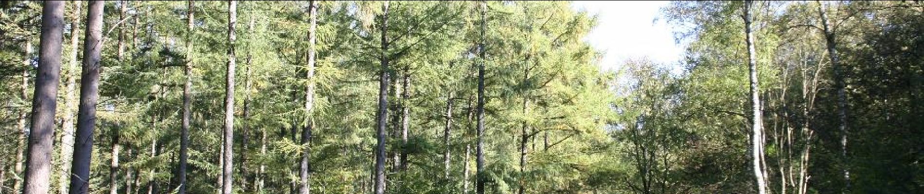
magnifique balade dans la forêt, ça descend vers l'Almache, ensuite une longue remontée dans le bois toujours, on a vu une biche et une belette :), on termine en traversant une sapinière.
Belle ballade au parcours très forestier (du feuillu essentiellement). La distance est plutôt de 9km et se fait en moins de 2h car le parcours est facile voire très facile. La seule difficulté est une courte descente un peu raide qui pourrait être glissante par temps humide.